 |
|
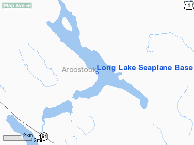
Long Lake Seaplane Base (92B) |
Location & QuickFacts
| FAA Information Effective: | 2008-09-25 |
| Airport Identifier: | 92B |
| Airport Status: | Operational |
| Longitude/Latitude: | 068-13-53.1340W/47-11-35.1460N
-68.231426/47.193096 (Estimated) |
| Elevation: | 581 ft / 177.09 m (Estimated) |
| Land: | 0 acres |
| From nearest city: | 3 nautical miles NE of Sinclair, ME |
| Location: | Aroostook County, ME |
| Magnetic Variation: | 21W (1985) |
Owner & Manager
| Ownership: | Privately owned |
| Owner: | Kevin Martin |
| Address: | Box 57
Sinclair, ME 04779 |
| Phone number: | 207-543-7584 |
| Manager: | Kevin Martin |
| Address: | Box 57
Sinclair, ME 04779 |
| Phone number: | 207-543-7584 |
Airport Operations and Facilities
| Airport Use: | Open to public |
| Wind indicator: | Yes |
| Segmented Circle: | No |
| Control Tower: | No |
| Lighting Schedule: | DUSK-DAWN |
| Beacon Color: | Clear (unlighted land airport) |
| Landing fee charge: | No |
| Sectional chart: | Halifax |
| Region: | ANE - New England |
| Boundary ARTCC: | ZBW - Boston |
| Tie-in FSS: | BGR - Bangor |
| FSS on Airport: | No |
| FSS Toll Free: | 1-800-WX-BRIEF |
| NOTAMs Facility: | BGR (NOTAM-d service avaliable) |
Airport Communications
Airport Services
| Fuel available: | MOGAS
FOR FUEL AFTER HOURS CALL 207-543-7584. |
| Airframe Repair: | NONE |
| Power Plant Repair: | NONE |
Runway Information
Runway 07/25
| Dimension: | 15800 x 2640 ft / 4815.8 x 804.7 m |
| Surface: | WATER, |
| |
Runway 07 |
Runway 25 |
| Traffic Pattern: | Left | Left |
|
Runway 15/33
| Dimension: | 25000 x 4000 ft / 7620.0 x 1219.2 m |
| Surface: | WATER, |
| |
Runway 15 |
Runway 33 |
| Traffic Pattern: | Left | Left |
|
Radio Navigation Aids
| ID |
Type |
Name |
Ch |
Freq |
Var |
Dist |
| FVE | NDB | Frenchville | | 257.00 | 20W | 4.6 nm |
| YSL | NDB | St Leonard | | 404.00 | 22W | 14.8 nm |
| LIF | NDB | Limestone | | 220.00 | 19W | 26.4 nm |
| PQI | VOR/DME | Presque Isle | 111X | 116.40 | 21W | 25.8 nm |
Remarks
Images and information placed above are from
http://www.airport-data.com/airport/92B/
We thank them for the data!
| General Info
|
| Country |
United States
|
| State |
MAINE
|
| FAA ID |
92B
|
| Latitude |
47-11-35.146N
|
| Longitude |
068-13-53.134W
|
| Elevation |
581 feet
|
| Near City |
SINCLAIR
|
We don't guarantee the information is fresh and accurate. The data may
be wrong or outdated.
For more up-to-date information please refer to other sources.
|
|


