 |
|
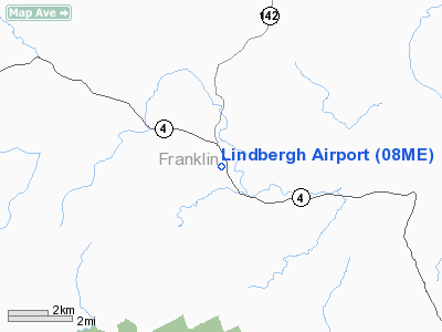
Location & QuickFacts
| FAA Information Effective: | 2008-09-25 |
| Airport Identifier: | 08ME |
| Airport Status: | Operational |
| Longitude/Latitude: | 070-20-43.2370W/44-48-51.2060N
-70.345344/44.814224 (Estimated) |
| Elevation: | 554 ft / 168.86 m (Estimated) |
| Land: | 0 acres |
| From nearest city: | 1 nautical miles S of Avon, ME |
| Location: | Franklin County, ME |
| Magnetic Variation: | 18W (1990) |
Owner & Manager
| Ownership: | Privately owned |
| Owner: | Sandy River Flying Club |
| Address: | 114 Ross Ave
Phillips, ME 04966 |
| Phone number: | 207-639-2168 |
| Manager: | Robert Childs |
| Address: | 114 Ross Ave
Phillips, ME 04966 |
| Phone number: | 207-639-2168 |
Airport Operations and Facilities
| Airport Use: | Private |
| Segmented Circle: | No |
| Control Tower: | No |
| Sectional chart: | Montreal |
| Region: | ANE - New England |
| Boundary ARTCC: | ZBW - Boston |
| Tie-in FSS: | BGR - Bangor |
| FSS on Airport: | No |
| FSS Toll Free: | 1-800-WX-BRIEF |
Runway Information
Runway 13/31
| Dimension: | 2300 x 90 ft / 701.0 x 27.4 m |
| Surface: | TURF, Fair Condition |
| |
Runway 13 |
Runway 31 |
| Traffic Pattern: | Left | Right |
| Obstruction: | 70 ft trees, 345.0 ft from runway, 100 ft right of centerline, 4:1 slope to clear | 15 ft road, 50.0 ft from runway, 3:1 slope to clear |
|
Radio Navigation Aids
| ID |
Type |
Name |
Ch |
Freq |
Var |
Dist |
| RQM | NDB | Rangeley | | 221.00 | 18W | 18.7 nm |
| RL | NDB | Bracy | | 399.00 | 18W | 33.7 nm |
| HXK | NDB | Hornebrook | | 281.00 | 17W | 38.4 nm |
| BUP | NDB | Burnham | | 348.00 | 18W | 42.7 nm |
| BML | VOR/DME | Berlin | 041X | 110.40 | 17W | 37.5 nm |
| AUG | VOR/DME | Augusta | 051X | 111.40 | 18W | 37.9 nm |
Remarks
- SKI OPERATIONS WINTER MONTHS ONLY.
- PRVDD DURG DAYTIME VISUAL FLIGHT RULE WEATHER CONDITIONS & RY 31 THR IS DSPLCD TO PROVIDE A VERTICAL CLEARANCE OVER STATE RT 4.
Images and information placed above are from
http://www.airport-data.com/airport/08ME/
We thank them for the data!
| General Info
|
| Country |
United States
|
| State |
MAINE
|
| FAA ID |
08ME
|
| Latitude |
44-48-51.206N
|
| Longitude |
070-20-43.237W
|
| Elevation |
554 feet
|
| Near City |
AVON
|
We don't guarantee the information is fresh and accurate. The data may
be wrong or outdated.
For more up-to-date information please refer to other sources.
|
|


