 |
|
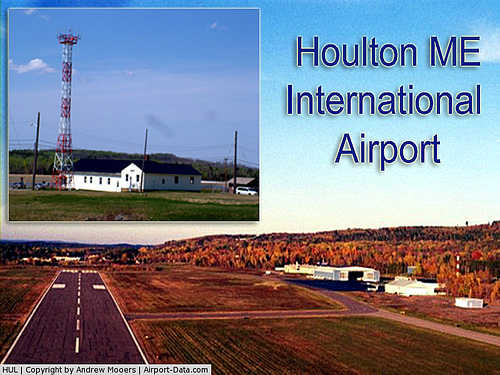
Houlton International Airport |
| Houlton International Airport |
| IATA: HUL – ICAO: KHUL – FAA LID: HUL |
| Summary |
| Airport type |
Public |
| Operator |
Town of Houlton |
| Location |
Houlton, Maine |
| Elevation AMSL |
489 ft / 149 m |
| Coordinates |
46°07′23″N 067°47′31″W / 46.12306°N 67.79194°W / 46.12306; -67.79194Coordinates: 46°07′23″N 067°47′31″W / 46.12306°N 67.79194°W / 46.12306; -67.79194 |
| Runways |
| Direction |
Length |
Surface |
| ft |
m |
| 5/23 |
5,001 |
1,524 |
Asphalt |
Houlton International Airport (IATA: HUL, ICAO: KHUL, FAA LID: HUL) is a public-use airport located two miles (3 km) east of Houlton (CDP), Maine, in the town of Houlton in Aroostook County, Maine, United States, on the border of New Brunswick, Canada. This general aviation airport is publicly owned by the town of Houlton. It once had scheduled airline service on Northeast Airlines. Facilities
Houlton International Airport covers an area of 1,615 acres (654 ha) and has one runway:
- Runway 5/23: 5,001 x 150 ft (1,524 x 46 m), Surface: Asphalt
The above content comes from Wikipedia and is published under free licenses – click here to read more.

|
 |
(Click on the photo to enlarge) |
Location & QuickFacts
| FAA Information Effective: | 2008-09-25 |
| Airport Identifier: | HUL |
| Airport Status: | Operational |
| Longitude/Latitude: | 067-47-31.4000W/46-07-23.1000N
-67.792056/46.123083 (Estimated) |
| Elevation: | 489 ft / 149.05 m (Surveyed) |
| Land: | 1615 acres |
| From nearest city: | 2 nautical miles E of Houlton, ME |
| Location: | Aroostook County, ME |
| Magnetic Variation: | 20W (1985) |
Owner & Manager
| Ownership: | Publicly owned |
| Owner: | Town Of Houlton |
| Address: | 21 Water Street
Houlton, ME 04730 |
| Phone number: | 207-532-7111 |
| Manager: | Doug Hazlett |
| Address: | 21 Water St.
Houlton, ME 04730 |
| Phone number: | 207-532-7111 |
Airport Operations and Facilities
| Airport Use: | Open to public |
| Wind indicator: | Yes |
| Segmented Circle: | Yes |
| Control Tower: | No |
| Lighting Schedule: | DUSK-DAWN
ACTVT MIRL RY 05/23 & REIL RYS 05 & 23 - CTAF. |
| Beacon Color: | Clear-Green (lighted land airport) |
| Landing fee charge: | No |
| Sectional chart: | Halifax |
| Region: | ANE - New England |
| Boundary ARTCC: | ZBW - Boston |
| Tie-in FSS: | BGR - Bangor |
| FSS Toll Free: | 1-800-WX-BRIEF |
| NOTAMs Facility: | HUL (NOTAM-d service avaliable) |
| Federal Agreements: | NGPRY3 |
Airport Communications
| CTAF: | 122.800 |
| Unicom: | 122.800 |
Airport Services
| Fuel available: | 100LLA
FOR FUEL AFTER HRS CALL 207-532-9079, 207-532-9461 OR 207-538-2997 (CELL). |
| Airframe Repair: | MAJOR |
| Power Plant Repair: | MAJOR |
| Bottled Oxygen: | NONE |
| Bulk Oxygen: | NONE |
Runway Information
Runway 05/23
| Dimension: | 5001 x 150 ft / 1524.3 x 45.7 m |
| Surface: | ASPH, Fair Condition |
| Weight Limit: | Single wheel: 30000 lbs.
Dual wheel: 57000 lbs. |
| Edge Lights: | Medium |
| |
Runway 05 |
Runway 23 |
| Longitude: | 067-47-49.7490W | 067-47-12.9440W |
| Latitude: | 46-07-01.9920N | 46-07-44.2060N |
| Elevation: | 481.00 ft | 489.00 ft |
| Alignment: | 31 | 127 |
| Traffic Pattern: | Left | Left |
| Markings: | Non-precision instrument, Fair Condition
MARKINGS FADED. | Non-precision instrument, Fair Condition
MARKINGS FADED. |
| Crossing Height: | 50.00 ft | 45.00 ft |
| VASI: | 4-box on left side | 2-light PAPI on left side |
| Visual Glide Angle: | 3.00° | 2.50° |
| Runway End Identifier: | Yes | Yes |
| Obstruction: | , 50:1 slope to clear
RISING GND TO +1 FT FROM 0-200 FT FM END OF RY. | 57 ft pole, 2023.0 ft from runway, 121 ft right of centerline, 31:1 slope to clear
10 FOOT TREES AND BRUSH, 125 FEET FROM THRESHOLD, 130 LEFT. |
|
Radio Navigation Aids
| ID |
Type |
Name |
Ch |
Freq |
Var |
Dist |
| LNT | NDB | Milnot | | 344.00 | 19W | 42.7 nm |
| LIF | NDB | Limestone | | 220.00 | 19W | 43.2 nm |
| HUL | VOR/DME | Houlton | 108X | 116.10 | 21W | 5.3 nm |
| PQI | VOR/DME | Presque Isle | 111X | 116.40 | 21W | 41.1 nm |
| MLT | VOR/DME | Millinocket | 126X | 117.90 | 20W | 44.2 nm |
| PNN | VOR/DME | Princeton | 090X | 114.30 | 21W | 47.9 nm |
Remarks
- USDA RECATERING FACILITY AVBL.
- HANGAR SPACE AVBL.
- DEER ON & INVOF ARPT.
- RY 05 SAFETY AREA (RSA) ROUGH.
- FOR AFTER HOURS ACCESS TO TERMINAL BUILDING USE FREQ 122.8.
- EXISTED PRIOR TO 1959.
Images and information placed above are from
http://www.airport-data.com/airport/HUL/
We thank them for the data!
| General Info
|
| Country |
United States
|
| State |
MAINE
|
| FAA ID |
HUL
|
| Latitude |
46-07-23.100N
|
| Longitude |
067-47-31.400W
|
| Elevation |
489 feet
|
| Near City |
HOULTON
|
We don't guarantee the information is fresh and accurate. The data may
be wrong or outdated.
For more up-to-date information please refer to other sources.
|
|


