 |
|
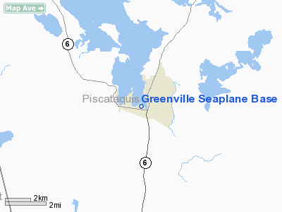
Location & QuickFacts
| FAA Information Effective: | 2008-09-25 |
| Airport Identifier: | 52B |
| Airport Status: | Operational |
| Longitude/Latitude: | 069-35-52.1960W/45-27-40.1660N
-69.597832/45.461157 (Estimated) |
| Elevation: | 1028 ft / 313.33 m (Estimated) |
| Land: | 0 acres |
| From nearest city: | 0 nautical miles N of Greenville, ME |
| Location: | Piscataquis County, ME |
| Magnetic Variation: | 18W (1995) |
Owner & Manager
| Ownership: | Privately owned |
| Owner: | West Outlet Llc |
| Address: | Po Box 512
Greenville, ME 04441 |
| Phone number: | 207-695-3766 |
| Manager: | Rodney Folsom |
| Address: | Po Box 512
Greenville, ME 04441 |
| Phone number: | 207-695-3766
EMERGENCY PHONE: 207-280-3125 (CELL). |
Airport Operations and Facilities
| Airport Use: | Open to public |
| Segmented Circle: | No |
| Control Tower: | No |
| Sectional chart: | Montreal |
| Region: | ANE - New England |
| Boundary ARTCC: | ZBW - Boston |
| Tie-in FSS: | BGR - Bangor |
| FSS on Airport: | No |
| FSS Toll Free: | 1-800-WX-BRIEF |
| NOTAMs Facility: | BGR (NOTAM-d service avaliable) |
Airport Communications
Airport Services
| Fuel available: | 100LL |
| Bottled Oxygen: | NONE |
| Bulk Oxygen: | NONE |
Runway Information
Runway 14/32
| Dimension: | 6000 x 1200 ft / 1828.8 x 365.8 m |
| Surface: | WATER, |
| |
Runway 14 |
Runway 32 |
| Longitude: | 069-36-59.3300W | 069-35-47.9200W |
| Latitude: | 45-28-48.5800N | 45-28-17.1900N |
| Alignment: | 122 | 127 |
| Traffic Pattern: | Left | Left |
| Runway End Identifier: | No | No |
| Touchdown Lights: | No | No |
|
Runway 18/36
| Dimension: | 5000 x 1000 ft / 1524.0 x 304.8 m |
| Surface: | WATER, |
| |
Runway 18 |
Runway 36 |
| Longitude: | 069-36-13.0400W | 069-35-51.3600W |
| Latitude: | 45-28-46.9400N | 45-28-00.0000N |
| Alignment: | 127 | 127 |
| Traffic Pattern: | Left | Left |
| Runway End Identifier: | No | No |
| Touchdown Lights: | No | No |
|
Radio Navigation Aids
| ID |
Type |
Name |
Ch |
Freq |
Var |
Dist |
| XQA | NDB | Squaw | | 236.00 | 18W | 4.9 nm |
| LRG | NDB | Lincoln | | 216.00 | 19W | 45.2 nm |
| LNT | NDB | Milnot | | 344.00 | 19W | 45.5 nm |
| BUP | NDB | Burnham | | 348.00 | 18W | 47.0 nm |
| OLD | NDB | Old Town | | 272.00 | 20W | 49.1 nm |
| MLT | VOR/DME | Millinocket | 126X | 117.90 | 20W | 46.2 nm |
| BGR | VORTAC | Bangor | 095X | 114.80 | 19W | 48.2 nm |
Remarks
Images and information placed above are from
http://www.airport-data.com/airport/52B/
We thank them for the data!
| General Info
|
| Country |
United States
|
| State |
MAINE
|
| FAA ID |
52B
|
| Latitude |
45-27-40.166N
|
| Longitude |
069-35-52.196W
|
| Elevation |
1028 feet
|
| Near City |
GREENVILLE
|
We don't guarantee the information is fresh and accurate. The data may
be wrong or outdated.
For more up-to-date information please refer to other sources.
|
|


