 |
|
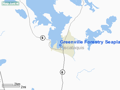
Greenville Forestry Seaplane Base |
Location & QuickFacts
| FAA Information Effective: | 2008-09-25 |
| Airport Identifier: | ME30 |
| Airport Status: | Operational |
| Longitude/Latitude: | 069-35-58.0780W/45-28-00.3620N
-69.599466/45.466767 (Estimated) |
| Elevation: | 1028 ft / 313.33 m (Estimated) |
| Land: | 0 acres |
| From nearest city: | 0 nautical miles N of Greenville, ME |
| Location: | Piscataquis County, ME |
| Magnetic Variation: | 17W (1985) |
Owner & Manager
| Ownership: | Publicly owned |
| Owner: | Bur.forestry Conserv.dept. |
| Address: |
Augusta, ME 04330 |
| Manager: | Otis B. Gray |
| Address: | Me Forestry Dept
Greenville, ME 04441 |
| Phone number: | 207-695-2281
OR 207-695-3721 |
Airport Operations and Facilities
| Airport Use: | Private |
| Wind indicator: | No |
| Segmented Circle: | No |
| Control Tower: | No |
| Landing fee charge: | No |
| Sectional chart: | Montreal |
| Region: | ANE - New England |
| Boundary ARTCC: | ZBW - Boston |
| Tie-in FSS: | BGR - Bangor |
| FSS on Airport: | No |
| FSS Toll Free: | 1-800-WX-BRIEF |
Airport Services
| Fuel available: | 100 80 |
| Airframe Repair: | MINOR |
| Power Plant Repair: | MINOR |
Runway Information
Runway N/S
| Dimension: | 5000 x 1000 ft / 1524.0 x 304.8 m |
| Surface: | WATER, |
| |
Runway N |
Runway S |
| Traffic Pattern: | Left | Left |
|
Runway NW/SE
| Dimension: | 6000 x 1200 ft / 1828.8 x 365.8 m |
| Surface: | WATER, |
| |
Runway NW |
Runway SE |
| Traffic Pattern: | Left | Left |
|
Radio Navigation Aids
| ID |
Type |
Name |
Ch |
Freq |
Var |
Dist |
| XQA | NDB | Squaw | | 236.00 | 18W | 4.6 nm |
| LRG | NDB | Lincoln | | 216.00 | 19W | 45.3 nm |
| LNT | NDB | Milnot | | 344.00 | 19W | 45.5 nm |
| BUP | NDB | Burnham | | 348.00 | 18W | 47.4 nm |
| OLD | NDB | Old Town | | 272.00 | 20W | 49.4 nm |
| MLT | VOR/DME | Millinocket | 126X | 117.90 | 20W | 46.2 nm |
| BGR | VORTAC | Bangor | 095X | 114.80 | 19W | 48.5 nm |
Images and information placed above are from
http://www.airport-data.com/airport/ME30/
We thank them for the data!
| General Info
|
| Country |
United States
|
| State |
MAINE
|
| FAA ID |
ME30
|
| Latitude |
45-28-00.362N
|
| Longitude |
069-35-58.078W
|
| Elevation |
1028 feet
|
| Near City |
GREENVILLE
|
We don't guarantee the information is fresh and accurate. The data may
be wrong or outdated.
For more up-to-date information please refer to other sources.
|
|


