 |
|
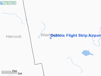
Deblois Flight Strip Airport |
Location & QuickFacts
| FAA Information Effective: | 2008-09-25 |
| Airport Identifier: | 43B |
| Airport Status: | Operational |
| Longitude/Latitude: | 067-59-26.6000W/44-43-35.1000N
-67.990722/44.726417 (Estimated) |
| Elevation: | 217 ft / 66.14 m (Surveyed) |
| Land: | 153 acres |
| From nearest city: | 2 nautical miles SE of Deblois, ME |
| Location: | Washington County, ME |
| Magnetic Variation: | 19W (1985) |
Owner & Manager
| Ownership: | Publicly owned |
| Owner: | State Of Maine Dot |
| Address: | 16 State House Station
Augusta, ME 04330
MAINE DEPT. OF TRANSPORTATION |
| Phone number: | 207-624-3578 |
| Manager: | Randy Gray |
| Address: | Maine Department Of Transportation, 219 Hogan Road
Bangor, ME 04401 |
| Phone number: | 207-941-4500 |
Airport Operations and Facilities
| Airport Use: | Open to public |
| Wind indicator: | Yes |
| Segmented Circle: | Yes |
| Control Tower: | No |
| Landing fee charge: | No |
| Sectional chart: | Halifax |
| Region: | ANE - New England |
| Boundary ARTCC: | ZBW - Boston |
| Tie-in FSS: | BGR - Bangor |
| FSS on Airport: | No |
| FSS Toll Free: | 1-800-WX-BRIEF |
| NOTAMs Facility: | BGR (NOTAM-d service avaliable) |
Airport Communications
Airport Services
| Airframe Repair: | NONE |
| Power Plant Repair: | NONE |
| Bottled Oxygen: | NONE |
| Bulk Oxygen: | NONE |
Runway Information
Runway 15/33
| Dimension: | 3520 x 75 ft / 1072.9 x 22.9 m |
| Surface: | ASPH, Good Condition |
| Weight Limit: | Single wheel: 84000 lbs.
Dual wheel: 200000 lbs.
Dual tandem wheel: 400000 lbs. |
| |
Runway 15 |
Runway 33 |
| Longitude: | 067-59-43.7809W | 067-59-09.3217W |
| Latitude: | 44-43-47.3673N | 44-43-22.7776N |
| Elevation: | 216.00 ft | 209.00 ft |
| Traffic Pattern: | Left | Left |
| Markings: | Basic, Fair Condition
RY 15/33 MARKINGS BADLY FADED. | Basic, Fair Condition |
| Runway End Identifier: | No | No |
| Centerline Lights: | No | No |
| Touchdown Lights: | No | No |
| Obstruction: | 75 ft trees, 3500.0 ft from runway, 44:1 slope to clear | 50 ft trees, 2500.0 ft from runway, 46:1 slope to clear |
|
Radio Navigation Aids
| ID |
Type |
Name |
Ch |
Freq |
Var |
Dist |
| BH | NDB | Surry | | 330.00 | 19W | 17.6 nm |
| MVM | NDB | Machias | | 251.00 | 19W | 21.9 nm |
| OLD | NDB | Old Town | | 272.00 | 20W | 32.1 nm |
| EPM | NDB | Eastport | | 260.00 | 19W | 43.2 nm |
| LRG | NDB | Lincoln | | 216.00 | 19W | 44.4 nm |
| BST | NDB | Belfast | | 278.00 | 18W | 47.6 nm |
| PNN | VOR/DME | Princeton | 090X | 114.30 | 21W | 38.2 nm |
| BGR | VORTAC | Bangor | 095X | 114.80 | 19W | 38.3 nm |
| BGR | VOT | Bangor | | 111.00 | | 35.3 nm |
Remarks
- CLSD WINTER MONTHS EXCEPT TO SKI ACFT.
- DAYLIGHT USE ONLY.
- EXISTED PRIOR TO 1959.
Images and information placed above are from
http://www.airport-data.com/airport/43B/
We thank them for the data!
| General Info
|
| Country |
United States
|
| State |
MAINE
|
| FAA ID |
43B
|
| Latitude |
44-43-35.100N
|
| Longitude |
067-59-26.600W
|
| Elevation |
217 feet
|
| Near City |
DEBLOIS
|
We don't guarantee the information is fresh and accurate. The data may
be wrong or outdated.
For more up-to-date information please refer to other sources.
|
|


