 |
|
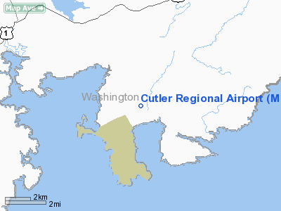
Location & QuickFacts
| FAA Information Effective: | 2008-09-25 |
| Airport Identifier: | ME2 |
| Airport Status: | Operational |
| Longitude/Latitude: | 067-15-51.3000W/44-40-47.6000N
-67.264250/44.679889 (Estimated) |
| Elevation: | 55 ft / 16.76 m (Surveyed) |
| Land: | 50 acres |
| From nearest city: | 2 nautical miles W of Cutler, ME |
| Location: | Washington County, ME |
| Magnetic Variation: | 19W (1985) |
Owner & Manager
| Ownership: | Publicly owned |
| Owner: | Charles Beam |
| Address: | #8 Airport Road
Cutler, ME 04626 |
| Phone number: | 207-259-3427 |
| Manager: | Charles Beam |
| Address: | #8 Airport Road
Cutler, ME 04626 |
| Phone number: | 207-259-3427
EMERGENCY PHONE: 239-877-1458. |
Airport Operations and Facilities
| Airport Use: | Open to public |
| Wind indicator: | Yes |
| Segmented Circle: | No |
| Control Tower: | No |
| Sectional chart: | Halifax |
| Region: | ANE - New England |
| Boundary ARTCC: | ZBW - Boston |
| Tie-in FSS: | BGR - Bangor |
| FSS on Airport: | No |
| FSS Toll Free: | 1-800-WX-BRIEF |
| NOTAMs Facility: | BGR (NOTAM-d service avaliable) |
Airport Communications
Runway Information
Runway 09/27
| Dimension: | 2950 x 40 ft / 899.2 x 12.2 m |
| Surface: | GRVL,
GRAVEL STABILIZED WITH GRASS. |
| |
Runway 09 |
Runway 27 |
| Longitude: | 067-16-10.2100W | 067-15-32.4300W |
| Latitude: | 44-40-42.0600N | 44-40-53.1300N |
| Traffic Pattern: | Left | Right |
| Obstruction: | 30 ft pline | 40 ft tree, 123.0 ft from runway, 125 ft right of centerline, 3:1 slope to clear |
|
Radio Navigation Aids
| ID |
Type |
Name |
Ch |
Freq |
Var |
Dist |
| MVM | NDB | Machias | | 251.00 | 19W | 9.3 nm |
| EPM | NDB | Eastport | | 260.00 | 19W | 17.6 nm |
| BH | NDB | Surry | | 330.00 | 19W | 45.4 nm |
| PNN | VOR/DME | Princeton | 090X | 114.30 | 21W | 43.3 nm |
Remarks
- ARPT CLSD NOV THRU APR.
- WILDLIFE ON & INVOF ARPT.
- LAND ON RY 27 WHEN WIND IS LGT & VARIABLE.
- PRVDD VFR OPNS, CLEAR 20:1 APCHS, WIND INDICATOR INSTALLED, AND ALL USERS ARE NOTIFIED AND COMPLY WITH THESE RESTRICTIONS.
Images and information placed above are from
http://www.airport-data.com/airport/ME2/
We thank them for the data!
| General Info
|
| Country |
United States
|
| State |
MAINE
|
| FAA ID |
ME2
|
| Latitude |
44-40-47.782N
|
| Longitude |
067-15-51.952W
|
| Elevation |
55 feet
|
| Near City |
CUTLER
|
We don't guarantee the information is fresh and accurate. The data may
be wrong or outdated.
For more up-to-date information please refer to other sources.
|
|


