 |
|
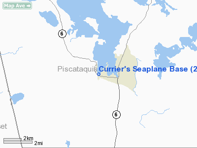
Location & QuickFacts
| FAA Information Effective: | 2008-09-25 |
| Airport Identifier: | 21M |
| Airport Status: | Operational |
| Longitude/Latitude: | 069-37-10.2000W/45-27-45.1700N
-69.619500/45.462547 (Estimated) |
| Elevation: | 1028 ft / 313.33 m (Estimated) |
| Land: | 0 acres |
| From nearest city: | 0 nautical miles N of Greenville Junction, ME |
| Location: | Piscataquis County, ME |
| Magnetic Variation: | 18W (2000) |
Owner & Manager
| Ownership: | Privately owned |
| Owner: | Roger Currier |
| Address: | Po Box 351
Greenville Junction, ME 04442 |
| Phone number: | 207-695-2778 |
| Manager: | Roger Currier |
| Address: | Po Box 351
Greenville Junction, ME 04442 |
| Phone number: | 207-695-2778 |
Airport Operations and Facilities
| Airport Use: | Open to public |
| Segmented Circle: | No |
| Control Tower: | No |
| Sectional chart: | Montreal |
| Region: | ANE - New England |
| Boundary ARTCC: | ZBW - Boston |
| Tie-in FSS: | BGR - Bangor |
| FSS Toll Free: | 1-800-WX-BRIEF |
| NOTAMs Facility: | BGR |
Airport Communications
Airport Services
| Fuel available: | 100LL |
| Airframe Repair: | MAJOR |
| Power Plant Repair: | MAJOR |
Runway Information
Runway 18W/36W
| Dimension: | 10000 x 3000 ft / 3048.0 x 914.4 m |
| Surface: | WATER, |
| |
Runway 18W |
Runway 36W |
| Traffic Pattern: | Left | Right |
|
Radio Navigation Aids
| ID |
Type |
Name |
Ch |
Freq |
Var |
Dist |
| XQA | NDB | Squaw | | 236.00 | 18W | 4.2 nm |
| LRG | NDB | Lincoln | | 216.00 | 19W | 46.1 nm |
| LNT | NDB | Milnot | | 344.00 | 19W | 46.4 nm |
| BUP | NDB | Burnham | | 348.00 | 18W | 47.3 nm |
| OLD | NDB | Old Town | | 272.00 | 20W | 49.9 nm |
| MLT | VOR/DME | Millinocket | 126X | 117.90 | 20W | 47.1 nm |
| BGR | VORTAC | Bangor | 095X | 114.80 | 19W | 48.9 nm |
Remarks
- SPB MAY BE UNUSABLE FROM MID-NOV TO MID-MAY DUE TO FALL ICE FORMATION AND SPRING ICE BREAK-UP AND OTHER ADVERSE CONDITIONS. ACFT MAY REQUIRE SKIS DURG WINTER MONTHS DUE TO FROZEN SURFACE CONDITIONS. FOR SPB CONDITIONS CALL 207-695-2778.
- BE ALERT FOR RECREATIONAL BOATS DURG SUMMER MONTHS AND SNOWMOBILES DURG WINTER MONTHS.
- 150 FT RADIO TOWER 200 FT W OF SEALANE AND 150 FT RADIO TOWER 1000 FT SW OF SEALANE.
- BE ALERT: NEARBY GREENVILLE SEAPLANE BASE (1.1 MI EAST) AND GREENVILLE MUNI (3.3 MI EAST) UTILIZE 122.8 FOR UNICOM/CTAF.
- PRVDD VFR OPNS; ALL USERS MUST BE IN RADIO CONTACT WITH EACH OTHER PRIOR TO ENTERING THE TRAFFIC PAT DUE TO PROXIMITY WITH GREENVILLE SPB (52B); ALL USERS MUST BE IN RADIO CONTACT PRIOR TO TAKE-OFF; AND ALL USERS ARE ADVISED AND COMPLY WITH THESE CONDITIONS.
Images and information placed above are from
http://www.airport-data.com/airport/21M/
We thank them for the data!
We don't guarantee the information is fresh and accurate. The data may
be wrong or outdated.
For more up-to-date information please refer to other sources.
|
|


