 |
|
Location & QuickFacts
| FAA Information Effective: | 2008-09-25 |
| Airport Identifier: | ME44 |
| Airport Status: | Operational |
| Longitude/Latitude: | 070-26-46.2130W/44-17-20.2480N
-70.446170/44.288958 (Estimated) |
| Elevation: | 960 ft / 292.61 m (Estimated) |
| Land: | 0 acres |
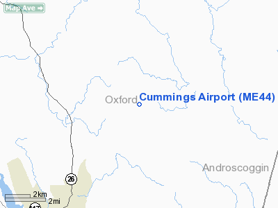
| From nearest city: | 3 nautical miles NE of Paris Hill, ME |
| Location: | Oxford County, ME |
| Magnetic Variation: | 17W (1985) |
Owner & Manager
| Ownership: | Privately owned |
| Owner: | Shirley R. Cummings |
| Address: | P.o. Box 520
North Turner, ME 04266 |
| Phone number: | 207-224-8281 |
| Manager: | Shirley R. Cummings |
| Address: | P.o. Box 520
North Turner, ME 04266 |
| Phone number: | 207-224-8281 |
Airport Operations and Facilities
| Airport Use: | Private |
| Wind indicator: | Yes |
| Segmented Circle: | No |
| Control Tower: | No |
| Landing fee charge: | Yes |
| Sectional chart: | New York |
| Region: | ANE - New England |
| Boundary ARTCC: | ZBW - Boston |
| Tie-in FSS: | BGR - Bangor |
| FSS on Airport: | No |
| FSS Toll Free: | 1-800-WX-BRIEF |
Airport Services
| Airframe Repair: | NONE |
| Power Plant Repair: | NONE |
Runway Information
Runway 17/35
| Dimension: | 1400 x 60 ft / 426.7 x 18.3 m |
| Surface: | TURF, |
| |
Runway 17 |
Runway 35 |
| Traffic Pattern: | Left | Left |
|
Radio Navigation Aids
| ID |
Type |
Name |
Ch |
Freq |
Var |
Dist |
| SZO | FAN MARKER | Grinn | | | 17W | 27.4 nm |
| HIE | FAN MARKER | Witey | | | 17W | 48.3 nm |
| PH | MARINE NDB | Portland Lhb-p | | 301.00 | 17W | 48.3 nm |
| SZO | NDB | Sebago | | 227.00 | 17W | 27.3 nm |
| RL | NDB | Bracy | | 399.00 | 18W | 32.2 nm |
| HXK | NDB | Hornebrook | | 281.00 | 17W | 35.9 nm |
| ISS | NDB | Wiscasset | | 407.00 | 18W | 39.3 nm |
| RQM | NDB | Rangeley | | 221.00 | 18W | 40.9 nm |
| NHZ | TACAN | Brunswick | 099X | | 17W | 33.7 nm |
| AUG | VOR/DME | Augusta | 051X | 111.40 | 18W | 28.0 nm |
| BML | VOR/DME | Berlin | 041X | 110.40 | 17W | 37.9 nm |
| PWM | VOT | Portland Intl Jetport | | 111.00 | | 39.3 nm |
Remarks
Images and information placed above are from
http://www.airport-data.com/airport/ME44/
We thank them for the data!
| General Info
|
| Country |
United States
|
| State |
MAINE
|
| FAA ID |
ME44
|
| Latitude |
44-17-20.248N
|
| Longitude |
070-26-46.213W
|
| Elevation |
960 feet
|
| Near City |
PARIS HILL
|
We don't guarantee the information is fresh and accurate. The data may
be wrong or outdated.
For more up-to-date information please refer to other sources.
|
|


