 |
|
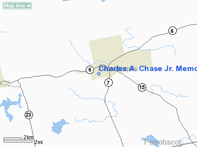
Charles A. Chase Jr. Memorial Field Airport |
Location & QuickFacts
| FAA Information Effective: | 2008-09-25 |
| Airport Identifier: | 44B |
| Airport Status: | Operational |
| Longitude/Latitude: | 069-14-40.8000W/45-10-38.9000N
-69.244667/45.177472 (Estimated) |
| Elevation: | 520 ft / 158.50 m (Surveyed) |
| Land: | 55 acres |
| From nearest city: | 1 nautical miles SW of Dover/foxcroft, ME |
| Location: | Piscataquis County, ME |
| Magnetic Variation: | 19W (1985) |
Owner & Manager
| Ownership: | Publicly owned |
| Owner: | Town Of Dover-foxcroft |
| Address: | Town Hall
Dover-foxcroft, ME 04426 |
| Phone number: | 207-564-3318 |
| Manager: | Brian Kelly |
| Address: | Town Hall
Dover-foxcroft, ME 04426 |
| Phone number: | 207-564-8508 |
Airport Operations and Facilities
| Airport Use: | Open to public |
| Wind indicator: | Yes |
| Segmented Circle: | No |
| Control Tower: | No |
| Landing fee charge: | No |
| Sectional chart: | Montreal |
| Region: | ANE - New England |
| Boundary ARTCC: | ZBW - Boston |
| Tie-in FSS: | BGR - Bangor |
| FSS on Airport: | No |
| FSS Toll Free: | 1-800-WX-BRIEF |
| NOTAMs Facility: | BGR (NOTAM-d service avaliable) |
| Federal Agreements: | N |
Airport Communications
Airport Services
| Airframe Repair: | NONE |
| Power Plant Repair: | NONE |
| Bottled Oxygen: | NONE |
| Bulk Oxygen: | NONE |
Runway Information
Runway 09/27
| Dimension: | 2926 x 75 ft / 891.8 x 22.9 m |
| Surface: | TURF, Good Condition |
| |
Runway 09 |
Runway 27 |
| Longitude: | 069-15-01.1873W | 069-14-20.4854W |
| Latitude: | 45-10-37.6736N | 45-10-40.1144N |
| Elevation: | 478.00 ft | 517.00 ft |
| Traffic Pattern: | Left | Left |
| Markings: | None, | None, |
| Runway End Identifier: | No | No |
| Centerline Lights: | No | No |
| Touchdown Lights: | No | No |
| Obstruction: | 50 ft trees | 10 ft road, 0.0 ft from runway |
|
Radio Navigation Aids
| ID |
Type |
Name |
Ch |
Freq |
Var |
Dist |
| XQA | NDB | Squaw | | 236.00 | 18W | 27.5 nm |
| OLD | NDB | Old Town | | 272.00 | 20W | 27.9 nm |
| BUP | NDB | Burnham | | 348.00 | 18W | 29.3 nm |
| LRG | NDB | Lincoln | | 216.00 | 19W | 31.8 nm |
| LNT | NDB | Milnot | | 344.00 | 19W | 40.7 nm |
| BST | NDB | Belfast | | 278.00 | 18W | 47.1 nm |
| RL | NDB | Bracy | | 399.00 | 18W | 47.9 nm |
| MLT | VOR/DME | Millinocket | 126X | 117.90 | 20W | 39.4 nm |
| BGR | VORTAC | Bangor | 095X | 114.80 | 19W | 25.6 nm |
| BGR | VOT | Bangor | | 111.00 | | 29.1 nm |
Remarks
- RWY ENDS NOT CLEARLY DEFINED.
- DEER ON & INVOF ARPT.
- PHONE AVBL FOR PILOT USE.
- EXISTED PRIOR TO 1959.
Images and information placed above are from
http://www.airport-data.com/airport/44B/
We thank them for the data!
| General Info
|
| Country |
United States
|
| State |
MAINE
|
| FAA ID |
44B
|
| Latitude |
45-11-00.197N
|
| Longitude |
069-13-58.161W
|
| Elevation |
520 feet
|
| Near City |
DOVER/FOXCROFT
|
We don't guarantee the information is fresh and accurate. The data may
be wrong or outdated.
For more up-to-date information please refer to other sources.
|
|


