 |
|
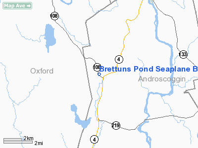
Brettuns Pond Seaplane Base |
Location & QuickFacts
| FAA Information Effective: | 2008-09-25 |
| Airport Identifier: | ME12 |
| Airport Status: | Operational |
| Longitude/Latitude: | 070-15-16.2090W/44-23-16.2400N
-70.254503/44.387844 (Estimated) |
| Elevation: | 400 ft / 121.92 m (Estimated) |
| Land: | 0 acres |
| From nearest city: | 0 nautical miles W of Livermore, ME |
| Location: | Androscoggin County, ME |
| Magnetic Variation: | 17W (1985) |
Owner & Manager
| Ownership: | Publicly owned |
| Owner: | William R. Brown |
| Address: | Po Box 716
Livermore, ME 04253 |
| Phone number: | 207-897-2833 |
| Manager: | William R. Brown |
| Address: | Po Box 716
Livermore, ME 04253 |
| Phone number: | 207-897-2833 |
Airport Operations and Facilities
| Airport Use: | Private |
| Segmented Circle: | No |
| Control Tower: | No |
| Sectional chart: | Montreal |
| Region: | ANE - New England |
| Boundary ARTCC: | ZBW - Boston |
| Tie-in FSS: | BGR - Bangor |
| FSS Toll Free: | 1-800-WX-BRIEF |
Runway Information
Runway 04W/22W
| Dimension: | 3000 x 200 ft / 914.4 x 61.0 m |
| Surface: | WATER, |
| |
Runway 04W |
Runway 22W |
| Traffic Pattern: | Left | Left |
|
Runway 17W/35W
| Dimension: | 3500 x 700 ft / 1066.8 x 213.4 m |
| Surface: | WATER, |
| |
Runway 17W |
Runway 35W |
| Traffic Pattern: | Left | Left |
|
Radio Navigation Aids
| ID |
Type |
Name |
Ch |
Freq |
Var |
Dist |
| SZO | FAN MARKER | Grinn | | | 17W | 37.4 nm |
| RL | NDB | Bracy | | 399.00 | 18W | 22.7 nm |
| ISS | NDB | Wiscasset | | 407.00 | 18W | 36.0 nm |
| SZO | NDB | Sebago | | 227.00 | 17W | 36.9 nm |
| RQM | NDB | Rangeley | | 221.00 | 18W | 39.1 nm |
| HXK | NDB | Hornebrook | | 281.00 | 17W | 41.3 nm |
| BUP | NDB | Burnham | | 348.00 | 18W | 42.7 nm |
| NHZ | TACAN | Brunswick | 099X | | 17W | 34.1 nm |
| AUG | VOR/DME | Augusta | 051X | 111.40 | 18W | 20.1 nm |
| BML | VOR/DME | Berlin | 041X | 110.40 | 17W | 42.6 nm |
| PWM | VOT | Portland Intl Jetport | | 111.00 | | 44.9 nm |
Remarks
Images and information placed above are from
http://www.airport-data.com/airport/ME12/
We thank them for the data!
| General Info
|
| Country |
United States
|
| State |
MAINE
|
| FAA ID |
ME12
|
| Latitude |
44-23-16.240N
|
| Longitude |
070-15-16.209W
|
| Elevation |
400 feet
|
| Near City |
LIVERMORE
|
We don't guarantee the information is fresh and accurate. The data may
be wrong or outdated.
For more up-to-date information please refer to other sources.
|
|


