 |
|
Belfast Municipal Airport |
| Belfast Municipal Airport |
| IATA: none – ICAO: KBST – FAA LID: BST |
| Summary |
| Airport type |
Public |
| Owner |
City of Belfast |
| Serves |
Belfast, Maine |
| Elevation AMSL |
198 ft / 60 m |
| Coordinates |
44°24′34″N 069°00′43″W / 44.40944°N 69.01194°W / 44.40944; -69.01194 |
| Runways |
| Direction |
Length |
Surface |
| ft |
m |
| 15/33 |
4,000 |
1,219 |
Asphalt |
| Statistics (2008) |
| Aircraft operations |
10,000 |
| Based aircraft |
26 |
| Source: Federal Aviation Administration |
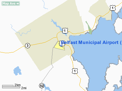
Belfast Municipal Airport (ICAO: KBST, FAA LID: BST) is a public use airport in Waldo County, Maine, United States. It is owned by the City of Belfast and is located one nautical mile (1.85 km) southwest of its central business district.
Although most U.S. airports use the same three-letter location identifier for the FAA and IATA, this airport is assigned BST by the FAA but has no designation from the IATA (which assigned BST to Bost Airport in Lashkar Gah, Afghanistan).
Facilities and aircraft
Belfast Municipal Airport covers an area of 320 acres (129 ha) at an elevation of 198 feet (60 m) above mean sea level. It has one runway designated 15/33 with an asphalt surface measuring 4,000 by 100 feet (1,219 x 30 m).
For the 12-month period ending August 9, 2008, the airport had 10,000 aircraft operations, an average of 27 per day: 80% general aviation and 20% air taxi. At that time there were 26 aircraft based at this airport: 88% single-engine, 8% helicopter and 4% ultralight.
The above content comes from Wikipedia and is published under free licenses – click here to read more.
Location & QuickFacts
| FAA Information Effective: | 2008-09-25 |
| Airport Identifier: | BST |
| Airport Status: | Operational |
| Longitude/Latitude: | 069-00-43.0000W/44-24-34.0000N
-69.011944/44.409444 (Estimated) |
| Elevation: | 198 ft / 60.35 m (Surveyed) |
| Land: | 320 acres |
| From nearest city: | 1 nautical miles SW of Belfast, ME |
| Location: | Waldo County, ME |
| Magnetic Variation: | 18W (2000) |
Owner & Manager
| Ownership: | Publicly owned |
| Owner: | City Of Belfast |
| Address: | City Hall 131 Churchst
Belfast, ME 04915 |
| Phone number: | 207-338-3370 |
| Manager: | Terry St. Peter
CITY MANAGER. |
| Address: | 131 Church Street
Belfast, ME 04915 |
| Phone number: | 207-338-3370 |
Airport Operations and Facilities
| Airport Use: | Open to public |
| Wind indicator: | Yes |
| Segmented Circle: | Yes |
| Control Tower: | No |
| Lighting Schedule: | DUSK-DAWN
ACTVT MIRL & REIL RYS 15 & 33 - CTAF. |
| Beacon Color: | Clear-Green (lighted land airport)
ROTG BCN OTS INDEFLY. |
| Landing fee charge: | No |
| Sectional chart: | Montreal |
| Region: | ANE - New England |
| Boundary ARTCC: | ZBW - Boston |
| Tie-in FSS: | BGR - Bangor |
| FSS on Airport: | No |
| FSS Toll Free: | 1-800-WX-BRIEF |
| NOTAMs Facility: | BGR (NOTAM-d service avaliable) |
| Federal Agreements: | NGY3 |
Airport Communications
| CTAF: | 122.800 |
| Unicom: | 122.800 |
Airport Services
| Fuel available: | 100LL
FOR FUEL & SERVICE CALL 207-338-4736. |
| Bottled Oxygen: | NONE |
| Bulk Oxygen: | NONE |
Runway Information
Runway 15/33
| Dimension: | 4000 x 100 ft / 1219.2 x 30.5 m |
| Surface: | ASPH, |
| Weight Limit: | Single wheel: 30000 lbs. |
| Edge Lights: | Medium |
| |
Runway 15 |
Runway 33 |
| Longitude: | 069-01-02.6000W | 069-00-22.5800W |
| Latitude: | 44-24-47.3900N | 44-24-20.2400N |
| Elevation: | 198.00 ft | 159.00 ft |
| Alignment: | 127 | 127 |
| Traffic Pattern: | Left | Left |
| Markings: | Non-precision instrument, Good Condition | Non-precision instrument, Good Condition |
| Runway End Identifier: | Yes | Yes |
| Obstruction: | 90 ft trees, 1360.0 ft from runway, 290 ft left of centerline, 12:1 slope to clear
RWY 15 +6 FT BRUSH 180 FT FM THLD 95 FT LEFT. | 25 ft trees, 650.0 ft from runway, 125 ft left of centerline, 18:1 slope to clear |
|
Radio Navigation Aids
| ID |
Type |
Name |
Ch |
Freq |
Var |
Dist |
| BST | NDB | Belfast | | 278.00 | 18W | 0.1 nm |
| SUH | NDB | Sprucehead | | 356.00 | 18W | 22.0 nm |
| BUP | NDB | Burnham | | 348.00 | 18W | 22.8 nm |
| RL | NDB | Bracy | | 399.00 | 18W | 31.2 nm |
| BH | NDB | Surry | | 330.00 | 19W | 31.2 nm |
| ISS | NDB | Wiscasset | | 407.00 | 18W | 37.3 nm |
| OLD | NDB | Old Town | | 272.00 | 20W | 39.4 nm |
| AUG | VOR/DME | Augusta | 051X | 111.40 | 18W | 34.1 nm |
| BGR | VORTAC | Bangor | 095X | 114.80 | 19W | 26.6 nm |
| BGR | VOT | Bangor | | 111.00 | | 25.3 nm |
Remarks
- RY 15 +27 FT TREES 5 FT FM RY END 245 FT R.
- WILDLIFE ON & INVOF ARPT.
- EXISTED PRIOR TO 1959.
Images and information placed above are from
http://www.airport-data.com/airport/BST/
We thank them for the data!
| General Info
|
| Country |
United States
|
| State |
MAINE
|
| FAA ID |
BST
|
| Latitude |
44-24-34.800N
|
| Longitude |
069-00-44.100W
|
| Elevation |
195 feet
|
| Near City |
BELFAST
|
We don't guarantee the information is fresh and accurate. The data may
be wrong or outdated.
For more up-to-date information please refer to other sources.
|
|


