 |
|
Owner & Manager
| Ownership: | Privately owned |
| Owner: | Robert T. Bushnell
OWNER/MGR RESIDES AT ARPT. |
| Address: | Po Box 248
Norridgewock, ME 04957 |
| Phone number: | 207-587-2211 |
| Manager: | Robert T. Bushnell |
| Address: | Po Box 248
Norridgewock, ME 04957 |
| Phone number: | 207-587-2211 |
Airport Operations and Facilities
| Airport Use: | Private |
| Wind indicator: | Yes |
| Segmented Circle: | No |
| Control Tower: | No |
| Landing fee charge: | No |
| Sectional chart: | Montreal |
| Region: | ANE - New England |
| Traffic Pattern Alt: | 1000 ft |
| Boundary ARTCC: | ZBW - Boston |
| Tie-in FSS: | BGR - Bangor |
| FSS on Airport: | No |
| FSS Toll Free: | 1-800-WX-BRIEF |
Airport Services
| Airframe Repair: | MINOR |
| Power Plant Repair: | MINOR |
| Bottled Oxygen: | NONE |
| Bulk Oxygen: | NONE |
Runway Information
Runway 15/33
| Dimension: | 1950 x 120 ft / 594.4 x 36.6 m |
| Surface: | TURF, |
| |
Runway 15 |
Runway 33 |
| Traffic Pattern: | Left | Left |
| Markings: | None, | None, |
| Obstruction: | 20 ft trees, 50.0 ft from runway, 1:1 slope to clear | 10 ft trees, 0.0 ft from runway, 1:1 slope to clear |
|
Radio Navigation Aids
| ID |
Type |
Name |
Ch |
Freq |
Var |
Dist |
| RL | NDB | Bracy | | 399.00 | 18W | 14.2 nm |
| BUP | NDB | Burnham | | 348.00 | 18W | 23.0 nm |
| RQM | NDB | Rangeley | | 221.00 | 18W | 39.9 nm |
| BST | NDB | Belfast | | 278.00 | 18W | 40.8 nm |
| ISS | NDB | Wiscasset | | 407.00 | 18W | 42.5 nm |
| NHZ | TACAN | Brunswick | 099X | | 17W | 47.7 nm |
| AUG | VOR/DME | Augusta | 051X | 111.40 | 18W | 21.3 nm |
| BGR | VORTAC | Bangor | 095X | 114.80 | 19W | 44.8 nm |
| BGR | VOT | Bangor | | 111.00 | | 47.0 nm |
Remarks
- SKIS ONLY WHEN SNOW COVERED.
- LOW ALT TURBULENCE DURG HIGH WINDS.
- P-LINE W. ALONG ROAD (NOT AN APCH OBS).
- RWY 15/33 SOFT WHEN WET.
- TRUCKS CROSSING APCH END OF RY 33 ON ACCESS ROAD.
- PPR CALL AMGR 207-587-2211.
- ANG ACFT AND HEL ACTIVITY ON AND INVOF ARPT.
- OPNS IN VFR CONDS, RIGHT TFC PAT FOR RWY 15.
Images and information placed above are from
http://www.airport-data.com/airport/04ME/
We thank them for the data!
| General Info
|
| Country |
United States
|
| State |
MAINE
|
| FAA ID |
04ME
|
| Latitude |
44-40-00.223N
|
| Longitude |
069-53-38.199W
|
| Elevation |
625 feet
|
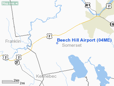
| Near City |
MERCER
|
We don't guarantee the information is fresh and accurate. The data may
be wrong or outdated.
For more up-to-date information please refer to other sources.
|
|


