 |
|
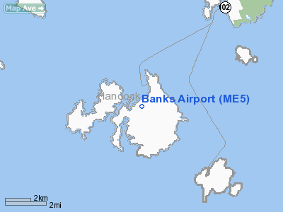
Location & QuickFacts
| FAA Information Effective: | 2008-09-25 |
| Airport Identifier: | ME5 |
| Airport Status: | Operational |
| Longitude/Latitude: | 068-25-41.4000W/44-09-55.4000N
-68.428167/44.165389 (Estimated) |
| Elevation: | 100 ft / 30.48 m (Estimated) |
| Land: | 0 acres |
| From nearest city: | 5 nautical miles N of Swans Island, ME |
| Location: | Hancock County, ME |
| Magnetic Variation: | 19W (1985) |
Owner & Manager
| Ownership: | Privately owned |
| Owner: | William H. Banks |
| Address: | Po Box 97
Swans Island, ME 04685 |
| Phone number: | 207-526-4305 |
| Manager: | William H. Bank |
| Address: | Po Box 97
Swans Island, ME 04479 |
| Phone number: | 207-526-4305
EMERGENCY PHONE: 207-460-1113. |
Airport Operations and Facilities
| Airport Use: | Open to public |
| Wind indicator: | No |
| Segmented Circle: | No |
| Control Tower: | No |
| Landing fee charge: | No |
| Sectional chart: | Halifax |
| Region: | ANE - New England |
| Boundary ARTCC: | ZBW - Boston |
| Tie-in FSS: | BGR - Bangor |
| FSS on Airport: | No |
| FSS Toll Free: | 1-800-WX-BRIEF |
| NOTAMs Facility: | BGR |
Airport Communications
Runway Information
Runway 10/28
| Dimension: | 1500 x 30 ft / 457.2 x 9.1 m |
| Surface: | GRVL, |
| |
Runway 10 |
Runway 28 |
| Longitude: | 068-25-51.4200W | 068-25-31.3000W |
| Latitude: | 44-09-53.8400N | 44-09-56.9500N |
| Traffic Pattern: | Left | Left |
| Displaced threshold: | 0.00 ft | 300.00 ft
DSPLCD THLD 300 FT; LDA 1,200 FT. |
| Obstruction: | | 15 ft bldg |
| Decleard distances: | Take off run available 1500.00 ft
Take off distance available 1500.00 ft
Actual stop distance available 1500.00 ft
Landing distance available 1500.00 ft
| Take off run available 1500.00 ft
Take off distance available 1500.00 ft
Actual stop distance available 1500.00 ft
Landing distance available 1200.00 ft
|
|
Helipad H1
| Dimension: | 40 x 40 ft / 12.2 x 12.2 m |
| Surface: | CONC, |
| |
Runway H1 |
Runway |
| Traffic Pattern: | Left | Left |
|
Radio Navigation Aids
| ID |
Type |
Name |
Ch |
Freq |
Var |
Dist |
| BH | NDB | Surry | | 330.00 | 19W | 23.0 nm |
| BST | NDB | Belfast | | 278.00 | 18W | 29.1 nm |
| SUH | NDB | Sprucehead | | 356.00 | 18W | 30.0 nm |
| BGR | VORTAC | Bangor | 095X | 114.80 | 19W | 44.9 nm |
| BGR | VOT | Bangor | | 111.00 | | 41.8 nm |
Remarks
- RY 28 TREES 50 FT AGL - 400 FT FM EOR. BLDG 15 FT AGL - 200 FT FM EOR.
- ALL OPNS RESTRICTED TO DAYLGT VFR ONLY.
- PRIOR TO USING ARPT CALL 207-526-4305.
- SEE AIRSPACE CASE 99-ANE-8016-NRA.
Images and information placed above are from
http://www.airport-data.com/airport/ME5/
We thank them for the data!
| General Info
|
| Country |
United States
|
| State |
MAINE
|
| FAA ID |
ME84
|
| Latitude |
44-09-55.294N
|
| Longitude |
068-25-40.067W
|
| Elevation |
100 feet
|
| Near City |
SWANS ISLAND
|
We don't guarantee the information is fresh and accurate. The data may
be wrong or outdated.
For more up-to-date information please refer to other sources.
|
|


