 |
|
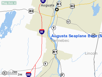
Location & QuickFacts
| FAA Information Effective: | 2008-09-25 |
| Airport Identifier: | M00 |
| Airport Status: | Operational |
| Longitude/Latitude: | 069-46-54.1600W/44-16-03.2480N
-69.781711/44.267569 (Estimated) |
| Elevation: | 23 ft / 7.01 m (Estimated) |
| Land: | 0 acres |
| From nearest city: | 3 nautical miles S of Augusta, ME |
| Location: | Kennebec County, ME |
| Magnetic Variation: | 18W (1980) |
Owner & Manager
| Ownership: | Publicly owned |
| Owner: | City Of Augusta |
| Address: | One City Center Plaza
Augusta, ME 04330 |
| Phone number: | 207-626-2350 |
| Manager: | John Guimond |
| Address: | 75 Airport Rd.
Augusta, ME 04330 |
| Phone number: | 207-626-2306 |
Airport Operations and Facilities
| Airport Use: | Open to public |
| Segmented Circle: | No |
| Control Tower: | No |
| Landing fee charge: | No |
| Sectional chart: | Montreal |
| Region: | ANE - New England |
| Boundary ARTCC: | ZBW - Boston |
| Tie-in FSS: | BGR - Bangor |
| FSS on Airport: | No |
| FSS Toll Free: | 1-800-WX-BRIEF |
| NOTAMs Facility: | BGR (NOTAM-d service avaliable) |
Airport Communications
Runway Information
Runway 13W/31W
| Dimension: | 2500 x 100 ft / 762.0 x 30.5 m |
| Surface: | WATER, |
| |
Runway 13W |
Runway 31W |
| Traffic Pattern: | Right | Left |
| Obstruction: | 80 ft trees, 1090.0 ft from runway, 219 ft right of centerline, 13:1 slope to clear | 160 ft trees, 2560.0 ft from runway, 355 ft right of centerline, 16:1 slope to clear |
|
Radio Navigation Aids
| ID |
Type |
Name |
Ch |
Freq |
Var |
Dist |
| PH | MARINE NDB | Portland Lhb-p | | 301.00 | 17W | 46.5 nm |
| RL | NDB | Bracy | | 399.00 | 18W | 11.8 nm |
| ISS | NDB | Wiscasset | | 407.00 | 18W | 18.2 nm |
| BUP | NDB | Burnham | | 348.00 | 18W | 31.6 nm |
| SUH | NDB | Sprucehead | | 356.00 | 18W | 32.0 nm |
| BST | NDB | Belfast | | 278.00 | 18W | 34.2 nm |
| SZO | NDB | Sebago | | 227.00 | 17W | 48.4 nm |
| NHZ | TACAN | Brunswick | 099X | | 17W | 24.4 nm |
| AUG | VOR/DME | Augusta | 051X | 111.40 | 18W | 3.2 nm |
| PWM | VOT | Portland Intl Jetport | | 111.00 | | 44.2 nm |
Remarks
- DOCKS REMOVED DURING WINTER MONTHS (OCT-MAY).
- LOCATION HAS TIDAL FLUCTUATION OF 4 FT.
- SEALANE POORLY MKD; IREG SHAPED CHANNEL.
- UNMARKED SHOALS EAST OF SEALANE
- DAYTIME USE ONLY.
- PROVIDED ALL TRAFFIC IS WEST OF RWY; ALTITUDES ARE ESTABLISHED AT 800 MSL.
We thank them for the data!
| General Info
|
| Country |
United States
|
| State |
MAINE
|
| FAA ID |
M00
|
| Latitude |
44-16-03.248N
|
| Longitude |
069-46-54.160W
|
| Elevation |
23 feet
|
| Near City |
AUGUSTA
|
We don't guarantee the information is fresh and accurate. The data may
be wrong or outdated.
For more up-to-date information please refer to other sources.
|
|


