 |
|
Auburn/lewiston Municipal Airport |
| Auburn/Lewiston Municipal Airport |
| IATA: LEW – ICAO: KLEW – FAA LID: LEW |
| Summary |
| Airport type |
Public |
| Owner/Operator |
Cities of Auburn & Lewiston |
| Serves |
Auburn / Lewiston, Maine |
| Elevation AMSL |
288 ft / 88 m |
| Coordinates |
44°02′55″N 070°17′01″W / 44.04861°N 70.28361°W / 44.04861; -70.28361 |
| Website |
www.FlyToME.com |
| Runways |
| Direction |
Length |
Surface |
| ft |
m |
| 4/22 |
5,001 |
1,524 |
Asphalt |
| 17/35 |
2,750 |
838 |
Asphalt |
| Statistics (2008) |
| Aircraft operations |
74,180 |
| Based aircraft |
120 |
| Sources: airport website, FAA |
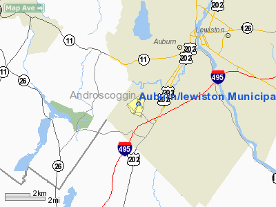
Auburn/Lewiston Municipal Airport (IATA: LEW, ICAO: KLEW, FAA LID: LEW) is a public use airport in Androscoggin County, Maine, United States. It is located four nautical miles (7 km) southwest the cities of Auburn and Lewiston, both of which own and operate the airport.
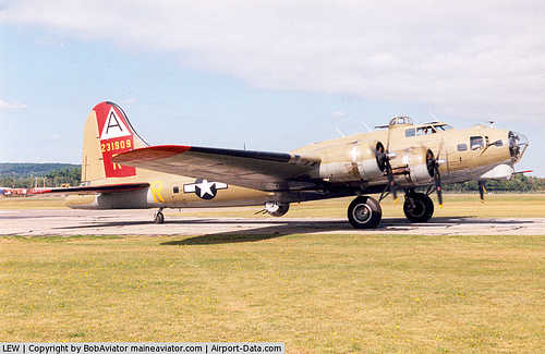
The airport is currently not served by any commercial airline, though scheduled service once served the airport on Northeast Airlines, Air New England, Northeast Express Regional Airlines, and Bar Harbor Airlines. The airport was the site of a fatal accident on the latter of those airlines, killing "America's Youngest Ambassador" Samantha Smith. Facilities and aircraft
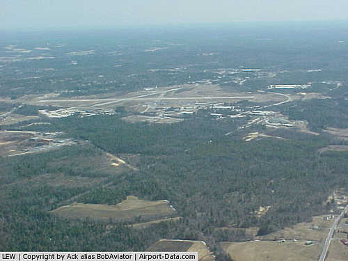
Auburn/Lewiston Municipal Airport covers an area of 547 acres (221 ha) at an elevation of 288 feet (88 m) above mean sea level. It has two asphalt paved runways: 4/22 is 5,001 by 100 feet (1,524 x 30 m) and 17/35 is 2,750 by 75 feet (838 x 23 m).
For the 12-month period ending May 1, 2008, the airport had 74,180 aircraft operations, an average of 203 per day: 64% general aviation, 36% air taxi, and <% military. At that time there were 120 aircraft based at this airport: 75% single-engine, 14% multi-engine, 1% jet, 3% helicopter and 6% ultralight.
The above content comes from Wikipedia and is published under free licenses – click here to read more.
|
 |
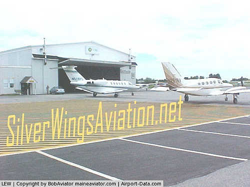
(Click on the photo to enlarge) |
|
 |
(Click on the photo to enlarge) |
|
 |
(Click on the photo to enlarge) |
|
 |
(Click on the photo to enlarge) |
Location & QuickFacts
| FAA Information Effective: | 2008-09-25 |
| Airport Identifier: | LEW |
| Airport Status: | Operational |
| Longitude/Latitude: | 070-17-00.6270W/44-02-54.5020N
-70.283507/44.048473 (Estimated) |
| Elevation: | 288 ft / 87.78 m (Surveyed) |
| Land: | 547 acres |
| From nearest city: | 4 nautical miles SW of Auburn/lewiston, ME |
| Location: | Androscoggin County, ME |
| Magnetic Variation: | 17W (1995) |
Owner & Manager
| Ownership: | Publicly owned |
| Owner: | Cities Of Auburn & Lewiston |
| Address: | 80 Airport Dr
Auburn, ME 04210 |
| Phone number: | 207-786-0631 |
| Manager: | Rick Cloutier |
| Address: | 80 Airport Dr
Aubrun, ME 04210 |
| Phone number: | 207-786-0631 |
Airport Operations and Facilities
| Airport Use: | Open to public |
| Wind indicator: | Yes |
| Segmented Circle: | Yes |
| Control Tower: | No |
| Lighting Schedule: | DUSK-DAWN
ACTVT MIRL RY 17/35; HIRL RY 04/22 & MALSR RY 04 & REIL RY 22 - CTAF. |
| Beacon Color: | Clear-Green (lighted land airport) |
| Landing fee charge: | Yes |
| Sectional chart: | Montreal |
| Region: | ANE - New England |
| Boundary ARTCC: | ZBW - Boston |
| Tie-in FSS: | BGR - Bangor |
| FSS on Airport: | No |
| FSS Toll Free: | 1-800-WX-BRIEF |
| NOTAMs Facility: | LEW (NOTAM-d service avaliable) |
| Federal Agreements: | NGPRY3 |
Airport Communications
| CTAF: | 122.800 |
| Unicom: | 122.800 |
Airport Services
| Fuel available: | 100LLA
24-HR SELF SERVICE FUEL & 24 HR RESTROOMS ON EAST RAMP. |
| Airframe Repair: | MAJOR |
| Power Plant Repair: | MAJOR |
Runway Information
Runway 04/22
| Dimension: | 5001 x 100 ft / 1524.3 x 30.5 m |
| Surface: | ASPH, Good Condition |
| Weight Limit: | Single wheel: 30000 lbs.
Dual wheel: 108000 lbs.
Dual tandem wheel: 180000 lbs. |
| Edge Lights: | High |
| |
Runway 04 |
Runway 22 |
| Longitude: | 070-17-17.0073W | 070-16-48.7404W |
| Latitude: | 44-02-32.0609N | 44-03-17.0375N |
| Elevation: | 270.00 ft | 263.00 ft |
| Alignment: | 24 | 127 |
| ILS Type: | ILS
| |
| Traffic Pattern: | Left | Left |
| Markings: | Precision instrument, Good Condition | Non-precision instrument, Good Condition |
| Crossing Height: | 60.00 ft | 35.00 ft |
| VASI: | 4-light PAPI on left side | 4-light PAPI on left side |
| Visual Glide Angle: | 3.25° | 3.50° |
| Approach lights: | MALSR | |
| Runway End Identifier: | No | Yes |
| Centerline Lights: | No | No |
| Touchdown Lights: | No | No |
| Obstruction: | 135 ft gnd, 4660.0 ft from runway, 33:1 slope to clear | 45 ft pline, 275.0 ft from runway, 375 ft right of centerline, 1:1 slope to clear
RY 22 +35' POLE 100' FROM RWY END, 490' R, +5' ROADWAY 0-200' FROM RWY END 0-350'R. |
|
Runway 17/35
| Dimension: | 2750 x 75 ft / 838.2 x 22.9 m |
| Surface: | ASPH, Good Condition |
| Weight Limit: | Single wheel: 30000 lbs. |
| Edge Lights: | Medium |
| |
Runway 17 |
Runway 35 |
| Longitude: | 070-17-06.5343W | 070-16-46.5057W |
| Latitude: | 44-03-05.8892N | 44-02-42.8919N |
| Elevation: | 256.00 ft | 288.00 ft |
| Alignment: | 127 | 127 |
| Traffic Pattern: | Left | Left |
| Markings: | Basic, Good Condition | Basic, Good Condition |
| Runway End Identifier: | No | No |
| Centerline Lights: | No | No |
| Touchdown Lights: | No | No |
| Obstruction: | 29 ft pole, 675.0 ft from runway, 50 ft right of centerline, 16:1 slope to clear | 3 ft gnd, 201.0 ft from runway
GND RISING FM THLD TO +3 FT AT 200 FT FM EOR. |
|
Radio Navigation Aids
| ID |
Type |
Name |
Ch |
Freq |
Var |
Dist |
| SZO | FAN MARKER | Grinn | | | 17W | 26.5 nm |
| PH | MARINE NDB | Portland Lhb-p | | 301.00 | 17W | 32.4 nm |
| SZO | NDB | Sebago | | 227.00 | 17W | 23.3 nm |
| ISS | NDB | Wiscasset | | 407.00 | 18W | 28.1 nm |
| RL | NDB | Bracy | | 399.00 | 18W | 34.2 nm |
| HXK | NDB | Hornebrook | | 281.00 | 17W | 49.9 nm |
| NHZ | TACAN | Brunswick | 099X | | 17W | 18.9 nm |
| AUG | VOR/DME | Augusta | 051X | 111.40 | 18W | 26.6 nm |
| ENE | VORTAC | Kennebunk | 118X | 117.10 | 17W | 40.1 nm |
| PWM | VOT | Portland Intl Jetport | | 111.00 | | 24.5 nm |
Remarks
- DEER & BIRDS ON & INVOF ARPT.
- RY 4 DESIGNATED CALM WIND RY.
- OCCASIONAL BLASTING IN PROGRESS MON-SAT APRXLY 4,800-5,000 FT SW OF RY 04 THLD 1100-1500 DURG VFR CONDITIONS ONLY. CHECK BGR AFSS LCL NOTAMS FOR SPECIFIC BLASTING TIMES.
- INTENSIVE HELICOPTER OPNS DLY FM 0500-2000. HELICOPTER TFC PAT 500 AGL, RIGHT HAND TFC.
- SILVER WINGS AVIATION 207-782-7070; TWIN CITIES AIR SERVICE 207-784-6318.
- EXISTED PRIOR TO 1959.
We thank them for the data!
| General Info
|
| Country |
United States
|
| State |
MAINE
|
| FAA ID |
LEW
|
| Latitude |
44-02-54.502N
|
| Longitude |
070-17-00.627W
|
| Elevation |
288 feet
|
| Near City |
AUBURN/LEWISTON
|
We don't guarantee the information is fresh and accurate. The data may
be wrong or outdated.
For more up-to-date information please refer to other sources.
|
|


