 |
|
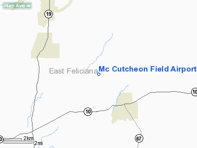
Mc Cutcheon Field Airport |
Location &
QuickFacts
|
FAA
Information Effective: |
2008-09-25 |
|
Airport
Identifier: |
LA83 |
|
Airport
Status: |
Operational |
|
Longitude/Latitude: |
091-02-45.3750W/30-53-45.6470N
-91.045937/30.896013 (Estimated) |
|
Elevation: |
272 ft / 82.91 m (Surveyed) |
|
Land: |
0 acres |
|
From
nearest city: |
3 nautical miles NW of Clinton, LA |
|
Location: |
East Feliciana Parish, LA |
|
Magnetic Variation: |
03E (1985) |
Owner & Manager
|
Ownership: |
Privately owned |
|
Owner: |
Gay B. Mccutcheon Et Al
OTHER CONTACT: JEFFERY T. MCCUTCHEON PO BOX 8534 CLINTON, LA 70722;
225-683-5242 |
|
Address: |
10810 Wilson-clinton Rd
Clinton, LA 70722 |
|
Phone number: |
225-683-8911 |
|
Address: |
|
Airport Operations and Facilities
|
Airport Use: |
Private |
|
Wind indicator: |
Yes |
|
Segmented Circle: |
No |
|
Control Tower: |
No |
|
Landing fee charge: |
No |
|
Sectional chart: |
Houston |
|
Region: |
ASW - Southwest |
|
Boundary ARTCC: |
ZHU - Houston |
|
Tie-in FSS: |
DRI - De Ridder |
|
FSS on Airport: |
No |
|
FSS Toll Free: |
1-800-WX-BRIEF |
Airport Services
|
Airframe
Repair: |
NONE |
|
Power
Plant Repair: |
NONE |
|
Runway
Information
Runway N/S
|
Dimension: |
2100 x 95 ft / 640.1 x 29.0 m |
|
Surface: |
TURF, |
|
|
Runway N
|
Runway S
|
|
Traffic
Pattern: |
Left |
Left |
|
Radio Navigation Aids
|
ID |
Type |
Name |
Ch |
Freq |
Var |
Dist |
|
HZ |
NDB |
Hazer |
|
356.00 |
04E |
27.8 nm |
|
MC |
NDB |
Ferni |
|
413.00 |
03E |
35.0 nm |
|
HAH |
NDB |
Natchez-adams County |
|
388.00 |
03E |
49.4 nm |
|
HMU |
VOR |
Hammond |
|
109.60 |
03E |
39.6 nm |
|
HEZ |
VOR/DME |
Natchez |
037X |
110.00 |
03E |
45.3 nm |
|
BTR |
VORTAC |
Baton Rouge |
112X |
116.50 |
06E |
27.8 nm |
|
MCB |
VORTAC |
Mc Comb |
114X |
116.70 |
03E |
47.4 nm |
Remarks
Mc Cutcheon Field Airport
Address:
East Feliciana Parish, LA
Tel:
225-683-8911
Images
and information placed above are from
http://www.airport-data.com/airport/LA83/
We
thank them for the data!
|
General Info |
| Country |
United
States |
| State |
LOUISIANA |
| FAA ID |
LA83
|
| Latitude |
30-53-45.647N |
|
Longitude |
091-02-45.375W |
|
Elevation |
272 feet
|
| Near
City |
CLINTON
|
We don't guarantee the information is fresh and accurate. The data may
be wrong or outdated.
For more up-to-date information please refer to other sources.
|
|


