 |
|
|
Location &
QuickFacts
|
FAA
Information Effective: |
2008-09-25 |
|
Airport
Identifier: |
2KY5 |
|
Airport
Status: |
Operational |
|
Longitude/Latitude: |
083-09-17.0000W/38-22-30.0000N
-83.154722/38.375000 (Estimated) |
|
Elevation: |
1050 ft / 320.04 m (Estimated) |
|
Land: |
10 acres |
|
From
nearest city: |
6 nautical miles N of Olive Hill, KY |
|
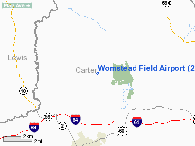
Location: |
Carter County, KY |
|
Magnetic Variation: |
05W (1995) |
Owner & Manager
|
Ownership: |
Privately owned |
|
Owner: |
Steve Womack |
|
Address: |
1094 North Route 7
Grayson, KY 41143 |
|
Phone number: |
606-286-5321 |
|
Manager: |
Steve Womack |
|
Address: |
1094 North Route 7
Grayson, KY 41143 |
|
Phone number: |
606-474-6601 |
Airport
Operations and Facilities
|
Airport
Use: |
Private |
|
Wind
indicator: |
Yes |
|
Segmented Circle: |
No |
|
Control
Tower: |
No |
|
Lighting
Schedule: |
PHONE REQ
FOR LIRL RY 16/34 CALL 606-286-5321 OR 606-286-8533. |
|
Sectional chart: |
Cincinnati |
|
Region: |
ASO - Southern |
|
Boundary
ARTCC: |
ZID - Indianapolis |
|
Tie-in
FSS: |
LOU - Louisville |
|
FSS Toll
Free: |
1-800-WX-BRIEF |
|
Runway Information
Runway 16/34
|
Dimension: |
3060 x 40 ft / 932.7 x 12.2 m |
|
Surface: |
ASPH, |
|
Edge Lights: |
Low |
|
|
Runway 16
|
Runway 34
|
|
Traffic
Pattern: |
Left |
Left |
|
Radio Navigation Aids
|
ID |
Type |
Name |
Ch |
Freq |
Var |
Dist |
|
AJY |
FAN MARKER |
Ashland |
|
|
03W |
20.2 nm |
|
XW |
NDB |
Flmng |
|
400.00 |
05W |
26.1 nm |
|
PMH |
NDB |
Portsmouth |
|
373.00 |
04W |
28.5 nm |
|
PZO |
NDB |
Peebles |
|
329.00 |
02W |
33.8 nm |
|
AMT |
NDB |
West Union |
|
359.00 |
04W |
34.7 nm |
|
IOB |
NDB |
Mount Sterling |
|
210.00 |
04W |
43.4 nm |
|
EOP |
NDB |
Waverly |
|
385.00 |
06W |
48.7 nm |
|
ECB |
VORTAC |
Newcombe |
041X |
110.40 |
02W |
17.4 nm |
|
YRK |
VORTAC |
York |
075X |
112.80 |
05W |
18.2 nm |
Remarks
Womstead Field Airport
Address:
Carter County, KY
Tel:
606-286-5321, 606-474-6601
Images
and information placed above are from
http://www.airport-data.com/airport/2KY5/
We
thank them for the data!
|
General Info |
| Country |
United
States |
| State |
KENTUCKY
|
| FAA ID |
2KY5
|
| Latitude |
38-22-30.000N |
|
Longitude |
083-09-17.000W |
|
Elevation |
1050
feet |
| Near
City |
OLIVE
HILL |
We don't guarantee the information is fresh and accurate. The data may
be wrong or outdated.
For more up-to-date information please refer to other sources.
|
|


