 |
|
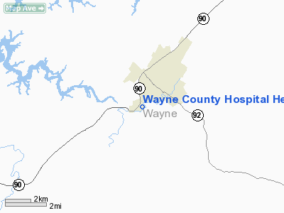
Wayne County Hospital Heliport |
|
Location &
QuickFacts
|
FAA
Information Effective: |
2008-09-25 |
|
Airport
Identifier: |
30KY |
|
Airport
Status: |
Operational |
|
Longitude/Latitude: |
084-52-02.8070W/36-49-10.2550N
-84.867446/36.819515 (Estimated) |
|
Elevation: |
923 ft / 281.33 m (Estimated) |
|
Land: |
0 acres |
|
From
nearest city: |
0 nautical miles N of Monticello, KY |
|
Location: |
Wayne County, KY |
|
Magnetic Variation: |
02W (1985) |
Owner & Manager
|
Ownership: |
Privately owned |
|
Owner: |
Wayne County Hospital |
|
Address: |
166 Hospital Street
Monticello, KY 42633-2416 |
|
Phone
number: |
606-348-9343 |
|
Manager: |
Barbara Germain |
|
Address: |
Rt 4 Box 56 B
Monticello, KY 42633 |
|
Phone number: |
606-348-9343 |
Airport Operations and Facilities
|
Airport
Use: |
Private
MEDICAL |
|
Wind
indicator: |
Yes |
|
Segmented Circle: |
No |
|
Control
Tower: |
No |
|
Lighting
Schedule: |
PHONE REQ
FOR PERIMETER LGTS CALL 606-348-9343. |
|
Sectional chart: |
Cincinnati |
|
Region: |
ASO - Southern |
|
Boundary
ARTCC: |
ZID - Indianapolis |
|
Tie-in
FSS: |
LOU - Louisville |
|
FSS Toll
Free: |
1-800-WX-BRIEF |
|
Runway Information
Helipad H1
|
Dimension: |
60 x 60 ft / 18.3 x 18.3 m |
|
Surface: |
CONC, |
|
|
Runway H1
|
Runway
|
|
Traffic
Pattern: |
Left |
Left |
|
Radio Navigation Aids
|
ID |
Type |
Name |
Ch |
Freq |
Var |
Dist |
|
EKQ |
NDB |
Elk Spring |
|
290.00 |
03W |
2.3 nm |
|
CDX |
NDB |
Cumberland River |
|
388.00 |
05E |
13.9 nm |
|
BPO |
NDB |
Piney Grove |
|
403.00 |
05W |
25.3 nm |
|
TYC |
NDB |
Taylor County |
|
272.00 |
02W |
39.4 nm |
|
JAU |
NDB |
Jacksboro |
|
204.00 |
03W |
44.7 nm |
|
DVK |
NDB |
Goodall |
|
311.00 |
03W |
45.8 nm |
|
LVT |
VORTAC |
Livingston |
021X |
108.40 |
02W |
20.2 nm |
|
LOZ |
VORTAC |
London |
108X |
116.10 |
03W |
38.6 nm |
Remarks
Wayne County Hospital Heliport
Address:
Wayne County, KY
Tel:
606-348-9343
Images
and information placed above are from
http://www.airport-data.com/airport/30KY/
We
thank them for the data!
|
General Info |
| Country |
United
States |
| State |
KENTUCKY
|
| FAA ID |
30KY
|
| Latitude |
36-49-10.255N |
|
Longitude |
084-52-02.807W |
|
Elevation |
923 feet
|
| Near
City |
MONTICELLO |
We don't guarantee the information is fresh and accurate. The data may
be wrong or outdated.
For more up-to-date information please refer to other sources.
|
|


