 |
|
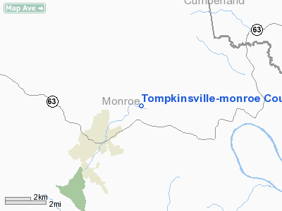
Tompkinsville-monroe County Airport |
|
|
|
Location &
QuickFacts
|
FAA
Information Effective: |
2008-09-25 |
|
Airport
Identifier: |
TZV |
|
Airport
Status: |
Operational |
|
Longitude/Latitude: |
085-39-08.6000W/36-43-44.5000N
-85.652389/36.729028 (Estimated) |
|
Elevation: |
1036 ft / 315.77 m (Surveyed) |
|
Land: |
92 acres |
|
From
nearest city: |
2 nautical miles NE of Tompkinsville, KY |
|
Location: |
Monroe County, KY |
|
Magnetic Variation: |
01W (1985) |
Owner & Manager
|
Ownership: |
Publicly owned |
|
Owner: |
Tompkinsville-monroe Co Apt |
|
Address: |
3556 Old Glasgow Rd
Tompkinsville, KY 42167 |
|
Phone
number: |
270-487-0678 |
|
Manager: |
Marshall Hodges |
|
Address: |
P.o. Box 162
Tompkinsville, KY 42167 |
|
Phone number: |
270-487-8563 |
Airport Operations and Facilities
|
Airport
Use: |
Open to public |
|
Wind
indicator: |
Yes |
|
Segmented Circle: |
Yes |
|
Control
Tower: |
No |
|
Lighting
Schedule: |
DUSK-DAWN
ACTVT MIRL RY 04/22, REIL RYS 04 & 22 AND VASI RYS 04 & 22 - CTAF. |
|
Beacon
Color: |
Clear-Green (lighted land airport) |
|
Landing
fee charge: |
No |
|
Sectional chart: |
St Louis |
|
Region: |
ASO - Southern |
|
Boundary
ARTCC: |
ZME - Memphis |
|
Tie-in
FSS: |
LOU - Louisville |
|
FSS on
Airport: |
No |
|
FSS Toll
Free: |
1-800-WX-BRIEF |
|
NOTAMs
Facility: |
LOU (NOTAM-d service avaliable) |
|
Federal Agreements: |
N |
Airport Communications
|
CTAF: |
122.800 |
|
Unicom: |
122.800 |
Airport Services
|
Runway Information
Runway 04/22
|
Dimension: |
4000 x 75 ft / 1219.2 x 22.9 m |
|
Surface: |
ASPH, Good Condition |
|
Weight Limit: |
Single wheel: 12000 lbs. |
|
Edge Lights: |
Medium |
|
|
Runway 04
|
Runway 22
|
|
Longitude: |
085-39-22.4600W |
085-38-54.6640W |
|
Latitude: |
36-43-28.2350N |
36-44-00.8480N |
|
Elevation: |
1015.00 ft |
1036.00 ft |
|
Alignment: |
34 |
127 |
|
Traffic
Pattern: |
Left |
Left |
|
Markings: |
Non-precision instrument, Fair Condition |
Non-precision instrument, Fair Condition |
|
Crossing
Height: |
35.00 ft |
42.00 ft |
|
VASI: |
2-box on left side |
2-box on left side |
|
Visual
Glide Angle: |
3.00° |
3.00° |
|
Runway End
Identifier: |
Yes
RY 04 & 22 REIL OTS INDEFLY. |
Yes |
|
Obstruction: |
37 ft pole, 1709.0 ft from runway, 226 ft left of
centerline, 40:1 slope to clear |
24 ft tree, 1292.0 ft from runway, 74 ft left of
centerline, 45:1 slope to clear
+15 FT TREES, 199 FT FROM RY END & 90 FT LEFT. |
|
Radio Navigation Aids
|
ID |
Type |
Name |
Ch |
Freq |
Var |
Dist |
|
LFB |
NDB |
Lafayette |
|
245.00 |
02W |
23.5 nm |
|
BVQ |
NDB |
Beaver Creek |
|
260.00 |
02W |
24.4 nm |
|
EKQ |
NDB |
Elk Spring |
|
290.00 |
03W |
39.2 nm |
|
HEM |
NDB |
Huchn |
|
233.00 |
02W |
44.7 nm |
|
TYC |
NDB |
Taylor County |
|
272.00 |
02W |
44.9 nm |
|
SKN |
NDB |
Hurricane |
|
256.00 |
02W |
45.4 nm |
|
JUE |
NDB |
Lebanon |
|
414.00 |
02W |
45.4 nm |
|
CDX |
NDB |
Cumberland River |
|
388.00 |
05E |
49.4 nm |
|
LVT |
VORTAC |
Livingston |
021X |
108.40 |
02W |
25.0 nm |
|
BWG |
VORTAC |
Bowling Green |
126X |
117.90 |
02E |
39.9 nm |
Remarks
Based Aircraft
|
Aircraft based
on field: |
15 |
|
Single Engine
Airplanes: |
13 |
|
Multi Engine
Airplanes: |
2 |
Operational Statistics
Time Period: 2005-02-09 - 2006-02-08
|
Aircraft
Operations: |
68/Week |
|
Air Taxi: |
12.9% |
|
General
Aviation Local: |
43.6% |
|
General
Aviation Itinerant: |
42.9% |
|
Military: |
0.7% |
Tompkinsville-monroe County Airport
Address:
Monroe County, KY
Tel:
270-487-0678,
270-487-8563
Images
and information placed above are from
http://www.airport-data.com/airport/TZV/
We
thank them for the data!
|
General Info |
| Country |
United
States |
| State |
KENTUCKY
|
| FAA ID |
TZV
|
| Latitude |
36-43-47.208N |
|
Longitude |
085-39-06.896W |
|
Elevation |
1036
feet |
| Near
City |
TOMPKINSVILLE |
We don't guarantee the information is fresh and accurate. The data may
be wrong or outdated.
For more up-to-date information please refer to other sources.
|
|


