 |
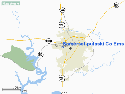
|
Somerset-pulaski Company Ems Heliport |
|
Location &
QuickFacts
|
FAA
Information Effective: |
2008-09-25 |
|
Airport
Identifier: |
39KY |
|
Airport
Status: |
Operational |
|
Longitude/Latitude: |
084-37-32.7910W/37-05-07.2780N
-84.625775/37.085355 (Estimated) |
|
Elevation: |
993 ft / 302.67 m (Estimated) |
|
Land: |
0 acres |
|
From
nearest city: |
2 nautical miles W of Somerset, KY |
|
Location: |
Pulaski County, KY |
|
Magnetic Variation: |
02W (1985) |
Owner & Manager
|
Ownership: |
Publicly owned |
|
Owner: |
Somerset-pulaski Co Ems |
|
Address: |
301 Hail Knob Rd
Somerset, KY 42501 |
|
Phone
number: |
606-679-6388 |
|
Manager: |
Billy Miller |
|
Address: |
P.o. Box 989
Somerset, KY 42502 |
|
Phone number: |
606-679-6388 |
Airport Operations and Facilities
|
Airport
Use: |
Private
MEDICAL. |
|
Wind
indicator: |
Yes |
|
Segmented Circle: |
No |
|
Control
Tower: |
No |
|
Sectional chart: |
Atlanta |
|
Region: |
ASO - Southern |
|
Boundary
ARTCC: |
ZID - Indianapolis |
|
Tie-in
FSS: |
LOU - Louisville |
|
FSS Toll
Free: |
1-800-WX-BRIEF |
|
Runway Information
Helipad H1
|
Dimension: |
60 x 45 ft / 18.3 x 13.7 m |
|
Surface: |
ASPH, Good Condition |
|
|
Runway H1
|
Runway
|
|
Traffic
Pattern: |
Left |
Left |
|
Radio Navigation Aids
|
ID |
Type |
Name |
Ch |
Freq |
Var |
Dist |
|
CDX |
NDB |
Cumberland River |
|
388.00 |
05E |
6.0 nm |
|
EKQ |
NDB |
Elk Spring |
|
290.00 |
03W |
17.6 nm |
|
DVK |
NDB |
Goodall |
|
311.00 |
03W |
30.2 nm |
|
BPO |
NDB |
Piney Grove |
|
403.00 |
05W |
33.6 nm |
|
TYC |
NDB |
Taylor County |
|
272.00 |
02W |
35.2 nm |
|
IKY |
NDB |
Springfield |
|
429.00 |
03W |
44.1 nm |
|
XYC |
NDB |
Seco |
|
393.00 |
03W |
49.4 nm |
|
LOZ |
VORTAC |
London |
108X |
116.10 |
03W |
24.9 nm |
|
LVT |
VORTAC |
Livingston |
021X |
108.40 |
02W |
39.8 nm |
Remarks
-
PROVIDED ALL OPS
VFR, PVT USE , APP/DEP OPS 180DEG-270DEG, TAKEOFF/LDG AREA APPROPRIATELY
MARKED, NON-OBSTRUCTING WIND INDICATOR.
Somerset-pulaski Company
Ems Heliport
Address:
Pulaski County, KY
Tel:
606-679-6388
Images
and information placed above are from
http://www.airport-data.com/airport/39KY/
We
thank them for the data!
|
General Info |
| Country |
United
States |
| State |
KENTUCKY
|
| FAA ID |
39KY
|
| Latitude |
37-05-07.278N |
|
Longitude |
084-37-32.791W |
|
Elevation |
993 feet
|
| Near
City |
SOMERSET
|
We don't guarantee the information is fresh and accurate. The data may
be wrong or outdated.
For more up-to-date information please refer to other sources.
|
|


