 |
|
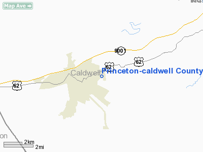
Princeton-caldwell County Airport |
|
|
|
Location &
QuickFacts
|
FAA
Information Effective: |
2008-09-25 |
|
Airport
Identifier: |
2M0 |
|
Airport
Status: |
Operational |
|
Longitude/Latitude: |
087-51-25.4900W/37-06-54.4700N
-87.857081/37.115131 (Estimated) |
|
Elevation: |
584 ft / 178.00 m (Estimated) |
|
Land: |
110 acres |
|
From
nearest city: |
2 nautical miles NE of Princeton, KY |
|
Location: |
Caldwell County, KY |
|
Magnetic Variation: |
00E (1985) |
Owner & Manager
|
Ownership: |
Publicly owned |
|
Owner: |
Princeton-caldwell Co Arpt Bd |
|
Address: |
Muirfield Dr
Princeton, KY 42445 |
|
Phone
number: |
270-365-3523 |
|
Manager: |
Kerry Creasey
AIRPORT BOARD CHAIRMAN. |
|
Address: |
100 Muirfield Dr
Princeton, KY 42445 |
|
Phone number: |
270-365-3523 |
Airport
Operations and Facilities
|
Airport
Use: |
Open to public |
|
Wind
indicator: |
Yes |
|
Segmented Circle: |
Yes |
|
Control
Tower: |
No |
|
Lighting
Schedule: |
DUSK-DAWN |
|
Beacon
Color: |
Clear-Green (lighted land airport) |
|
Landing
fee charge: |
No |
|
Sectional chart: |
St Louis |
|
Region: |
ASO - Southern |
|
Boundary
ARTCC: |
ZME - Memphis |
|
Tie-in
FSS: |
LOU - Louisville |
|
FSS on
Airport: |
No |
|
FSS Toll
Free: |
1-800-WX-BRIEF |
|
NOTAMs
Facility: |
LOU (NOTAM-d service avaliable) |
|
Federal Agreements: |
NY1 |
Airport Communications
|
CTAF: |
122.800 |
|
Unicom: |
122.800 |
Airport Services
|
Airframe
Repair: |
MINOR |
|
Power
Plant Repair: |
MINOR |
|
Bottled
Oxygen: |
NONE |
|
Bulk
Oxygen: |
NONE |
|
Runway Information
Runway 05/23
|
Dimension: |
4099 x 75 ft / 1249.4 x 22.9 m |
|
Surface: |
ASPH, Good Condition |
|
Weight Limit: |
Single wheel: 12000 lbs. |
|
Edge Lights: |
Medium |
|
|
Runway 05
|
Runway 23
|
|
Longitude: |
087-51-44.0500W |
087-51-06.9300W |
|
Latitude: |
37-06-40.6900N |
37-07-08.2400N |
|
Elevation: |
584.00 ft |
541.00 ft |
|
Traffic
Pattern: |
Left |
Left |
|
Markings: |
Basic, Good Condition |
Basic, Good Condition |
|
Obstruction: |
3 ft berm, 201.0 ft from runway, 125 ft right of
centerline
+3 FT BERM 199 FT FROM RY END, 100 FT R. |
45 ft trees, 1100.0 ft from runway, 300 ft right of
centerline, 20:1 slope to clear |
|
Radio Navigation Aids
|
ID |
Type |
Name |
Ch |
Freq |
Var |
Dist |
|
TWT |
NDB |
Tradewater |
|
276.00 |
00E |
21.6 nm |
|
HIX |
NDB |
Honey Grove |
|
356.00 |
01W |
28.6 nm |
|
FK |
NDB |
Airbe |
|
273.00 |
01W |
31.1 nm |
|
GMH |
NDB |
Muhlenberg |
|
362.00 |
01E |
34.1 nm |
|
BDD |
NDB |
Bellgrade |
|
254.00 |
00E |
39.0 nm |
|
GVA |
NDB |
Geneva |
|
224.00 |
01W |
41.6 nm |
|
GGK |
NDB |
Mayfield |
|
401.00 |
00E |
43.6 nm |
|
HXW |
TACAN |
Screaming Eagle |
096X |
|
01W |
31.6 nm |
|
CKV |
VOR/DME |
Clarksville |
043X |
110.60 |
01W |
36.5 nm |
|
CCT |
VORTAC |
Central City |
035X |
109.80 |
01W |
32.6 nm |
|
CNG |
VORTAC |
Cunningham |
078X |
113.10 |
03E |
47.4 nm |
|
PXV |
VORTAC |
Pocket City |
080X |
113.30 |
03E |
49.1 nm |
Remarks
Based Aircraft
|
Aircraft based
on field: |
10 |
|
Single Engine
Airplanes: |
10 |
Operational Statistics
Time Period: 2005-02-02 - 2006-02-01
|
Aircraft
Operations: |
122/Week |
|
Air Taxi: |
3.2% |
|
General
Aviation Local: |
31.7% |
|
General
Aviation Itinerant: |
63.5% |
|
Military: |
1.6% |
Princeton-caldwell County Airport
Address:
Caldwell County, KY
Tel:
270-365-3523
Images
and information placed above are from
http://www.airport-data.com/airport/2M0/
We
thank them for the data!
|
General Info |
| Country |
United
States |
| State |
KENTUCKY
|
| FAA ID |
2M0
|
| Latitude |
37-06-56.176N |
|
Longitude |
087-51-20.050W |
|
Elevation |
582 feet
|
| Near
City |
PRINCETON |
We don't guarantee the information is fresh and accurate. The data may
be wrong or outdated.
For more up-to-date information please refer to other sources.
|
|


