 |
|
|
Location &
QuickFacts
|
FAA
Information Effective: |
2008-09-25 |
|
Airport
Identifier: |
16KY |
|
Airport
Status: |
Operational |
|
Longitude/Latitude: |
083-07-21.6330W/38-26-38.2850N
-83.122676/38.443968 (Estimated) |
|
Elevation: |
1070 ft / 326.14 m (Surveyed) |
|
Land: |
207 acres |
|
From
nearest city: |
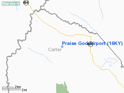
2 nautical miles NE of Carter, KY |
|
Location: |
Carter County, KY |
|
Magnetic Variation: |
04W (1985) |
Owner & Manager
|
Ownership: |
Privately owned |
|
Owner: |
Jack B. Cales |
|
Address: |
Gen Delivery
Carter, KY 41128 |
|
Phone number: |
606-474-4316 |
|
Manager: |
Jack B. Cales |
|
Address: |
Gen Delivery
Carter, KY 41128 |
|
Phone number: |
606-474-4316 |
Airport
Operations and Facilities
|
Airport
Use: |
Private |
|
Wind
indicator: |
Yes |
|
Segmented Circle: |
No |
|
Control
Tower: |
No |
|
Sectional chart: |
Cincinnati |
|
Region: |
ASO - Southern |
|
Boundary
ARTCC: |
ZID - Indianapolis |
|
Tie-in
FSS: |
LOU - Louisville |
|
FSS Toll
Free: |
1-800-WX-BRIEF |
|
Runway Information
Runway 17/35
|
Dimension: |
2400 x 30 ft / 731.5 x 9.1 m |
|
Surface: |
TURF, |
|
|
Runway 17
|
Runway 35
|
|
Traffic
Pattern: |
Left |
Left |
|
Obstruction: |
|
100 ft trees |
|
Radio Navigation Aids
|
ID |
Type |
Name |
Ch |
Freq |
Var |
Dist |
|
AJY |
FAN MARKER |
Ashland |
|
|
03W |
16.9 nm |
|
PMH |
NDB |
Portsmouth |
|
373.00 |
04W |
24.1 nm |
|
XW |
NDB |
Flmng |
|
400.00 |
05W |
25.9 nm |
|
PZO |
NDB |
Peebles |
|
329.00 |
02W |
30.2 nm |
|
AMT |
NDB |
West Union |
|
359.00 |
04W |
32.3 nm |
|
EOP |
NDB |
Waverly |
|
385.00 |
06W |
44.4 nm |
|
IOB |
NDB |
Mount Sterling |
|
210.00 |
04W |
46.6 nm |
|
HOC |
NDB |
Hillsboro |
|
278.00 |
05W |
48.7 nm |
|
YRK |
VORTAC |
York |
075X |
112.80 |
05W |
13.8 nm |
|
ECB |
VORTAC |
Newcombe |
041X |
110.40 |
02W |
19.9 nm |
Remarks
-
PROVIDED VFR/PR
USE ONLY.
Based Aircraft
|
Aircraft based
on field: |
2 |
|
Single Engine
Airplanes: |
2 |
Praise God Airport
Address:
Carter County, KY
Tel:
606-474-4316
Images
and information placed above are from
http://www.airport-data.com/airport/16KY/
We
thank them for the data!
|
General Info |
| Country |
United
States |
| State |
KENTUCKY
|
| FAA ID |
16KY
|
| Latitude |
38-26-38.285N |
|
Longitude |
083-07-21.633W |
|
Elevation |
1070
feet |
| Near
City |
CARTER
|
We don't guarantee the information is fresh and accurate. The data may
be wrong or outdated.
For more up-to-date information please refer to other sources.
|
|


