 |
|
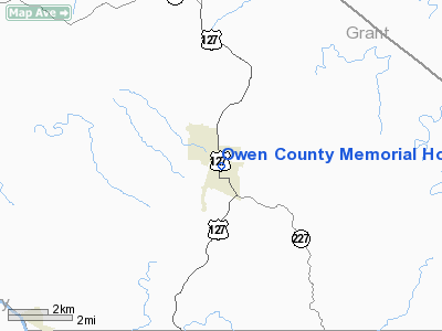
Owen County Memorial Hospital Heliport |
|
Location &
QuickFacts
|
FAA
Information Effective: |
2008-09-25 |
|
Airport
Identifier: |
78KY |
|
Airport
Status: |
Operational |
|
Longitude/Latitude: |
084-50-24.8130W/38-32-30.2410N
-84.840226/38.541734 (Estimated) |
|
Elevation: |
970 ft / 295.66 m (Estimated) |
|
Land: |
0 acres |
|
From
nearest city: |
0 nautical miles N of Owenton, KY |
|
Location: |
Owen County, KY |
|
Magnetic Variation: |
03W (1985) |
Owner & Manager
|
Ownership: |
Privately owned |
|
Owner: |
Owen County Memorial Hospital |
|
Address: |
330 Roland Avenue
Owenton, KY 40359 |
|
Phone number: |
502-484-3441 |
|
Manager: |
Robin L Mc Neely |
|
Address: |
330 Roland Avenue
Owenton, KY 40359 |
|
Phone number: |
502-484-3441 |
Airport
Operations and Facilities
|
Airport
Use: |
Private
MEDICAL. |
|
Segmented Circle: |
No |
|
Control
Tower: |
No |
|
Lighting
Schedule: |
PHONE REQ
FOR PERIMETER LGTS CALL 502-484-3441. |
|
Sectional chart: |
Cincinnati |
|
Region: |
ASO - Southern |
|
Boundary
ARTCC: |
ZID - Indianapolis |
|
Tie-in
FSS: |
LOU - Louisville |
|
FSS Toll
Free: |
1-800-WX-BRIEF |
|
Runway Information
Helipad H1
|
Dimension: |
40 x 40 ft / 12.2 x 12.2 m |
|
Surface: |
CONC, |
|
|
Runway H1
|
Runway
|
|
Traffic
Pattern: |
Left |
Left |
|
Radio Navigation Aids
|
ID |
Type |
Name |
Ch |
Freq |
Var |
Dist |
|
FEU |
NDB |
Arnold |
|
521.00 |
03W |
19.7 nm |
|
UR |
NDB |
Burln |
|
321.00 |
04W |
30.5 nm |
|
IMS |
NDB |
Madison |
|
404.00 |
03W |
32.0 nm |
|
LE |
NDB |
Blayd |
|
242.00 |
04W |
34.4 nm |
|
PWF |
NDB |
Sportys |
|
245.00 |
04W |
43.5 nm |
|
LUK |
NDB |
Cincinnati |
|
335.00 |
04W |
43.9 nm |
|
MDE |
NDB |
Madeira |
|
379.00 |
04W |
46.8 nm |
|
OVO |
NDB |
North Vernon |
|
374.00 |
02W |
46.9 nm |
|
ISZ |
NDB |
Cincinnati-blue Ash |
|
388.00 |
04W |
47.4 nm |
|
IOB |
NDB |
Mount Sterling |
|
210.00 |
04W |
49.8 nm |
|
FFT |
VOR |
Frankfort |
|
109.40 |
03W |
21.8 nm |
|
FLM |
VOR/DME |
Falmouth |
117X |
117.00 |
04W |
25.7 nm |
|
BQM |
VOR/DME |
Bowman |
059X |
112.20 |
01W |
43.1 nm |
|
CVG |
VORTAC |
Cincinnati |
120X |
117.30 |
04W |
29.2 nm |
|
ABB |
VORTAC |
Nabb |
071X |
112.40 |
01E |
37.5 nm |
|
HYK |
VORTAC |
Lexington |
073X |
112.60 |
00E |
38.7 nm |
|
IIU |
VORTAC |
Louisville |
095X |
114.80 |
01E |
43.6 nm |
|
LUK |
VOT |
Cincinnati Muni/lunken |
|
108.40 |
|
40.2 nm |
|
SDF |
VOT |
Louisville Standifd |
|
111.00 |
|
47.6 nm |
Remarks
Owen County Memorial Hospital Heliport
Address:
Owen County, KY
Tel:
502-484-3441
Images
and information placed above are from
http://www.airport-data.com/airport/78KY/
We
thank them for the data!
|
General Info |
| Country |
United
States |
| State |
KENTUCKY
|
| FAA ID |
78KY
|
| Latitude |
38-32-30.241N |
|
Longitude |
084-50-24.813W |
|
Elevation |
970 feet
|
| Near
City |
OWENTON
|
We don't guarantee the information is fresh and accurate. The data may
be wrong or outdated.
For more up-to-date information please refer to other sources.
|
|


