 |
|
|
|
|
|
|
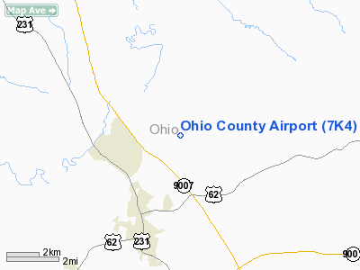
Location &
QuickFacts
|
FAA
Information Effective: |
2008-09-25 |
|
Airport
Identifier: |
7K4 |
|
Airport
Status: |
Operational |
|
Longitude/Latitude: |
086-50-59.8270W/37-27-29.9670N
-86.849952/37.458324 (Estimated) |
|
Elevation: |
535 ft / 163.07 m (Surveyed) |
|
Land: |
115 acres |
|
From
nearest city: |
3 nautical miles NE of Hartford, KY |
|
Location: |
Ohio County, KY |
|
Magnetic Variation: |
02W (2000) |
Owner & Manager
|
Ownership: |
Publicly owned |
|
Owner: |
Ohio County Airport Board
CHUCK PRICE LL CHAIRMAN |
|
Address: |
3312 Bobwhite Avenue
Owensboro, KY 42301 |
|
Phone
number: |
270-274-3306 |
|
Manager: |
Ron Fortener |
|
Address: |
2260 Country Club Rd
Hartford, KY 42347 |
|
Phone number: |
270-298-3500 |
Airport Operations and Facilities
|
Airport
Use: |
Open to public |
|
Wind
indicator: |
Yes |
|
Segmented Circle: |
No |
|
Control
Tower: |
No |
|
Lighting
Schedule: |
DUSK-DAWN
ACTVT MIRL RY 03/21 AND VASI RYS 03 & 21 - CTAF. LGTS ALSO AVBL BY
PHONE REQ BY CALLING 270-298-3500. |
|
Beacon
Color: |
Clear-Green (lighted land airport) |
|
Landing
fee charge: |
No |
|
Sectional chart: |
St Louis |
|
Region: |
ASO - Southern |
|
Boundary
ARTCC: |
ZID - Indianapolis |
|
Tie-in
FSS: |
LOU - Louisville |
|
FSS on
Airport: |
No |
|
FSS Toll
Free: |
1-800-WX-BRIEF |
|
NOTAMs
Facility: |
LOU (NOTAM-d service avaliable) |
|
Federal Agreements: |
N |
Airport Communications
|
CTAF: |
122.800 |
|
Unicom: |
122.800 |
Airport Services
|
Fuel
available: |
100LLA |
|
Airframe
Repair: |
MAJOR |
|
Power
Plant Repair: |
MAJOR |
|
Bottled
Oxygen: |
NONE |
|
Bulk
Oxygen: |
HIGH |
|
Runway Information
Runway 03/21
|
Dimension: |
4818 x 60 ft / 1468.5 x 18.3 m |
|
Surface: |
ASPH, Fair Condition |
|
Weight Limit: |
Single wheel: 12500 lbs. |
|
Edge Lights: |
Medium |
|
|
Runway 03
|
Runway 21
|
|
Longitude: |
086-51-12.3070W |
086-50-47.3480W |
|
Latitude: |
37-27-08.3250N |
37-27-51.6080N |
|
Elevation: |
530.00 ft |
535.00 ft |
|
Alignment: |
25 |
127 |
|
Traffic
Pattern: |
Left |
Left |
|
Markings: |
Non-precision instrument, Fair Condition
RY 03/21 MARKINGS FADED. |
Non-precision instrument, Fair Condition |
|
Crossing
Height: |
22.00 ft |
35.00 ft |
|
VASI: |
2-box on right side |
2-box on left side |
|
Visual
Glide Angle: |
3.00° |
4.50° |
|
Obstruction: |
18 ft tree, 295.0 ft from runway, 26 ft left of
centerline, 5:1 slope to clear
+10 FT TREE 195 FT FROM RY END 100 FT L. |
47 ft trees, 460.0 ft from runway, 232 ft left of
centerline, 5:1 slope to clear
+10 FT TREE 190 FT FROM RY END 150 FT R. |
|
Radio Navigation Aids
|
ID |
Type |
Name |
Ch |
Freq |
Var |
Dist |
|
GMH |
NDB |
Muhlenberg |
|
362.00 |
01E |
20.3 nm |
|
TEL |
NDB |
Tell City |
|
206.00 |
02W |
34.3 nm |
|
HIX |
NDB |
Honey Grove |
|
356.00 |
01W |
41.8 nm |
|
FNZ |
NDB |
Ferdinand |
|
239.00 |
00E |
47.5 nm |
|
PDW |
NDB |
Evansville |
|
284.00 |
00E |
47.6 nm |
|
BVQ |
NDB |
Beaver Creek |
|
260.00 |
02W |
48.2 nm |
|
GVA |
NDB |
Geneva |
|
224.00 |
01W |
48.5 nm |
|
MYS |
VOR |
Mystic |
|
108.20 |
01W |
38.9 nm |
|
OWB |
VOR/DME |
Owensboro |
023X |
108.60 |
01E |
22.8 nm |
|
HNB |
VOR/DME |
Huntingburg |
029X |
109.20 |
00E |
47.9 nm |
|
FTK |
VOR/DME |
Fort Knox |
033X |
109.60 |
01W |
49.7 nm |
|
CCT |
VORTAC |
Central City |
035X |
109.80 |
01W |
20.3 nm |
|
BWG |
VORTAC |
Bowling Green |
126X |
117.90 |
02E |
37.3 nm |
Remarks
-
DEER ON & INVOF ARPT.
-
DETERMINATION PENDING.
Based Aircraft
|
Aircraft based
on field: |
3 |
|
Single Engine
Airplanes: |
2 |
|
Multi Engine
Airplanes: |
1 |
Operational Statistics
Time Period: 2005-08-10 - 2006-08-09
|
Aircraft
Operations: |
110/Week |
|
Air Taxi: |
3.1% |
|
General
Aviation Local: |
35.0% |
|
General
Aviation Itinerant: |
61.3% |
|
Military: |
0.6% |
Ohio County Airport
Address:
Ohio County, KY
Tel:
270-274-3306,
270-298-3500
Images
and information placed above are from
http://www.airport-data.com/airport/7K4/
We
thank them for the data!
|
General Info |
| Country |
United
States |
| State |
KENTUCKY
|
| FAA ID |
7K4
|
| Latitude |
37-27-29.967N |
|
Longitude |
086-50-59.827W |
|
Elevation |
535 feet
|
| Near
City |
HARTFORD
|
We don't guarantee the information is fresh and accurate. The data may
be wrong or outdated.
For more up-to-date information please refer to other sources.
|
|


