 |
|
|
Location &
QuickFacts
|
FAA
Information Effective: |
2008-09-25 |
|
Airport
Identifier: |
66KY |
|
Airport
Status: |
Operational |
|
Longitude/Latitude: |
086-12-19.8990W/37-30-27.2010N
-86.205527/37.507556 (Estimated) |
|
Elevation: |
720 ft / 219.46 m (Estimated) |
|
Land: |
0 acres |
|
From
nearest city: |
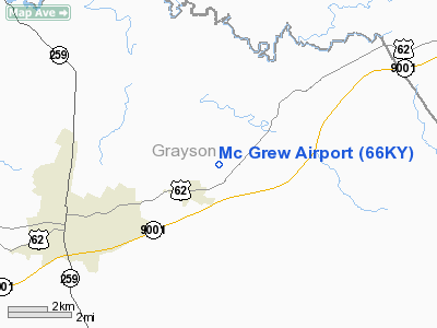
1 nautical miles NE of Clarkson, KY |
|
Location: |
Grayson County, KY |
|
Magnetic Variation: |
01W (1985) |
Owner & Manager
|
Ownership: |
Privately owned |
|
Owner: |
Robert Mc Grew |
|
Address: |
Rt 3, Box 186
Clarkson, KY 42726 |
|
Phone number: |
502-242-7378 |
|
Address: |
|
Airport
Operations and Facilities
|
Airport
Use: |
Private |
|
Wind
indicator: |
Yes |
|
Segmented Circle: |
No |
|
Control
Tower: |
No |
|
Landing
fee charge: |
No |
|
Sectional chart: |
St Louis |
|
Region: |
ASO - Southern |
|
Boundary
ARTCC: |
ZID - Indianapolis |
|
Tie-in
FSS: |
LOU - Louisville |
|
FSS on
Airport: |
No |
|
FSS Toll
Free: |
1-800-WX-BRIEF |
|
Runway Information
Runway 10/28
|
Dimension: |
2400 x 150 ft / 731.5 x 45.7 m |
|
Surface: |
TURF, |
|
|
Runway 10
|
Runway 28
|
|
Traffic
Pattern: |
Left |
Left |
|
Obstruction: |
30 ft trees |
30 ft trees |
|
Radio Navigation Aids
|
ID |
Type |
Name |
Ch |
Freq |
Var |
Dist |
|
GOI |
NDB |
Godman |
|
396.00 |
02W |
29.2 nm |
|
BVQ |
NDB |
Beaver Creek |
|
260.00 |
02W |
30.9 nm |
|
TEL |
NDB |
Tell City |
|
206.00 |
02W |
38.2 nm |
|
BRY |
NDB |
Bardstown/dcmsnd |
|
248.00 |
02W |
40.0 nm |
|
TYC |
NDB |
Taylor County |
|
272.00 |
02W |
46.3 nm |
|
IKY |
NDB |
Springfield |
|
429.00 |
03W |
46.8 nm |
|
GMH |
NDB |
Muhlenberg |
|
362.00 |
01E |
48.6 nm |
|
MYS |
VOR |
Mystic |
|
108.20 |
01W |
23.3 nm |
|
EWO |
VOR/DME |
New Hope |
045X |
110.80 |
01E |
26.3 nm |
|
FTK |
VOR/DME |
Fort Knox |
033X |
109.60 |
01W |
26.5 nm |
|
OWB |
VOR/DME |
Owensboro |
023X |
108.60 |
01E |
47.9 nm |
|
BWG |
VORTAC |
Bowling Green |
126X |
117.90 |
02E |
36.6 nm |
|
IIU |
VORTAC |
Louisville |
095X |
114.80 |
01E |
46.6 nm |
|
SDF |
VOT |
Louisville Standifd |
|
111.00 |
|
46.0 nm |
Remarks
Based Aircraft
|
Aircraft based
on field: |
6 |
|
Single Engine
Airplanes: |
4 |
|
Ultralights: |
2 |
Mc Grew Airport
Address:
Grayson County, KY
Tel:
502-242-7378
Images
and information placed above are from
http://www.airport-data.com/airport/66KY/
We
thank them for the data!
|
General Info |
| Country |
United
States |
| State |
KENTUCKY
|
| FAA ID |
66KY
|
| Latitude |
37-30-27.201N |
|
Longitude |
086-12-19.899W |
|
Elevation |
720 feet
|
| Near
City |
CLARKSON
|
We don't guarantee the information is fresh and accurate. The data may
be wrong or outdated.
For more up-to-date information please refer to other sources.
|
|


