 |
|
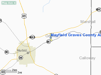
Mayfield Graves County Airport |
|
|
|
Location &
QuickFacts
|
FAA
Information Effective: |
2008-09-25 |
|
Airport
Identifier: |
M25 |
|
Airport
Status: |
Operational |
|
Longitude/Latitude: |
088-35-05.0000W/36-46-08.8250N
-88.584722/36.769118 (Estimated) |
|
Elevation: |
523 ft / 159.41 m (Surveyed) |
|
Land: |
113 acres |
|
From
nearest city: |
3 nautical miles NE of Mayfield, KY |
|
Location: |
Graves County, KY |
|
Magnetic Variation: |
00E (1995) |
Owner & Manager
|
Ownership: |
Publicly owned |
|
Owner: |
Mayfield & Graves County Arpt Board
ARPT BOARD CHAIRMAN - TODD MCBEE |
|
Address: |
Po Box 5385
Mayfield, KY 42066 |
|
Phone number: |
270-251-9980 |
|
Manager: |
Eddie Robertson |
|
Address: |
227 Airport Road
Mayfield, KY 42066 |
|
Phone number: |
270-247-6878 |
Airport
Operations and Facilities
|
Airport
Use: |
Open to public |
|
Wind
indicator: |
Yes |
|
Segmented Circle: |
Yes |
|
Control
Tower: |
No |
|
Lighting
Schedule: |
DUSK-DAWN
ACTVT MIRL RY 18/36, PAPI RYS 18 & 36 AND REIL RYS 18 & 36 - CTAF. |
|
Beacon
Color: |
Clear-Green (lighted land airport) |
|
Landing
fee charge: |
No |
|
Sectional chart: |
St Louis |
|
Region: |
ASO - Southern |
|
Boundary
ARTCC: |
ZME - Memphis |
|
Tie-in
FSS: |
LOU - Louisville |
|
FSS on
Airport: |
No |
|
FSS Toll
Free: |
1-800-WX-BRIEF |
|
NOTAMs
Facility: |
LOU (NOTAM-d service avaliable) |
|
Federal Agreements: |
NGY |
Airport Communications
|
CTAF: |
122.800 |
|
Unicom: |
122.800 |
Airport Services
|
Fuel
available: |
100LLA |
|
Bottled
Oxygen: |
NONE |
|
Bulk
Oxygen: |
NONE |
|
Runway Information
Runway 18/36
|
Dimension: |
4627 x 100 ft / 1410.3 x 30.5 m |
|
Surface: |
ASPH, Fair Condition |
|
Weight Limit: |
Single wheel: 30000 lbs. |
|
Edge Lights: |
Medium |
|
|
Runway 18
|
Runway 36
|
|
Longitude: |
088-35-02.7710W |
088-35-07.2000W |
|
Latitude: |
36-46-31.6300N |
36-45-46.0130N |
|
Elevation: |
520.00 ft |
520.00 ft |
|
Alignment: |
127 |
4 |
|
Traffic
Pattern: |
Left |
Left |
|
Markings: |
Non-precision instrument, Good Condition |
Non-precision instrument, Good Condition |
|
Crossing
Height: |
42.00 ft |
42.00 ft |
|
VASI: |
4-light PAPI on left side |
4-light PAPI on left side |
|
Visual
Glide Angle: |
3.00° |
3.00° |
|
Runway End
Identifier: |
Yes |
Yes |
|
Obstruction: |
37 ft trees, 571.0 ft from runway, 211 ft right of
centerline, 11:1 slope to clear |
29 ft bldg, 591.0 ft from runway, 282 ft left of
centerline, 13:1 slope to clear |
|
Radio Navigation Aids
|
ID |
Type |
Name |
Ch |
Freq |
Var |
Dist |
|
GGK |
NDB |
Mayfield |
|
401.00 |
00E |
4.7 nm |
|
BDD |
NDB |
Bellgrade |
|
254.00 |
00E |
23.0 nm |
|
TIQ |
NDB |
Trainer |
|
410.00 |
00E |
32.3 nm |
|
UC |
NDB |
Obion |
|
212.00 |
00E |
34.6 nm |
|
CIR |
NDB |
Cairo |
|
397.00 |
00E |
35.4 nm |
|
CHQ |
NDB |
Charleston |
|
208.00 |
01E |
37.4 nm |
|
HZD |
NDB |
Huntingdon |
|
217.00 |
00E |
41.3 nm |
|
CNG |
VORTAC |
Cunningham |
078X |
113.10 |
03E |
18.8 nm |
Remarks
-
(CONTACT TITLE)
ARPT BOARD CHAIRMAN, DR DOUGLAS LENEAVE.
-
EXISTED PRIOR TO 1959.
Based Aircraft
|
Aircraft based
on field: |
16 |
|
Single Engine
Airplanes: |
14 |
|
Multi Engine
Airplanes: |
2 |
Operational Statistics
Time Period: 2005-02-01 - 2006-01-31
|
Aircraft
Operations: |
159/Week |
|
Air Taxi: |
6.7% |
|
General
Aviation Local: |
48.5% |
|
General
Aviation Itinerant: |
42.4% |
|
Military: |
2.4% |
Mayfield Graves County Airport
Address:
Graves County, KY
Tel:
270-251-9980, 270-247-6878
Images
and information placed above are from
http://www.airport-data.com/airport/M25/
We
thank them for the data!
|
General Info |
| Country |
United
States |
| State |
KENTUCKY
|
| FAA ID |
M25
|
| Latitude |
36-46-08.800N |
|
Longitude |
088-35-05.000W |
|
Elevation |
522 feet
|
| Near
City |
MAYFIELD
|
We don't guarantee the information is fresh and accurate. The data may
be wrong or outdated.
For more up-to-date information please refer to other sources.
|
|


