 |
|
Louisville International-Standiford Field Airport |
Louisville International Airport
(Standiford Field) |
 |
| IATA: SDF â ICAO: KSDF
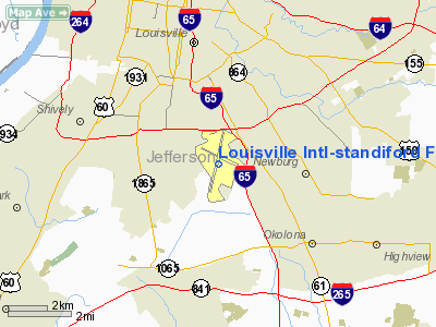
Location of the Louisville International Airport
|
| Summary |
| Airport type |
Public |
| Operator |
Louisville Regional Airport Authority (LRAA) |
| Location |
Louisville, Kentucky |
| Hub for |
UPS Airlines |
| Elevation AMSL |
501 ft / 152.7 m |
| Coordinates |
38°10â²28â³N 85°44â²10â³W / 38.17444°N 85.73611°W / 38.17444; -85.73611 |
| Website |
http://www.flylouisville.com/ |
| Runways |
| Direction |
Length |
Surface |
| ft |
m |
| 17R/35L |
11,890 |
3,624 |
Concrete |
| 17L/35R |
8,579 |
2,615 |
Concrete |
| 11/29 |
7,250 |
2,210 |
Concrete |
| Statistics (2009) |
| Aircraft operations |
170,096 |
| Based aircraft |
22 |
Louisville International Airport (IATA: SDF, ICAO: KSDF) is a joint civil-military public airport centrally located in the city of Louisville in Jefferson County, Kentucky, USA. The airport covers 1,200 acres (4.9 km²) and has three runways. Its IATA airport code SDF is based on the airport's former name, Standiford Field. The airport is the second busiest in Kentucky behind Cincinnati/Northern Kentucky International Airport which is in Boone County, Kentucky.
The Kentucky Air National Guard's 123d Airlift Wing is based at the airport. The organization operates C-130 transport aircraft. History
Standiford Field was built by the Army Corps of Engineers in 1941 on a parcel of land south of Louisville that was found not to have flooded during the Ohio River flood of 1937. It was named for Dr. Elisha David Standiford, a local businessman and politician, who was active in transportation issues and owned part of the land. The field remained under Army control until 1947, when it was turned over to the Louisville Air Board for commercial operations.
Before Standiford Field became the main conduit for passenger air traffic in Louisville, Bowman Field was Louisville's main airport. For many years passenger traffic went through the now relatively small brick Lee Terminal at Standiford Field. Major construction in the 1980s resulted in the newer, more modern and much larger facilities that are used today. Most of the Lee Terminal was subsequently torn down.
Parallel runways, enabling a much higher volume of air traffic and facilitating expanded United Parcel Service operations, were also part of an airport expansion plan begun in the 1980s.
Airlines and destinations
| Airlines |
Destinations |
Concourse |
| American Airlines |
Dallas/Fort Worth |
A |
| American Eagle |
Chicago O'Hare, Dallas/Fort Worth, Miami |
A |
| Continental Express operated by Chautauqua Airlines |
Cleveland, Houston-Intercontinental |
A |
| Continental Express operated by ExpressJet Airlines |
Cleveland, Houston-Intercontinental, Newark |
A |
| Delta Air Lines |
Atlanta |
A |
| Delta Connection operated by Atlantic Southeast Airlines |
Atlanta |
A |
| Delta Connection operated by Chautauqua Airlines |
Cincinnati/Northern Kentucky |
A |
| Delta Connection operated by Comair |
Atlanta, Cincinnati/Northern Kentucky, Detroit |
A |
| Delta Connection operated by Compass Airlines |
Atlanta, Detroit, Minneapolis/St. Paul |
A |
| Delta Connection operated by Mesaba Airlines |
Minneapolis/St. Paul |
A |
| Delta Connection operated by Skywest Airlines |
Atlanta |
A |
| Delta Connection operated by Pinnacle Airlines |
Cincinnati/Northern Kentucky, Detroit, Memphis |
A |
| Frontier Airlines |
Denver |
A |
| Midwest Connect operated by Chautauqua Airlines |
Milwaukee |
A |
| Southwest Airlines |
Baltimore, Birmingham (AL), Chicago-Midway, Las Vegas, Orlando, Phoenix, St. Louis, Tampa |
B |
| United Express operated by Shuttle America |
Chicago-O'Hare, Denver |
A |
| United Express operated by SkyWest Airlines |
Chicago-O'Hare, Denver |
A |
| United Express operated by Expressjet Airlines |
Chicago-O'Hare |
A |
| US Airways Express operated by Air Wisconsin |
New York-LaGuardia, Philadelphia, Washington-Reagan |
B |
| US Airways Express operated by Chautauqua Airlines |
New York-LaGuardia, Philadelphia, Washington-Reagan |
B |
| US Airways Express operated by Mesa Airlines |
Charlotte |
B |
| US Airways Express operated by PSA Airlines |
Charlotte, Washington-Reagan |
B |
Cargo Airlines
- UPS Airlines
- FedEx Express
- DHL
- Ameriflight
- Air Cargo Carriers
Operations
Worldport is the worldwide air hub for UPS (United Parcel Service) located at the Louisville International Airport in Louisville, Kentucky. Although UPS has had a hub at Louisville since 1980, the term was not used officially by the company until 2002, after a $1 billion, five-year expansion.[1] Previously, the project was named "Hub 2000." The facility is currently the size of 80 football fields and capable of handling 84 packages a second, or 304,000 per hour. With over 20,000 employees, UPS is one of the largest employers in Louisville, and in the Commonwealth of Kentucky. The facility mainly handles express and international packages and letters. Worldport serves all major domestic and international hubs. Over 3.5 million passengers and more than 10 billion pounds of cargo pass through Louisville International Airport each year, making it the 67th busiest domestic airport for passengers and the third busiest for cargo (due to the its status as the primary hub for UPS The airport, currently in the midst of major terminal renovations, has three operational runways. The two parallel main runways run north/south and allow for simultaneous takeoffs and landings. The east/west runway is shorter and generally only used in adverse weather conditions.
Louisville International Airport is home to one of Chautauqua Airlines maintenance complex, capable of holding nine planes, as well as the Compass Airlines main maintenance complex.
In addition to commercial air traffic there is a significant amount of general aviation activity at Louisville International Airport, for business travel and other purposes.
Accidents and incidents
On April 14, 2010, UPS flight 2752, a UPS Boeing 747-400 freighter bound for Dallas, Texas, declared an emergency due to a computer problem. The airplane landed safely at Louisville International Airport at 6:45 PM EDT that day .
The above content comes from Wikipedia and is published under free licenses – click here to read more.
|
Location &
QuickFacts
|
FAA
Information Effective: |
2008-09-25 |
|
Airport
Identifier: |
SDF |
|
Airport
Status: |
Operational |
|
Longitude/Latitude: |
085-44-11.3960W/38-10-26.7090N
-85.736499/38.174086 (Estimated) |
|
Elevation: |
501 ft / 152.70 m (Surveyed) |
|
Land: |
1200 acres |
|
From
nearest city: |
4 nautical miles S of Louisville, KY |
|
Location: |
Jefferson County, KY |
|
Magnetic Variation: |
03W (1995) |
Owner & Manager
|
Ownership: |
Publicly owned |
|
Owner: |
Regional Arpt Auth
LOUISVILLE REGIONAL AIRPORT AUTHORITY |
|
Address: |
Po Box 9129
Louisville, KY 40209-0129
P.O. BOX 9129, STANDIFORD FIELD. |
|
Phone
number: |
502-368-6524 |
|
Manager: |
Charles Miller |
|
Address: |
P.o. Box 9129, Standiford Field
Louisville, KY 40209-9129 |
|
Phone number: |
502-368-6524 |
Airport Operations and Facilities
|
Airport
Use: |
Open to public |
|
Wind
indicator: |
Yes |
|
Segmented Circle: |
No |
|
Control
Tower: |
Yes |
|
Lighting
Schedule: |
DUSK-DAWN |
|
Beacon
Color: |
Clear-Green (lighted land airport) |
|
Landing
fee charge: |
No |
|
Sectional chart: |
St Louis |
|
Region: |
ASO - Southern |
|
Boundary
ARTCC: |
ZID - Indianapolis |
|
Tie-in
FSS: |
LOU - Louisville |
|
FSS on
Airport: |
No |
|
FSS Toll
Free: |
1-800-WX-BRIEF |
|
NOTAMs
Facility: |
SDF (NOTAM-d service avaliable) |
|
Certification type/date: |
I C S 05/2005 |
|
Federal Agreements: |
NGRY |
Airport
Communications
Airport Services
|
Fuel
available: |
100LLA |
|
Airframe
Repair: |
MAJOR |
|
Power
Plant Repair: |
MAJOR |
|
Bottled
Oxygen: |
LOW |
|
Runway Information
Runway 11/29
|
Dimension: |
7250 x 150 ft / 2209.8 x 45.7 m |
|
Surface: |
CONC, Good Condition |
|
Surface
Treatment: |
Wire Comb or Wire Tine |
|
Weight Limit: |
Single wheel: 75000 lbs.
Dual wheel: 170000 lbs.
Dual tandem wheel: 360000 lbs.
Dual dual tandem wheel: 850000 lbs. |
|
Edge Lights: |
High |
|
|
Runway 11
|
Runway 29
|
|
Longitude: |
085-44-50.4626W |
085-43-25.7686W |
|
Latitude: |
38-10-48.8183N |
38-10-22.9906N |
|
Elevation: |
477.00 ft |
480.00 ft |
|
Alignment: |
111 |
127 |
|
ILS Type: |
|
LOCALIZER |
|
Traffic
Pattern: |
Left |
Left |
|
Markings: |
Basic, Fair Condition |
Precision instrument, Good Condition |
|
RVR
Equipment: |
|
touchdown |
|
Approach
lights: |
|
MALSR |
|
Runway End
Identifier: |
No |
|
|
Obstruction: |
55 ft bldg, 1375.0 ft from runway, 325 ft right of
centerline, 20:1 slope to clear |
, 34:1 slope to clear |
|
Runway 17L/35R
|
Dimension: |
8579 x 150 ft / 2614.9 x 45.7 m |
|
Surface: |
CONC, Good Condition |
|
Surface
Treatment: |
Saw-cut or plastic Grooved |
|
Weight Limit: |
Single wheel: 75000 lbs.
Dual wheel: 207000 lbs.
Dual tandem wheel: 360000 lbs.
Dual dual tandem wheel: 850000 lbs. |
|
Edge Lights: |
High |
|
|
Runway 17L
|
Runway 35R
|
|
Longitude: |
085-43-52.8335W |
085-43-24.8712W |
|
Latitude: |
38-11-14.2821N |
38-09-52.4039N |
|
Elevation: |
501.00 ft |
471.00 ft |
|
Alignment: |
127 |
127 |
|
ILS Type: |
ILS/DME |
ILS/DME |
|
Traffic
Pattern: |
Left |
Left |
|
Markings: |
Nonstandard, Good Condition |
Nonstandard, Good Condition |
|
Crossing
Height: |
75.00 ft |
75.00 ft |
|
Displaced
threshold: |
329.00 ft |
450.00 ft |
|
VASI: |
4-light PAPI on left side |
4-light PAPI on right side |
|
Visual
Glide Angle: |
3.00° |
3.00° |
|
RVR
Equipment: |
touchdown, midfield, rollout |
touchdown, midfield, rollout |
|
Approach
lights: |
MALSR |
ALSF2 |
|
Centerline
Lights: |
Yes |
Yes |
|
Touchdown
Lights: |
Yes |
Yes |
|
Decleard
distances: |
Take off run available 8579.00 ft
Take off distance available 8579.00 ft
Actual stop distance available 8129.00 ft
Landing distance available 7800.00 ft |
Take off run available 8579.00 ft
Take off distance available 8579.00 ft
Actual stop distance available 8250.00 ft
Landing distance available 7800.00 ft |
|
Runway 17R/35L
|
Dimension: |
11890 x 150 ft / 3624.1 x 45.7 m |
|
Surface: |
CONC, Good Condition |
|
Surface
Treatment: |
Saw-cut or plastic Grooved |
|
Weight Limit: |
Single wheel: 75000 lbs.
Dual wheel: 207000 lbs.
Dual tandem wheel: 360000 lbs.
Dual dual tandem wheel: 850000 lbs. |
|
Edge Lights: |
High |
|
|
Runway 17R
|
Runway 35L
|
|
Longitude: |
085-44-55.6300W |
085-44-18.1000W |
|
Latitude: |
38-11-13.1900N |
38-09-19.4600N |
|
Elevation: |
489.00 ft |
461.00 ft |
|
Alignment: |
127 |
127 |
|
ILS Type: |
ILS/DME |
ILS/DME |
|
Traffic
Pattern: |
Left |
Left |
|
Markings: |
Precision instrument, Good Condition |
Precision instrument, Good Condition |
|
Crossing
Height: |
75.00 ft |
75.00 ft |
|
Displaced
threshold: |
850.00 ft |
1040.00 ft |
|
VASI: |
4-light PAPI on left side |
4-light PAPI on left side |
|
Visual
Glide Angle: |
3.00° |
3.00° |
|
RVR
Equipment: |
touchdown, midfield, rollout |
touchdown, midfield, rollout |
|
Approach
lights: |
MALSR |
ALSF2 |
|
Centerline
Lights: |
Yes |
Yes |
|
Touchdown
Lights: |
Yes |
Yes |
|
Decleard
distances: |
Take off run available 11095.00 ft
Take off distance available 11095.00 ft
Actual stop distance available 11095.00 ft
Landing distance available 10000.00 ft |
Take off run available 11290.00 ft
Take off distance available 11290.00 ft
Actual stop distance available 10250.00 ft
Landing distance available 10000.00 ft |
|
Radio Navigation Aids
|
ID |
Type |
Name |
Ch |
Freq |
Var |
Dist |
|
GOI |
NDB |
Godman |
|
396.00 |
02W |
17.2 nm |
|
BRY |
NDB |
Bardstown/dcmsnd |
|
248.00 |
02W |
23.0 nm |
|
IMS |
NDB |
Madison |
|
404.00 |
03W |
37.6 nm |
|
IKY |
NDB |
Springfield |
|
429.00 |
03W |
40.2 nm |
|
RRJ |
NDB |
Oranj |
|
368.00 |
02W |
42.9 nm |
|
EQZ |
NDB |
Captain |
|
308.00 |
02W |
43.1 nm |
|
FEU |
NDB |
Arnold |
|
521.00 |
03W |
43.4 nm |
|
TEL |
NDB |
Tell City |
|
206.00 |
02W |
46.1 nm |
|
MYS |
VOR |
Mystic |
|
108.20 |
01W |
29.4 nm |
|
FFT |
VOR |
Frankfort |
|
109.40 |
03W |
39.1 nm |
|
BQM |
VOR/DME |
Bowman |
059X |
112.20 |
01W |
4.8 nm |
|
FTK |
VOR/DME |
Fort Knox |
033X |
109.60 |
01W |
19.5 nm |
|
EWO |
VOR/DME |
New Hope |
045X |
110.80 |
01E |
32.7 nm |
|
IIU |
VORTAC |
Louisville |
095X |
114.80 |
01E |
8.6 nm |
|
ABB |
VORTAC |
Nabb |
071X |
112.40 |
01E |
25.4 nm |
|
SDF |
VOT |
Louisville Standifd |
|
111.00 |
|
0.2 nm |
Remarks
-
BIRDS ON AND
INVOF ARPT.
-
CONTINUOUS
CONSTRUCTION ON ARPT; BE ALERT FOR FREQUENT RUNWAY & TWY CLOSURES.
-
ASDE-X
SURVEILLANCE SYS IN USE: PILOTS SHOULD OPER TRANSPONDERS WITH MODE-C ON ALL
TWYS AND RYS .
-
TAXI IN POSITION
AND HOLD WAIVER IN EFFECT FROM 0330 UNTIL SUNRISE AT THE INTERSECTION OF RY
17R AT TWY B, AND AT THE INTERSECTION OF RY 35L AT TWY B. THESE RYS WILL BE
USED FOR DEP ONLY WHEN EXERCISING THE PROVISIONS OF THIS WAIVER.
-
STD DEP POINT ON
RY 17R IS AT TWY B. PILOTS MUST REQ USE OF RY 17R EXTN. DECLARED DIST FOR TKF
AT TWY B ASDA/TORA/TODA 10,245 FT.
-
STD DEP POINT ON
RY 35L IS AT TWY B. PILOTS MUST REQ USE OF RY 35L EXTN. DECLARED DIST FOR TKF
AT TWY B ASDA/TORA/TODA 10,250 FT
-
ANG: APVL AUTH
123 AW/OGC, BASE OPS DSN 741-4581/4584, C502-413-4581/4584.
-
EXISTED PRIOR TO 1959.
Based Aircraft
|
Aircraft based
on field: |
31 |
|
Single Engine
Airplanes: |
3 |
|
Multi Engine
Airplanes: |
2 |
|
Jet Engine
Airplanes: |
16 |
|
Helicopters: |
2 |
|
Military: |
8 |
Major
Carriers Serving This Airport
|
Southwest Airlines Co. |
33.6% |
|
Expressjet Airlines Inc. |
19.1% |
|
American Eagle Airlines Inc. |
16.9% |
|
Delta Air Lines Inc. |
8.9% |
|
Northwest Airlines Inc. |
6.2% |
|
Atlantic Southeast Airlines |
4.1% |
|
Comair Inc. |
3.8% |
|
American Airlines Inc. |
3.7% |
|
Skywest Airlines Inc. |
3.7% |
Most Popular
Destinations
|
Chicago O'hare Intl (ORD) |
13.0% |
|
Hartsfield - Jackson Atlanta Intl (ATL) |
12.8% |
|
Dallas/fort Worth Intl (DFW) |
9.4% |
|
Chicago Midway Intl (MDW) |
8.7% |
|
Baltimore/washington Intl Thurgood Marshal (BWI) |
8.6% |
|
George Bush Intercontinental/houston (IAH) |
8.6% |
|
Cleveland-hopkins Intl (CLE) |
5.6% |
|
Lambert-st Louis Intl (STL) |
5.3% |
|
Newark Liberty Intl (EWR) |
4.9% |
|
Cincinnati/northern Kentucky Intl (CVG) |
3.9% |
Most Popular Aircraft
|
N612AE |
0.3% |
|
N662EH |
0.2% |
|
N933JN |
0.2% |
|
N763NW |
0.2% |
|
N15985 |
0.2% |
|
N13988 |
0.2% |
|
N435 |
0.2% |
|
N29906 |
0.2% |
|
N15973 |
0.2% |
|
N397SW |
0.2% |
Operational Statistics
Time Period: 2006-08-01 - 2007-07-31
|
Aircraft
Operations: |
490/Day |
|
Commerical: |
53.3% |
|
Air Taxi: |
34.3% |
|
General
Aviation Local: |
0.1% |
|
General
Aviation Itinerant: |
9.7% |
|
Military: |
2.7% |
Louisville International-standiford
Field Airport
Address:
Jefferson County, KY
Tel:
502-368-6524
Images
and information placed above are from
http://www.airport-data.com/airport/SDF/
We
thank them for the data!
|
General Info |
| Country |
United
States |
| State |
KENTUCKY
|
| FAA ID |
SDF
|
| Latitude |
38-10-27.800N |
|
Longitude |
085-44-09.600W |
|
Elevation |
501 feet
|
| Near
City |
LOUISVILLE |
We don't guarantee the information is fresh and accurate. The data may
be wrong or outdated.
For more up-to-date information please refer to other sources.
|
|


