 |
|
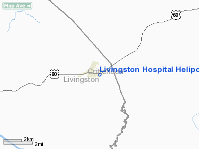
Livingston Hospital Heliport |
|
|
|
Location &
QuickFacts
|
FAA
Information Effective: |
2008-09-25 |
|
Airport
Identifier: |
2KY2 |
|
Airport
Status: |
Operational |
|
Longitude/Latitude: |
088-13-55.0000W/37-15-44.0000N
-88.231944/37.262222 (Estimated) |
|
Elevation: |
420 ft / 128.02 m (Estimated) |
|
Land: |
0 acres |
|
From
nearest city: |
1 nautical miles NE of Salem, KY |
|
Location: |
Livingston County, KY |
|
Magnetic Variation: |
01W (1995) |
Owner & Manager
|
Ownership: |
Privately owned |
|
Owner: |
Livingston Hospital |
|
Address: |
131 Hospital Drive, P.o. Box 138
Salem, KY 42078 |
|
Phone
number: |
502-988-2299 |
|
Manager: |
Jerry Deatherage |
|
Address: |
131 Hospital Drive, P.o. Box 138
Salem, KY 42078 |
|
Phone number: |
502-988-2299
ADDL PHONE 502-988-2484 (RESIDENCE). |
Airport
Operations and Facilities
|
Airport
Use: |
Private |
|
Wind
indicator: |
Yes |
|
Segmented Circle: |
No |
|
Control
Tower: |
No |
|
Lighting
Schedule: |
PHONE REQ
FOR PERIMETER LGTS CALL 502-988-2299. |
|
Sectional chart: |
St Louis |
|
Region: |
ASO - Southern |
|
Boundary
ARTCC: |
ZME - Memphis |
|
Tie-in
FSS: |
LOU - Louisville |
|
FSS Toll
Free: |
1-800-WX-BRIEF |
|
Runway Information
Helipad H1
|
Dimension: |
50 x 50 ft / 15.2 x 15.2 m |
|
Surface: |
CONC, |
|
|
Runway H1
|
Runway
|
|
Traffic
Pattern: |
Left |
Left |
|
Radio Navigation Aids
|
ID |
Type |
Name |
Ch |
Freq |
Var |
Dist |
|
TWT |
NDB |
Tradewater |
|
276.00 |
00E |
18.3 nm |
|
BDD |
NDB |
Bellgrade |
|
254.00 |
00E |
22.1 nm |
|
HSB |
NDB |
Harrisburg-raleigh |
|
230.00 |
00E |
36.2 nm |
|
GGK |
NDB |
Mayfield |
|
401.00 |
00E |
38.5 nm |
|
GVA |
NDB |
Geneva |
|
224.00 |
01W |
39.2 nm |
|
HIX |
NDB |
Honey Grove |
|
356.00 |
01W |
48.6 nm |
|
CIR |
NDB |
Cairo |
|
397.00 |
00E |
49.0 nm |
|
HXW |
TACAN |
Screaming Eagle |
096X |
|
01W |
50.0 nm |
|
MWA |
VOR/DME |
Marion |
041X |
110.40 |
04E |
47.5 nm |
|
CNG |
VORTAC |
Cunningham |
078X |
113.10 |
03E |
32.8 nm |
|
PXV |
VORTAC |
Pocket City |
080X |
113.30 |
03E |
45.9 nm |
|
CCT |
VORTAC |
Central City |
035X |
109.80 |
01W |
46.8 nm |
Remarks
-
PRVDD VFR, PVT
USE, ALL APCH/DEP OPNS FROM 090-270 DEGS, AREA MKD, WIND INDICATOR MAINTAINED.
Livingston Hospital Heliport
Address:
Livingston County, KY
Tel:
502-988-2299
Images
and information placed above are from
http://www.airport-data.com/airport/2KY2/
We
thank them for the data!
|
General Info |
| Country |
United
States |
| State |
KENTUCKY
|
| FAA ID |
2KY2
|
| Latitude |
37-15-44.000N |
|
Longitude |
088-13-55.000W |
|
Elevation |
420 feet
|
| Near
City |
SALEM
|
We don't guarantee the information is fresh and accurate. The data may
be wrong or outdated.
For more up-to-date information please refer to other sources.
|
|


