 |
|
|
|
|
|
|
Location &
QuickFacts
|
FAA
Information Effective: |
2008-09-25 |
|
Airport
Identifier: |
JKL |
|
Airport
Status: |
Operational |
|
Longitude/Latitude: |
083-19-02.1000W/37-35-37.9000N
-83.317250/37.593861 (Estimated) |
|
Elevation: |
1381 ft / 420.93 m (Surveyed) |
|
Land: |
125 acres |
|
From
nearest city: |
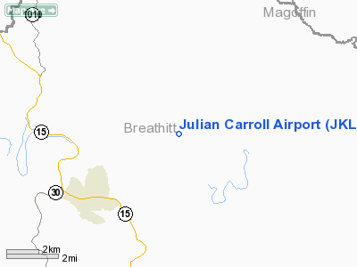
3 nautical miles NE of Jackson, KY |
|
Location: |
Breathitt County, KY |
|
Magnetic Variation: |
04W (1985) |
Owner & Manager
|
Ownership: |
Publicly owned |
|
Owner: |
Jackson-breathitt County |
|
Address: |
City Hall/courthouse
Jackson, KY 41339 |
|
Phone
number: |
606-666-7069
ARPT BOARD CHAIRMAN JAMES W COMBS. |
|
Manager: |
Air Board
FOR FBO CALL 606-666-9907. |
|
Address: |
City Hall/courthouse
Jackson, KY 41339 |
|
Phone number: |
606-666-7069 |
Airport Operations and Facilities
|
Airport
Use: |
Open to public |
|
Wind
indicator: |
Yes |
|
Segmented Circle: |
Yes |
|
Control
Tower: |
No |
|
Lighting
Schedule: |
DUSK-DAWN
ACTVT MIRL RY 01/19 AND REILS RYS 1 & 19 - CTAF. |
|
Beacon
Color: |
Clear-Green (lighted land airport) |
|
Landing
fee charge: |
No |
|
Sectional chart: |
Cincinnati |
|
Region: |
ASO - Southern |
|
Boundary
ARTCC: |
ZID - Indianapolis |
|
Tie-in
FSS: |
LOU - Louisville |
|
FSS on
Airport: |
No |
|
FSS Toll
Free: |
1-800-WX-BRIEF |
|
NOTAMs
Facility: |
JKL (NOTAM-d service avaliable) |
|
Federal Agreements: |
N |
Airport Communications
|
CTAF: |
122.800 |
|
Unicom: |
122.800 |
Airport Services
|
Fuel
available: |
100LLA |
|
Airframe
Repair: |
NONE |
|
Power
Plant Repair: |
NONE |
|
Bottled
Oxygen: |
NONE |
|
Bulk
Oxygen: |
NONE |
|
Runway Information
Runway 01/19
|
Dimension: |
4400 x 75 ft / 1341.1 x 22.9 m |
|
Surface: |
ASPH, Good Condition |
|
Weight Limit: |
Single wheel: 12500 lbs. |
|
Edge Lights: |
Medium |
|
|
Runway 01
|
Runway 19
|
|
Longitude: |
083-19-05.8330W |
083-18-58.3070W |
|
Latitude: |
37-35-16.3500N |
37-35-59.4340N |
|
Elevation: |
1353.00 ft |
1381.00 ft |
|
Alignment: |
8 |
127 |
|
Traffic
Pattern: |
Left |
Left |
|
Markings: |
Non-precision instrument, Good Condition |
Non-precision instrument, Good Condition |
|
Runway End
Identifier: |
Yes |
Yes |
|
Obstruction: |
30 ft trees, 230.0 ft from runway, 190 ft left of
centerline, 1:1 slope to clear |
25 ft trees, 225.0 ft from runway, 200 ft right of
centerline, 1:1 slope to clear
8 FT FENCE 180 FT FM THLD 115 FT LEFT. |
|
Radio Navigation Aids
|
ID |
Type |
Name |
Ch |
Freq |
Var |
Dist |
|
XYC |
NDB |
Seco |
|
393.00 |
03W |
35.3 nm |
|
IOB |
NDB |
Mount Sterling |
|
210.00 |
04W |
42.2 nm |
|
AZQ |
VOR/DME |
Hazard |
049X |
111.20 |
04W |
12.4 nm |
|
ECB |
VORTAC |
Newcombe |
041X |
110.40 |
02W |
39.0 nm |
Based Aircraft
|
Aircraft based
on field: |
4 |
|
Single Engine
Airplanes: |
2 |
|
Multi Engine
Airplanes: |
1 |
|
Helicopters: |
1 |
Operational Statistics
Time Period: 2006-02-23 - 2007-02-22
|
Aircraft
Operations: |
42/Week |
|
Air Taxi: |
23.3% |
|
General
Aviation Local: |
23.3% |
|
General
Aviation Itinerant: |
46.5% |
|
Military: |
7.0% |
Julian Carroll Airport
Address:
Breathitt County, KY
Tel:
606-666-7069
Images
and information placed above are from
http://www.airport-data.com/airport/JKL/
We
thank them for the data!
|
General Info |
| Country |
United
States |
| State |
KENTUCKY
|
| FAA ID |
JKL
|
| Latitude |
37-35-37.900N |
|
Longitude |
083-19-02.100W |
|
Elevation |
1381
feet |
| Near
City |
JACKSON
|
We don't guarantee the information is fresh and accurate. The data may
be wrong or outdated.
For more up-to-date information please refer to other sources.
|
|


