 |
|
| Fulton Airport |
| IATA: none – ICAO: none – FAA LID: 1M7 |
| Summary |
| Airport type |
Public |
| Owner |
Fulton City & County |
| Serves |
Fulton, Kentucky |
| Elevation AMSL |
400 ft / 122 m |
| Coordinates |
36°31′33″N 088°54′56″W / 36.52583°N 88.91556°W / 36.52583; -88.91556 |
| Runways |
| Direction |
Length |
Surface |
| ft |
m |
| 9/27 |
2,700 |
823 |
Asphalt |
| Statistics (2006) |
| Aircraft operations |
7,375 |
| Based aircraft |
10 |
| Source: Federal Aviation Administration |
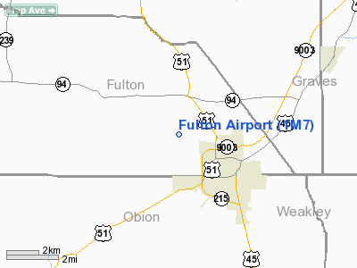
Fulton Airport (FAA LID: 1M7) is a public use airport located two nautical miles (4 km) northwest of the central business district of Fulton, in Fulton County, Kentucky, United States. It is owned by Fulton City & County.
Facilities and aircraft
Fulton Airport covers an area of 85 acres (34 ha) at an elevation of 400 feet (122 m) above mean sea level. It has one asphalt paved runway designated 9/27 which measures 2,700 by 60 feet (823 x 18 m).
For the 12-month period ending January 30, 2006, the airport had 7,375 aircraft operations, an average of 20 per day: 98% general aviation, 1% air taxi and 1% military. At that time there were 10 aircraft based at this airport: 70% single-engine and 30% multi-engine.
The above content comes from Wikipedia and is published under free licenses – click here to read more.
|
Location &
QuickFacts
|
FAA
Information Effective: |
2008-09-25 |
|
Airport
Identifier: |
1M7 |
|
Airport
Status: |
Operational |
|
Longitude/Latitude: |
088-54-56.2180W/36-31-33.2190N
-88.915616/36.525894 (Estimated) |
|
Elevation: |
400 ft / 121.92 m (Estimated) |
|
Land: |
85 acres |
|
From
nearest city: |
2 nautical miles NW of Fulton, KY |
|
Location: |
Fulton County, KY |
|
Magnetic Variation: |
01E (1985) |
Owner & Manager
|
Ownership: |
Publicly owned |
|
Owner: |
Fulton City & County |
|
Address: |
Courthouse
Fulton, KY 42041 |
|
Phone
number: |
270-472-1964
AIR BOARD CHAIRMAN: BOB CRAVEN. |
|
Manager: |
David White |
|
Address: |
306 Rt 1641
Fulton, KY 42041 |
|
Phone number: |
731 479-7744 |
Airport
Operations and Facilities
|
Airport
Use: |
Open to public |
|
Wind
indicator: |
Yes |
|
Segmented Circle: |
Yes |
|
Control
Tower: |
No |
|
Lighting
Schedule: |
DUSK-DAWN
ACTVT MIRL RY 09/27 AND REIL RYS 09 & 27 - CTAF. |
|
Beacon
Color: |
Clear-Green (lighted land airport) |
|
Landing
fee charge: |
No |
|
Sectional chart: |
St Louis |
|
Region: |
ASO - Southern |
|
Boundary
ARTCC: |
ZME - Memphis |
|
Tie-in
FSS: |
LOU - Louisville |
|
FSS on
Airport: |
No |
|
FSS Toll
Free: |
1-800-WX-BRIEF |
|
NOTAMs
Facility: |
LOU (NOTAM-d service avaliable) |
|
Federal Agreements: |
N |
Airport Communications
|
CTAF: |
122.700 |
|
Unicom: |
122.700 |
Airport Services
|
Fuel
available: |
100LL |
|
Airframe
Repair: |
MINOR |
|
Power
Plant Repair: |
MINOR |
|
Bottled
Oxygen: |
NONE |
|
Bulk
Oxygen: |
NONE |
|
Runway Information
Runway 09/27
|
Dimension: |
2700 x 60 ft / 823.0 x 18.3 m |
|
Surface: |
ASPH, Fair Condition |
|
Weight Limit: |
Single wheel: 12000 lbs. |
|
Edge Lights: |
Medium |
|
|
Runway 09
|
Runway 27
|
|
Traffic
Pattern: |
Left |
Left |
|
Markings: |
Basic, Good Condition |
Basic, Good Condition |
|
VASI: |
2-box on left side
VASI OTS INDEFLY. |
2-box on left side |
|
Runway End
Identifier: |
Yes
REIL OTS INDEFLY. |
Yes
REIL OTS INDEFLY. |
|
Radio Navigation Aids
|
ID |
Type |
Name |
Ch |
Freq |
Var |
Dist |
|
UC |
NDB |
Obion |
|
212.00 |
00E |
14.2 nm |
|
GGK |
NDB |
Mayfield |
|
401.00 |
00E |
18.5 nm |
|
CHQ |
NDB |
Charleston |
|
208.00 |
01E |
28.6 nm |
|
TIQ |
NDB |
Trainer |
|
410.00 |
00E |
29.4 nm |
|
HZD |
NDB |
Huntingdon |
|
217.00 |
00E |
34.1 nm |
|
CIR |
NDB |
Cairo |
|
397.00 |
00E |
35.5 nm |
|
TGC |
NDB |
Gibson |
|
378.00 |
01E |
35.7 nm |
|
BDD |
NDB |
Bellgrade |
|
254.00 |
00E |
39.1 nm |
|
DNT |
NDB |
Nally Dunston |
|
343.00 |
01W |
39.8 nm |
|
CNG |
VORTAC |
Cunningham |
078X |
113.10 |
03E |
29.3 nm |
|
DYR |
VORTAC |
Dyersburg |
115X |
116.80 |
03E |
36.2 nm |
|
MAW |
VORTAC |
Malden |
049X |
111.20 |
03E |
48.1 nm |
Remarks
-
FUEL SYS HAS NOT
BEEN INSPTD AND CERTIFIED BY LOCAL AUTH.
Based Aircraft
|
Aircraft based
on field: |
10 |
|
Single Engine
Airplanes: |
7 |
|
Multi Engine
Airplanes: |
2 |
|
Jet Engine
Airplanes: |
1 |
Operational Statistics
Time Period: 2005-01-31 - 2006-01-30
|
Aircraft
Operations: |
142/Week |
|
Air Taxi: |
1.4% |
|
General
Aviation Local: |
40.7% |
|
General
Aviation Itinerant: |
56.9% |
|
Military: |
1.0% |
Fulton Airport
Address:
Fulton County, KY
Tel:
270-472-1964, 731 479-7744
Images
and information placed above are from
http://www.airport-data.com/airport/1M7/
We
thank them for the data!
|
General Info |
| Country |
United
States |
| State |
KENTUCKY
|
| FAA ID |
1M7
|
| Latitude |
36-31-33.219N |
|
Longitude |
088-54-56.218W |
|
Elevation |
400 feet
|
| Near
City |
FULTON
|
We don't guarantee the information is fresh and accurate. The data may
be wrong or outdated.
For more up-to-date information please refer to other sources.
|
|


