|
|
| Fleming-Mason Airport |
| IATA: none â ICAO: KFGX â FAA LID: FGX |
| Summary |
| Airport type |
Public |
| Owner |
Fleming-Mason Airport Board |
| Serves |
Flemingsburg, Kentucky |
| Location |
Mason County |
| Elevation AMSL |
913 ft / 278 m |
| Coordinates |
38°32â²30â³N 083°44â²36â³W / 38.54167°N 83.74333°W / 38.54167; -83.74333 |
| Runways |
| Direction |
Length |
Surface |
| ft |
m |
| 7/25 |
5,001 |
1,524 |
Asphalt |
| Statistics (2007) |
| Aircraft operations |
15,800 |
| Based aircraft |
24 |
| Source: Federal Aviation Administration |
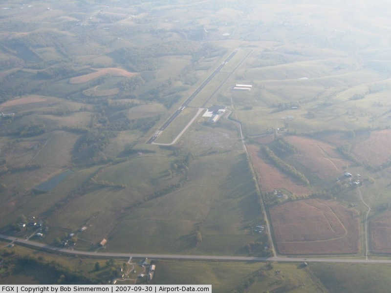
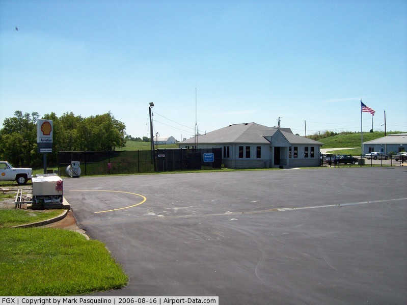
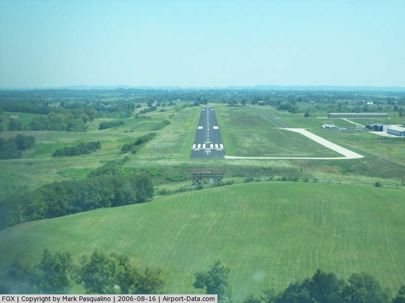
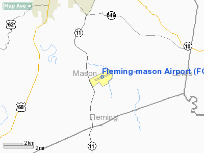
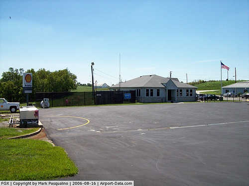
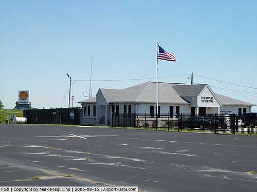
Fleming-Mason Airport (ICAO: KFGX, FAA LID: FGX) is a public use airport located in Mason County, Kentucky, United States. It is seven nautical miles (13 km) north of the central business district of Flemingsburg, a city in Fleming County. The airport is owned by the Fleming-Mason Airport Board.
Although most U.S. airports use the same three-letter location identifier for the FAA and IATA, this airport is assigned FGX by the FAA but has no designation from the IATA.
Facilities and aircraft
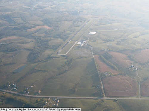
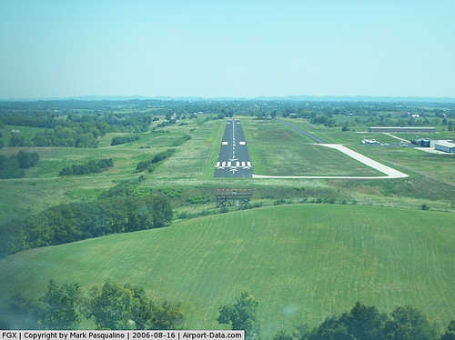
Fleming-Mason Airport covers an area of 77 acres (31 ha) at an elevation of 913 feet (278 m) above mean sea level. It has one asphalt paved runway designated 7/25 which measures 5,001 by 75 feet (1,524 x 23 m).
For the 12-month period ending May 10, 2007, the airport had 15,800 aircraft operations, an average of 43 per day: 98% general aviation and 2% military. At that time there were 24 aircraft based at this airport: 96% single-engine and 4% multi-engine.
The above content comes from Wikipedia and is published under free licenses – click here to read more.
|
 |
(Click on the photo to enlarge) |
|
 |
(Click on the photo to enlarge) |
|
 |
(Click on the photo to enlarge) |
|
 |
(Click on the photo to enlarge) |
|
Location &
QuickFacts
|
FAA
Information Effective: |
2008-09-25 |
|
Airport
Identifier: |
FGX |
|
Airport
Status: |
Operational |
|
Longitude/Latitude: |
083-44-36.2000W/38-32-30.5000N
-83.743389/38.541806 (Estimated) |
|
Elevation: |
913 ft / 278.28 m (Surveyed) |
|
Land: |
77 acres |
|
From
nearest city: |
7 nautical miles N of Flemingsburg, KY |
|
Location: |
Mason County, KY |
|
Magnetic Variation: |
05W (2000) |
Owner & Manager
|
Ownership: |
Publicly owned |
|
Owner: |
Fleming-mason Arpt Board |
|
Address: |
P.o. Box 460
Flemingsburg, KY 41041 |
|
Phone
number: |
606-849-3030
JOHN SIMS, AIR BOARD CHAIR |
|
Manager: |
Mitchell Coleman |
|
Address: |
7079 Airport Rd.
Maysville, KY 41056 |
|
Phone number: |
606-742-2411 |
Airport
Operations and Facilities
|
Airport
Use: |
Open to public |
|
Wind
indicator: |
Yes |
|
Segmented Circle: |
No |
|
Control
Tower: |
No |
|
Lighting
Schedule: |
DUSK-DAWN
ACTVT MIRL RY 07/25, REIL RYS 07 & 25 AND PAPI RYS 07 & 25 - CTAF. |
|
Beacon
Color: |
Clear-Green (lighted land airport) |
|
Landing
fee charge: |
No |
|
Sectional chart: |
Cincinnati |
|
Region: |
ASO - Southern |
|
Boundary
ARTCC: |
ZID - Indianapolis |
|
Tie-in
FSS: |
LOU - Louisville |
|
FSS on
Airport: |
No |
|
FSS Toll
Free: |
1-800-WX-BRIEF |
|
NOTAMs
Facility: |
LOU (NOTAM-d service avaliable) |
|
Federal Agreements: |
NY1 |
Airport Communications
|
CTAF: |
123.000 |
|
Unicom: |
123.000 |
Airport Services
|
Fuel
available: |
100LLA |
|
Airframe
Repair: |
MAJOR |
|
Power
Plant Repair: |
MAJOR |
|
Bottled
Oxygen: |
NONE |
|
Bulk
Oxygen: |
NONE |
|
Runway Information
Runway 07/25
|
Dimension: |
5001 x 75 ft / 1524.3 x 22.9 m |
|
Surface: |
ASPH, Good Condition |
|
Weight Limit: |
Single wheel: 36000 lbs.
Dual wheel: 50000 lbs. |
|
Edge Lights: |
Medium |
|
|
Runway 07
|
Runway 25
|
|
Longitude: |
083-45-05.1631W |
083-44-07.1418W |
|
Latitude: |
38-32-20.9619N |
38-32-40.1243N |
|
Elevation: |
905.00 ft |
910.00 ft |
|
Alignment: |
67 |
127 |
|
ILS Type: |
|
LOCALIZER |
|
Traffic
Pattern: |
Left |
Left |
|
Markings: |
Non-precision instrument, Good Condition |
Non-precision instrument, Good Condition |
|
Crossing
Height: |
40.00 ft |
40.00 ft |
|
Displaced
threshold: |
299.00 ft |
0.00 ft |
|
VASI: |
4-light PAPI on left side |
4-light PAPI on left side |
|
Visual
Glide Angle: |
3.00° |
3.00° |
|
Runway End
Identifier: |
Yes |
Yes |
|
Obstruction: |
10 ft trees, 450.0 ft from runway, 85 ft left of
centerline, 25:1 slope to clear
RY 07 APCH RATIO 50:1 TO DSPLCD THLD.
RY 07 +10 FT TREES 197 FT FR RY END & 150 FT L. |
, 50:1 slope to clear |
|
Radio Navigation Aids
|
ID |
Type |
Name |
Ch |
Freq |
Var |
Dist |
|
AJY |
FAN MARKER |
Ashland |
|
|
03W |
44.6 nm |
|
XW |
NDB |
Flmng |
|
400.00 |
05W |
4.9 nm |
|
AMT |
NDB |
West Union |
|
359.00 |
04W |
20.7 nm |
|
PZO |
NDB |
Peebles |
|
329.00 |
02W |
30.0 nm |
|
IOB |
NDB |
Mount Sterling |
|
210.00 |
04W |
31.1 nm |
|
PWF |
NDB |
Sportys |
|
245.00 |
04W |
39.0 nm |
|
HOC |
NDB |
Hillsboro |
|
278.00 |
05W |
39.8 nm |
|
PMH |
NDB |
Portsmouth |
|
373.00 |
04W |
44.6 nm |
|
LUK |
NDB |
Cincinnati |
|
335.00 |
04W |
46.5 nm |
|
XYC |
NDB |
Seco |
|
393.00 |
03W |
49.0 nm |
|
HW |
NDB |
Cubla |
|
299.00 |
04W |
49.2 nm |
|
MDE |
NDB |
Madeira |
|
379.00 |
04W |
50.0 nm |
|
FLM |
VOR/DME |
Falmouth |
117X |
117.00 |
04W |
27.4 nm |
|
YRK |
VORTAC |
York |
075X |
112.80 |
05W |
36.5 nm |
|
ECB |
VORTAC |
Newcombe |
041X |
110.40 |
02W |
45.5 nm |
|
HYK |
VORTAC |
Lexington |
073X |
112.60 |
00E |
48.8 nm |
|
LUK |
VOT |
Cincinnati Muni/lunken |
|
108.40 |
|
46.3 nm |
Based Aircraft
|
Aircraft based
on field: |
24 |
|
Single Engine
Airplanes: |
23 |
|
Multi Engine
Airplanes: |
1 |
Operational Statistics
Time Period: 2006-05-11 - 2007-05-10
|
Aircraft
Operations: |
44/Day |
|
General
Aviation Local: |
38.0% |
|
General
Aviation Itinerant: |
60.1% |
|
Military: |
1.9% |
Fleming-mason Airport
Address:
Mason County, KY
Tel:
606-849-3030, 606-742-2411
Images
and information placed above are from
http://www.airport-data.com/airport/FGX/
We
thank them for the data!
|
General Info |
| Country |
United
States |
| State |
KENTUCKY
|
| FAA ID |
FGX
|
| Latitude |
38-32-30.500N |
|
Longitude |
083-44-36.200W |
|
Elevation |
913 feet
|
| Near
City |
FLEMINGSBURG |
We don't guarantee the information is fresh and accurate. The data may
be wrong or outdated.
For more up-to-date information please refer to other sources.
|
|