 |
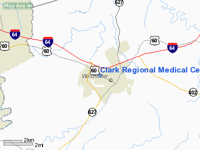
|
Clark Regional Medical Center Heliport |
|
|
|
Location &
QuickFacts
|
FAA
Information Effective: |
2008-09-25 |
|
Airport
Identifier: |
89KY |
|
Airport
Status: |
Operational |
|
Longitude/Latitude: |
084-11-53.7420W/38-00-00.2830N
-84.198262/38.000079 (Estimated) |
|
Elevation: |
1000 ft / 304.80 m (Estimated) |
|
Land: |
0 acres |
|
From
nearest city: |
0 nautical miles N of Winchester, KY |
|
Location: |
Clark County, KY |
|
Magnetic Variation: |
03W (1990) |
Owner & Manager
|
Ownership: |
Publicly owned |
|
Owner: |
Clark Regional Medical Center |
|
Address: |
1107 W. Lexington Avenue
Winchester, KY 40391 |
|
Phone
number: |
606-745-3400 |
|
Manager: |
James R. Freedman |
|
Address: |
1107 W. Lexington Avenue
Winchester, KY 40391 |
|
Phone number: |
606-745-3400 |
Airport Operations and Facilities
|
Airport
Use: |
Private
MEDICAL USE. |
|
Segmented Circle: |
No |
|
Control
Tower: |
No |
|
Lighting
Schedule: |
PHONE REQ
FOR PERIMETER LIGHTS CALL 606-745-3400. |
|
Sectional chart: |
Cincinnati |
|
Region: |
ASO - Southern |
|
Boundary
ARTCC: |
ZID - Indianapolis |
|
Tie-in
FSS: |
LOU - Louisville |
|
FSS on
Airport: |
No |
|
FSS Toll
Free: |
1-800-WX-BRIEF |
|
Runway Information
Helipad H1
|
Dimension: |
40 x 40 ft / 12.2 x 12.2 m |
|
Surface: |
CONC, |
|
|
Runway H1
|
Runway
|
|
Traffic
Pattern: |
Left |
Left |
|
Radio Navigation Aids
|
ID |
Type |
Name |
Ch |
Freq |
Var |
Dist |
|
IOB |
NDB |
Mount Sterling |
|
210.00 |
04W |
10.9 nm |
|
XYC |
NDB |
Seco |
|
393.00 |
03W |
16.6 nm |
|
LE |
NDB |
Blayd |
|
242.00 |
04W |
21.9 nm |
|
FEU |
NDB |
Arnold |
|
521.00 |
03W |
32.1 nm |
|
DVK |
NDB |
Goodall |
|
311.00 |
03W |
37.0 nm |
|
XW |
NDB |
Flmng |
|
400.00 |
05W |
43.2 nm |
|
FFT |
VOR |
Frankfort |
|
109.40 |
03W |
35.3 nm |
|
FLM |
VOR/DME |
Falmouth |
117X |
117.00 |
04W |
39.4 nm |
|
HYK |
VORTAC |
Lexington |
073X |
112.60 |
00E |
13.2 nm |
Remarks
-
VFR, PVT USE,
OPNS CONDUCTED FROM 310 DEG CLKWS TO 50 DEG AND FROM 90 DEG TO 170 DEG, TKOF/LNDG
AREA MARKED, WIND INDICATOR MAINTD.
Clark Regional Medical Center Heliport
Address:
Clark County, KY
Tel:
606-745-3400
Images
and information placed above are from
http://www.airport-data.com/airport/89KY/
We
thank them for the data!
|
General Info |
| Country |
United
States |
| State |
KENTUCKY
|
| FAA ID |
89KY
|
| Latitude |
38-00-00.283N |
|
Longitude |
084-11-53.742W |
|
Elevation |
1000
feet |
| Near
City |
WINCHESTER |
We don't guarantee the information is fresh and accurate. The data may
be wrong or outdated.
For more up-to-date information please refer to other sources.
|
|


