 |
|
|
Location &
QuickFacts
|
FAA
Information Effective: |
2008-09-25 |
|
Airport
Identifier: |
72KY |
|
Airport
Status: |
Operational |
|
Longitude/Latitude: |
084-11-57.7660W/36-45-54.3000N
-84.199379/36.765083 (Estimated) |
|
Elevation: |
1105 ft / 336.80 m (Estimated) |
|
Land: |
7 acres |
|
From
nearest city: |
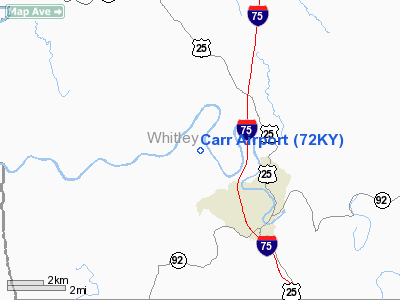
4 nautical miles W of Williamsburg, KY |
|
Location: |
Whitley County, KY |
|
Magnetic Variation: |
03W (1985) |
Owner & Manager
|
Ownership: |
Privately owned |
|
Owner: |
Alvin Ray Carr |
|
Address: |
3168 Redbird Road
Williamsburg, KY 40769 |
|
Phone number: |
606-549-0202 |
|
Address: |
|
Airport
Operations and Facilities
|
Airport
Use: |
Private |
|
Wind
indicator: |
Yes |
|
Segmented Circle: |
No |
|
Control
Tower: |
No |
|
Landing
fee charge: |
No |
|
Sectional chart: |
Cincinnati |
|
Region: |
ASO - Southern |
|
Boundary
ARTCC: |
ZID - Indianapolis |
|
Tie-in
FSS: |
LOU - Louisville |
|
FSS on
Airport: |
No |
|
FSS Toll
Free: |
1-800-WX-BRIEF |
|
Runway Information
Runway 06/24
|
Dimension: |
1500 x 50 ft / 457.2 x 15.2 m |
|
Surface: |
ASPH-TURF, |
|
|
Runway 06
|
Runway 24
|
|
Traffic
Pattern: |
Left |
Left |
|
Radio Navigation Aids
|
ID |
Type |
Name |
Ch |
Freq |
Var |
Dist |
|
BPO |
NDB |
Piney Grove |
|
403.00 |
05W |
19.0 nm |
|
JAU |
NDB |
Jacksboro |
|
204.00 |
03W |
25.7 nm |
|
CDX |
NDB |
Cumberland River |
|
388.00 |
05E |
27.0 nm |
|
EKQ |
NDB |
Elk Spring |
|
290.00 |
03W |
31.9 nm |
|
LOZ |
VORTAC |
London |
108X |
116.10 |
03W |
16.7 nm |
|
LVT |
VORTAC |
Livingston |
021X |
108.40 |
02W |
47.9 nm |
Remarks
-
OWNER DESIRES
ARPT NOT BE CHARTED.
-
VFR, PVT USE ONLY.
Based Aircraft
|
Aircraft based
on field: |
1 |
|
Single Engine
Airplanes: |
1 |
Carr Airport
Address:
Whitley County, KY
Tel:
606-549-0202
Images
and information placed above are from
http://www.airport-data.com/airport/72KY/
We
thank them for the data!
|
General Info |
| Country |
United
States |
| State |
KENTUCKY
|
| FAA ID |
72KY
|
| Latitude |
36-45-54.300N |
|
Longitude |
084-11-57.766W |
|
Elevation |
1105
feet |
| Near
City |
WILLIAMSBURG |
We don't guarantee the information is fresh and accurate. The data may
be wrong or outdated.
For more up-to-date information please refer to other sources.
|
|


