 |
|
|
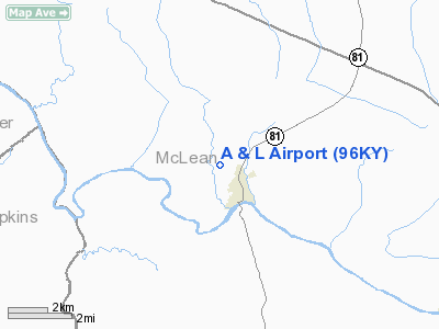
Location
& QuickFacts
|
FAA
Information Effective: |
2008-09-25 |
|
Airport
Identifier: |
96KY |
|
Airport
Status: |
Operational |
|
Longitude/Latitude: |
087-16-17.0000W/37-33-08.0000N
-87.271389/37.552222 (Estimated) |
|
Elevation: |
465 ft / 141.73 m (Estimated) |
|
Land: |
0 acres |
|
From
nearest city: |
1 nautical miles NW of Calhoun, KY |
|
Location: |
Mc Lean County, KY |
|
Magnetic Variation: |
01W (1990) |
Owner
& Manager
|
Ownership: |
Privately
owned |
|
Owner: |
Jessie Abney |
|
Address: |
393 Everett Cherry La
Calhoun, KY 42327 |
|
Phone
number: |
502-273-3219 |
|
Manager: |
Jessie Abney |
|
Address: |
Box 393 Everett Cherry Lane
Calhoun, KY 42327 |
|
Phone number: |
502-273-3219 |
Airport Operations and Facilities
|
Airport
Use: |
Private |
|
Segmented Circle: |
No |
|
Control
Tower: |
No |
|
Sectional chart: |
St Louis |
|
Region: |
ASO - Southern |
|
Boundary
ARTCC: |
ZID - Indianapolis |
|
Tie-in
FSS: |
LOU - Louisville |
|
FSS
on Airport: |
No |
|
FSS
Toll Free: |
1-800-WX-BRIEF |
|
Runway Information
Runway 09/27
|
Dimension: |
1400
x 100 ft / 426.7 x 30.5 m |
|
Surface: |
TURF, |
|
|
Runway 09 |
Runway 27 |
|
Traffic
Pattern: |
Left |
Left |
|
Obstruction: |
|
50 ft trees, 400.0 ft from runway |
|
Radio Navigation
Aids
|
ID |
Type |
Name |
Ch |
Freq |
Var |
Dist |
|
GMH |
NDB |
Muhlenberg |
|
362.00 |
01E |
20.3 nm |
|
GVA |
NDB |
Geneva |
|
224.00 |
01W |
28.1 nm |
|
PDW |
NDB |
Evansville |
|
284.00 |
00E |
31.8 nm |
|
TWT |
NDB |
Tradewater |
|
276.00 |
00E |
32.6 nm |
|
TEL |
NDB |
Tell City |
|
206.00 |
02W |
39.2 nm |
|
HIX |
NDB |
Honey Grove |
|
356.00 |
01W |
40.5 nm |
|
FNZ |
NDB |
Ferdinand |
|
239.00 |
00E |
46.6 nm |
|
FK |
NDB |
Airbe |
|
273.00 |
01W |
49.5 nm |
|
OWB |
VOR/DME |
Owensboro |
023X |
108.60 |
01E |
12.5 nm |
|
HNB |
VOR/DME |
Huntingburg |
029X |
109.20 |
00E |
44.5 nm |
|
CCT |
VORTAC |
Central City |
035X |
109.80 |
01W |
10.2 nm |
|
PXV |
VORTAC |
Pocket City |
080X |
113.30 |
03E |
32.5 nm |
Remarks
A And L Airport
Address:
Mc Lean County, KY
Tel:
502-273-3219
Images
and information placed above are from
http://www.airport-data.com/airport/96KY/
We
thank them for the data!
| General
Info |
| Country |
United
States |
| State |
KENTUCKY
|
| FAA ID |
96KY |
| Latitude |
37-33-08.000N
|
| Longitude |
087-16-17.000W
|
| Elevation |
465 feet
|
| Near City |
CALHOUN
|
We don't guarantee the information is fresh and accurate. The data may
be wrong or outdated.
For more up-to-date information please refer to other sources.
|
|


