 |
|
|
|
|
|
|
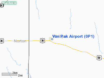
Location &
QuickFacts
|
FAA
Information Effective: |
2008-09-25 |
|
Airport
Identifier: |
0P1 |
|
Airport
Status: |
Operational |
|
Longitude/Latitude: |
099-34-06.4000W/39-49-54.1000N
-99.568444/39.831694 (Estimated) |
|
Elevation: |
2213 ft / 674.52 m (Surveyed) |
|
Land: |
8 acres |
|
From
nearest city: |
0 nautical miles E of Prairie View, KS |
|
Location: |
Phillips County, KS |
|
Magnetic Variation: |
08E (1985) |
Owner & Manager
|
Ownership: |
Privately owned |
|
Owner: |
Buford J Van Loenen |
|
Address: |
Box 365
Prairie View, KS 67664 |
|
Phone number: |
785-973-2345 |
|
Manager: |
Roger Van Loenen |
|
Address: |
Box 404
Prairie View, KS 67664 |
|
Phone number: |
785-973-2252 |
Airport
Operations and Facilities
|
Airport
Use: |
Open to public |
|
Wind
indicator: |
No |
|
Segmented Circle: |
No |
|
Control
Tower: |
No |
|
Landing
fee charge: |
No |
|
Sectional chart: |
Wichita |
|
Region: |
ACE - Central |
|
Boundary
ARTCC: |
ZDV - Denver |
|
Tie-in
FSS: |
ICT - Wichita |
|
FSS on
Airport: |
No |
|
FSS Toll
Free: |
1-800-WX-BRIEF |
|
NOTAMs
Facility: |
ICT (NOTAM-d service avaliable) |
Airport Communications
Airport Services
|
Airframe
Repair: |
NONE |
|
Power
Plant Repair: |
NONE |
|
Bottled
Oxygen: |
NONE |
|
Bulk
Oxygen: |
NONE |
|
Runway Information
Runway 16/34
|
Dimension: |
2590 x 128 ft / 789.4 x 39.0 m |
|
Surface: |
TURF, Poor Condition
12 INCH WEEDS COVER ENTIRE RY. |
|
|
Runway 16
|
Runway 34
|
|
Longitude: |
099-34-10.0600W |
099-34-02.7100W |
|
Latitude: |
39-50-06.6200N |
39-49-41.6600N |
|
Traffic
Pattern: |
Left |
Left |
|
Obstruction: |
4 ft gnd, 16.0 ft from runway, 4:1 slope to clear |
15 ft road, 15.0 ft from runway, 1:1 slope to clear |
|
Radio Navigation Aids
|
ID |
Type |
Name |
Ch |
Freq |
Var |
Dist |
|
MCK |
FAN MARKER |
Mc Cook |
|
|
11E |
49.6 nm |
|
NRN |
NDB |
Norton |
|
230.00 |
08E |
14.9 nm |
|
PHG |
NDB |
Phillipsburg |
|
368.00 |
08E |
15.0 nm |
|
HDE |
NDB |
Holdrege |
|
396.00 |
07E |
38.5 nm |
|
CSB |
NDB |
Harry Strunk |
|
389.00 |
08E |
39.3 nm |
|
OIN |
NDB |
Oberlin |
|
341.00 |
09E |
44.7 nm |
|
HLC |
VORTAC |
Hill City |
084X |
113.70 |
08E |
46.0 nm |
Remarks
Operational Statistics
Time Period: 2006-08-16 - 2007-08-15
|
Aircraft
Operations: |
13/Month |
|
General
Aviation Local: |
33.3% |
|
General
Aviation Itinerant: |
66.7% |
Van Pak Airport
Address:
Phillips County, KS
Tel:
785-973-2345, 785-973-2252
Images
and information placed above are from
http://www.airport-data.com/airport/0P1/
We
thank them for the data!
|
General Info |
| Country |
United
States |
| State |
KANSAS
|
| FAA ID |
0P1
|
| Latitude |
39-49-56.029N |
|
Longitude |
099-34-07.385W |
|
Elevation |
2213
feet |
| Near
City |
PRAIRIE
VIEW |
We don't guarantee the information is fresh and accurate. The data may
be wrong or outdated.
For more up-to-date information please refer to other sources.
|
|


