 |
|
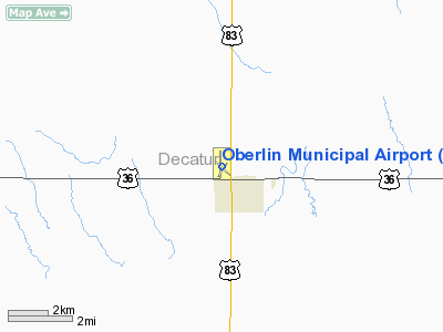
Oberlin Municipal Airport |
|
|
|
Location &
QuickFacts
|
FAA
Information Effective: |
2008-09-25 |
|
Airport
Identifier: |
OIN |
|
Airport
Status: |
Operational |
|
Longitude/Latitude: |
100-32-21.6000W/39-50-02.1000N
-100.539333/39.833917 (Estimated) |
|
Elevation: |
2703 ft / 823.87 m (Surveyed) |
|
Land: |
164 acres |
|
From
nearest city: |
1 nautical miles NW of Oberlin, KS |
|
Location: |
Decatur County, KS |
|
Magnetic Variation: |
09E (1985) |
Owner & Manager
|
Ownership: |
Publicly owned |
|
Owner: |
City Of Oberlin |
|
Address: |
Oberline, KS 67749 |
|
Manager: |
Bob Fraker Fbo |
|
Address: |
Box 153
Oberlin, KS 67749 |
|
Phone number: |
785-475-8982
OR 785-475-3080. |
Airport
Operations and Facilities
|
Airport
Use: |
Open to public |
|
Wind
indicator: |
Yes |
|
Segmented Circle: |
Yes |
|
Control
Tower: |
No |
|
Lighting
Schedule: |
DUSK-DAWN |
|
Beacon
Color: |
Clear-Green (lighted land airport) |
|
Landing
fee charge: |
No |
|
Sectional chart: |
Wichita |
|
Region: |
ACE - Central |
|
Boundary
ARTCC: |
ZDV - Denver |
|
Tie-in
FSS: |
ICT - Wichita |
|
FSS on
Airport: |
No |
|
FSS Toll
Free: |
1-800-WX-BRIEF |
|
NOTAMs
Facility: |
ICT (NOTAM-d service avaliable) |
|
Federal Agreements: |
NGY |
Airport Communications
|
CTAF: |
122.800 |
|
Unicom: |
122.800 |
Airport Services
|
Fuel
available: |
100LL |
|
Airframe
Repair: |
MAJOR |
|
Power
Plant Repair: |
MAJOR |
|
Bottled
Oxygen: |
NONE |
|
Bulk
Oxygen: |
NONE |
|
Runway Information
Runway 03/21
|
Dimension: |
2000 x 190 ft / 609.6 x 57.9 m |
|
Surface: |
TURF, Fair Condition
RWY 12/30 ROUGH WHEN CROSSING RY 17/35. |
|
|
Runway 03
|
Runway 21
|
|
Longitude: |
100-32-26.3347W |
100-32-09.0975W |
|
Latitude: |
39-49-51.2584N |
39-50-05.8891N |
|
Elevation: |
2669.00 ft |
2674.00 ft |
|
Alignment: |
42 |
127 |
|
Traffic
Pattern: |
Left |
Left |
|
Obstruction: |
30 ft tree, 800.0 ft from runway, 26:1 slope to clear |
16 ft road, 400.0 ft from runway, 165 ft left of
centerline, 25:1 slope to clear |
|
Runway 12/30
|
Dimension: |
2850 x 125 ft / 868.7 x 38.1 m |
|
Surface: |
TURF, Fair Condition
RWY 12/30 ROUGH WHEN CROSSING RY 17/35. |
|
|
Runway 12
|
Runway 30
|
|
Longitude: |
100-32-34.5515W |
100-32-08.8388W |
|
Latitude: |
39-50-09.9643N |
39-49-49.9563N |
|
Elevation: |
2685.00 ft |
2650.00 ft |
|
Alignment: |
127 |
127 |
|
Traffic
Pattern: |
Left |
Left |
|
Obstruction: |
, 50:1 slope to clear |
12 ft trees, 300.0 ft from runway, 60 ft left of
centerline, 25:1 slope to clear
DIAGONAL ROW OF 12 FT TREES 300 FT.
FROM THE
APPROACH END OF RWY30 |
|
Runway 17/35
|
Dimension: |
3793 x 50 ft / 1156.1 x 15.2 m |
|
Surface: |
ASPH, Good Condition
RWY 12/30 ROUGH WHEN CROSSING RY 17/35. |
|
Weight Limit: |
Single wheel: 4000 lbs. |
|
Edge Lights: |
Low |
|
|
Runway 17
|
Runway 35
|
|
Longitude: |
100-32-24.3571W |
100-32-24.7557W |
|
Latitude: |
39-50-24.3488N |
39-49-46.8682N |
|
Elevation: |
2703.00 ft |
2668.00 ft |
|
Alignment: |
127 |
0 |
|
Traffic
Pattern: |
Left |
Left |
|
Markings: |
Numbers only, Fair Condition
REPAINTED |
Numbers only, Fair Condition |
|
Obstruction: |
20 ft tree, 877.0 ft from runway, 202 ft right of
centerline, 33:1 slope to clear |
23 ft pole, 896.0 ft from runway, 78 ft right of
centerline, 30:1 slope to clear |
|
Radio Navigation Aids
|
ID |
Type |
Name |
Ch |
Freq |
Var |
Dist |
|
MCK |
FAN MARKER |
Mc Cook |
|
|
11E |
20.8 nm |
|
OIN |
NDB |
Oberlin |
|
341.00 |
09E |
0.3 nm |
|
ADT |
NDB |
Atwood |
|
365.00 |
09E |
23.3 nm |
|
NRN |
NDB |
Norton |
|
230.00 |
08E |
30.0 nm |
|
JDM |
NDB |
Wheatfield |
|
408.00 |
08E |
30.5 nm |
|
CSB |
NDB |
Harry Strunk |
|
389.00 |
08E |
33.3 nm |
|
OEL |
NDB |
Oakley |
|
380.00 |
08E |
45.2 nm |
|
MCK |
VOR/DME |
Mc Cook |
100X |
115.30 |
08E |
22.4 nm |
|
HLC |
VORTAC |
Hill City |
084X |
113.70 |
08E |
37.5 nm |
|
HCT |
VORTAC |
Hayes Center |
124X |
117.70 |
11E |
41.2 nm |
Based Aircraft
|
Aircraft based
on field: |
15 |
|
Single Engine
Airplanes: |
13 |
|
Jet Engine
Airplanes: |
1 |
|
Helicopters: |
1 |
Operational Statistics
Time Period: 2006-07-23 - 2007-07-22
|
Aircraft
Operations: |
137/Week |
|
Air Taxi: |
1.4% |
|
General
Aviation Local: |
59.2% |
|
General
Aviation Itinerant: |
39.4% |
Oberlin Municipal Airport
Address:
Decatur County, KS
Tel:
785-475-8982, 785-475-3080
Images
and information placed above are from
http://www.airport-data.com/airport/OIN/
We
thank them for the data!
|
General Info |
| Country |
United
States |
| State |
KANSAS
|
| FAA ID |
OIN
|
| Latitude |
39-50-01.618N |
|
Longitude |
100-32-21.925W |
|
Elevation |
2703
feet |
| Near
City |
OBERLIN
|
We don't guarantee the information is fresh and accurate. The data may
be wrong or outdated.
For more up-to-date information please refer to other sources.
|
|


