 |
|
|
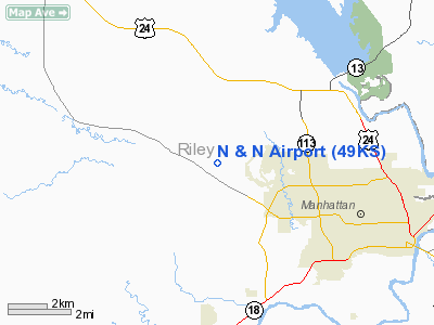
Location &
QuickFacts
|
FAA
Information Effective: |
2008-09-25 |
|
Airport
Identifier: |
49KS |
|
Airport
Status: |
Operational |
|
Longitude/Latitude: |
096-40-20.2972W/39-12-50.7257N
-96.672305/39.214090 (Estimated) |
|
Elevation: |
1230 ft / 374.90 m (Estimated) |
|
Land: |
4 acres |
|
From
nearest city: |
3 nautical miles SE of Manhattan, KS |
|
Location: |
Riley County, KS |
|
Magnetic Variation: |
06E (1985) |
Owner & Manager
|
Ownership: |
Privately owned |
|
Owner: |
John Bath |
|
Address: |
2340 W. 60th Ave
Manhattan, KS 66503 |
|
Phone
number: |
785-539-7436 |
|
Manager: |
John Bath |
|
Address: |
2340 W. 60th Ave
Manhattan, KS 66503 |
|
Phone number: |
785-539-7436 |
Airport Operations and Facilities
|
Airport
Use: |
Private |
|
Segmented Circle: |
No |
|
Control
Tower: |
No |
|
Sectional chart: |
Kansas City |
|
Region: |
ACE - Central |
|
Boundary
ARTCC: |
ZKC - Kansas City |
|
Tie-in
FSS: |
ICT - Wichita |
|
FSS Toll
Free: |
1-800-WX-BRIEF |
|
Runway Information
Runway 17/35
|
Dimension: |
2200 x 100 ft / 670.6 x 30.5 m |
|
Surface: |
TURF, |
|
|
Runway 17
|
Runway 35
|
|
Traffic
Pattern: |
Left |
Right |
|
Obstruction: |
4 ft fence |
|
|
Radio Navigation Aids
|
ID |
Type |
Name |
Ch |
Freq |
Var |
Dist |
|
MQD |
NDB |
Mc Dowell Creek |
|
391.00 |
06E |
6.1 nm |
|
CVY |
NDB |
Cavalry |
|
314.00 |
06E |
12.7 nm |
|
CYW |
NDB |
Clay Center |
|
362.00 |
07E |
24.9 nm |
|
HRU |
NDB |
Herington |
|
407.00 |
06E |
32.0 nm |
|
DBX |
NDB |
Morrison |
|
212.00 |
06E |
37.1 nm |
|
MYZ |
NDB |
Marysville |
|
341.00 |
06E |
38.4 nm |
|
TO |
NDB |
Biloy |
|
521.00 |
05E |
46.3 nm |
|
CNK |
NDB |
Concordia |
|
335.00 |
06E |
49.8 nm |
|
FOE |
TACAN |
Forbes |
053X |
|
05E |
49.8 nm |
|
FRI |
VOR |
Fort Riley |
|
109.40 |
06E |
17.1 nm |
|
MHK |
VOR/DME |
Manhattan |
039X |
110.20 |
06E |
4.1 nm |
|
SLN |
VORTAC |
Salina |
118X |
117.10 |
07E |
47.6 nm |
|
FOE |
VOT |
Forbes |
|
111.00 |
|
49.5 nm |
Remarks
-
OWNER DESIRES
ARPT NOT BE CHARTED.
-
PRVDD APCHS ARE
MAINTD FOR A 20:1 APCH SLOPE & TRSNL SFCS FOR A 7:1 SLOPE, AVOID ADJACENT
R-3602B AIRSPACE RIGHT HAND TFC PAT TO AVOID MANHATTAN MUNI ARPT.
Based Aircraft
|
Aircraft based
on field: |
1 |
|
Single Engine
Airplanes: |
1 |
N And N Airport
Address:
Riley County, KS
Tel:
785-539-7436
Images
and information placed above are from
http://www.airport-data.com/airport/49KS/
We
thank them for the data!
|
General Info |
| Country |
United
States |
| State |
KANSAS
|
| FAA ID |
49KS
|
| Latitude |
39-12-51.987N |
|
Longitude |
096-40-20.018W |
|
Elevation |
1230
feet |
| Near
City |
MANHATTAN |
We don't guarantee the information is fresh and accurate. The data may
be wrong or outdated.
For more up-to-date information please refer to other sources.
|
|


