 |
|
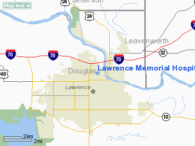
Lawrence Memorial Hospital Heliport |
|
Location &
QuickFacts
|
FAA
Information Effective: |
2008-09-25 |
|
Airport
Identifier: |
SN38 |
|
Airport
Status: |
Operational |
|
Longitude/Latitude: |
095-14-56.0000W/38-58-48.0000N
-95.248889/38.980000 (Estimated) |
|
Elevation: |
858 ft / 261.52 m (Estimated) |
|
Land: |
13 acres |
|
From
nearest city: |
1 nautical miles N of Lawrence, KS |
|
Location: |
Douglas County, KS |
|
Magnetic Variation: |
05E (1995) |
Owner & Manager
|
Ownership: |
Publicly owned |
|
Owner: |
City Of Lawrence |
|
Address: |
325 Maine
Lawrence, KS 66044 |
|
Phone number: |
785-749-6100 |
|
Manager: |
Skanda Skandaverl |
|
Address: |
325 Maine
Lawrence, KS 66044 |
|
Phone number: |
785-840-3011 |
Airport
Operations and Facilities
|
Airport
Use: |
Private |
|
Wind
indicator: |
Yes |
|
Segmented Circle: |
No |
|
Control
Tower: |
No |
|
Sectional chart: |
Kansas City |
|
Region: |
ACE - Central |
|
Boundary
ARTCC: |
ZKC - Kansas City |
|
Tie-in
FSS: |
ICT - Wichita |
|
FSS on
Airport: |
No |
|
FSS Toll
Free: |
1-800-WX-BRIEF |
|
Runway Information
Helipad H1
|
Dimension: |
40 x 40 ft / 12.2 x 12.2 m |
|
Surface: |
CONC, |
|
|
Runway H1
|
Runway
|
|
Traffic
Pattern: |
Left |
Left |
|
Radio Navigation Aids
|
ID |
Type |
Name |
Ch |
Freq |
Var |
Dist |
|
TO |
NDB |
Biloy |
|
521.00 |
05E |
22.1 nm |
|
DO |
NDB |
Dotte |
|
359.00 |
05E |
27.4 nm |
|
GQ |
NDB |
Norge |
|
517.00 |
05E |
28.1 nm |
|
GKB |
NDB |
Norge |
|
517.00 |
05E |
28.1 nm |
|
LXT |
NDB |
Lesumit |
|
263.00 |
04E |
41.0 nm |
|
UKL |
NDB |
Boyd |
|
245.00 |
05E |
46.5 nm |
|
GPH |
NDB |
Mosby |
|
284.00 |
03E |
49.1 nm |
|
FOE |
TACAN |
Forbes |
053X |
|
05E |
19.4 nm |
|
OJC |
VOR/DME |
Johnson County |
077X |
113.00 |
06E |
25.4 nm |
|
RIS |
VOR/DME |
Riverside |
051X |
111.40 |
05E |
31.6 nm |
|
TOP |
VORTAC |
Topeka |
125X |
117.80 |
05E |
16.9 nm |
|
MCI |
VORTAC |
Kansas City |
079Y |
113.25 |
05E |
30.1 nm |
|
FOE |
VOT |
Forbes |
|
111.00 |
|
19.6 nm |
|
MKC |
VOT |
Kansas City Downtown |
|
108.60 |
|
31.6 nm |
Remarks
-
PRVDD THE SIGN;
LGT POLES; POWER LINES AND TREES THAT PENETRATE 8:1 ARE REMOVED.
Lawrence Memorial Hospital Heliport
Address:
Douglas County, KS
Tel:
785-749-6100, 785-840-3011
Images
and information placed above are from
http://www.airport-data.com/airport/SN38/
We
thank them for the data!
|
General Info |
| Country |
United
States |
| State |
KANSAS
|
| FAA ID |
SN38
|
| Latitude |
38-58-48.000N |
|
Longitude |
095-14-56.000W |
|
Elevation |
858 feet
|
| Near
City |
LAWRENCE
|
We don't guarantee the information is fresh and accurate. The data may
be wrong or outdated.
For more up-to-date information please refer to other sources.
|
|


