 |
|
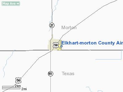
Elkhart-morton County Airport |
| Elkhart-Morton County Airport |
| IATA: none â ICAO: KEHA â FAA LID: EHA |
| Summary |
| Airport type |
Public |
| Owner |
Morton County |
| Serves |
Elkhart, Kansas |
| Elevation AMSL |
3,622 ft / 1,104 m |
| Coordinates |
37°00â²03â³N 101°52â²48â³W / 37.00083°N 101.88°W / 37.00083; -101.88 |
| Runways |
| Direction |
Length |
Surface |
| ft |
m |
| 4/22 |
4,900 |
1,494 |
Asphalt |
| 17/35 |
4,900 |
1,494 |
Asphalt |
| Statistics (2007) |
| Aircraft operations |
6,000 |
| Based aircraft |
12 |
| Source: Federal Aviation Administration |
Elkhart-Morton County Airport (ICAO: KEHA, FAA LID: EHA) is a county-owned public-use airport located one nautical mile (1.85 km) east of the central business district of Elkhart, a city in Morton County, Kansas, United States.
Although most U.S. airports use the same three-letter location identifier for the FAA and IATA, this airport is assigned EHA by the FAA but has no designation from the IATA.
Facilities and aircraft
Elkhart-Morton County Airport covers an area of 346 acres (140 ha) at an elevation of 3,622 feet (1,104 m) above mean sea level. It has two asphalt paved runways designated 4/22 and 17/35, each of which measure 4,900 by 60 feet (1,494 x 18 m).
For the 12-month period ending August 22, 2007, the airport had 6,000 general aviation aircraft operations, an average of 16 per day. At that time there were 12 aircraft based at this airport: 92% single-engine and 8% multi-engine.
The above content comes from Wikipedia and is published under free licenses – click here to read more.
|
Location &
QuickFacts
|
FAA
Information Effective: |
2008-06-05 |
|
Airport
Identifier: |
EHA |
|
Airport
Status: |
Operational |
|
Longitude/Latitude: |
101-52-48.0410W/37-00-02.6480N
-101.880011/37.000736 (Estimated) |
|
Elevation: |
3622 ft / 1103.99 m (Surveyed) |
|
Land: |
346 acres |
|
From
nearest city: |
1 nautical miles E of Elkhart, KS |
|
Location: |
Morton County, KS |
|
Magnetic Variation: |
10E (1980) |
Owner & Manager
|
Ownership: |
Publicly owned |
|
Owner: |
Morton County |
|
Address: |
P.o. Box 1116
Elkhart, KS 67950 |
|
Phone number: |
620-697-2157 |
|
Manager: |
Ed Johnson |
|
Address: |
Box 70
Elkhart, KS 67950 |
|
Phone number: |
620-697-2448
CELL PHONE # 620-360-0607. |
Airport
Operations and Facilities
|
Airport
Use: |
Open to public |
|
Wind
indicator: |
Yes |
|
Segmented Circle: |
Yes |
|
Control
Tower: |
No |
|
Lighting
Schedule: |
DUSK-DAWN |
|
Beacon
Color: |
Clear-Green (lighted land airport) |
|
Landing
fee charge: |
No |
|
Sectional chart: |
Wichita |
|
Region: |
ACE - Central |
|
Boundary
ARTCC: |
ZKC - Kansas City |
|
Tie-in
FSS: |
ICT - Wichita |
|
FSS on
Airport: |
No |
|
FSS Toll
Free: |
1-800-WX-BRIEF |
|
NOTAMs
Facility: |
EHA (NOTAM-d service avaliable) |
|
Federal Agreements: |
NGSY |
Airport Communications
|
CTAF: |
122.800 |
|
Unicom: |
122.800 |
Airport Services
|
Fuel
available: |
100LL
FOR FUEL CALL (620) 697-4624. |
|
Bottled
Oxygen: |
NONE |
|
Bulk
Oxygen: |
NONE |
|
Runway Information
Runway 04/22
|
Dimension: |
4900 x 60 ft / 1493.5 x 18.3 m |
|
Surface: |
ASPH, Fair Condition |
|
Edge Lights: |
Medium |
|
|
Runway 04
|
Runway 22
|
|
Longitude: |
101-53-03.0290W |
101-52-17.8300W |
|
Latitude: |
36-59-42.4520N |
37-00-14.5910N |
|
Elevation: |
3622.00 ft |
3594.00 ft |
|
Alignment: |
48 |
127 |
|
Traffic
Pattern: |
Left |
Left |
|
Crossing
Height: |
38.00 ft |
39.00 ft |
|
VASI: |
4-light PAPI on left side |
4-light PAPI on left side |
|
Visual
Glide Angle: |
3.00° |
3.00° |
|
Obstruction: |
18 ft road, 800.0 ft from runway, 33:1 slope to clear |
10 ft tower, 240.0 ft from runway, 4:1 slope to clear |
|
Runway 17/35
|
Dimension: |
4900 x 60 ft / 1493.5 x 18.3 m |
|
Surface: |
ASPH, Fair Condition |
|
Edge Lights: |
Medium |
|
|
Runway 17
|
Runway 35
|
|
Longitude: |
101-52-56.0240W |
101-52-55.2820W |
|
Latitude: |
37-00-30.9960N |
36-59-42.5530N |
|
Elevation: |
3605.00 ft |
3616.00 ft |
|
Alignment: |
127 |
127 |
|
Traffic
Pattern: |
Left |
Left |
|
Crossing
Height: |
40.00 ft |
44.00 ft |
|
VASI: |
4-light PAPI on left side |
4-light PAPI on left side |
|
Visual
Glide Angle: |
3.00° |
3.00° |
|
Obstruction: |
20 ft pole, 800.0 ft from runway, 100 ft right of
centerline, 30:1 slope to clear |
14 ft road, 500.0 ft from runway, 21:1 slope to clear |
|
Radio Navigation Aids
|
ID |
Type |
Name |
Ch |
Freq |
Var |
Dist |
|
EHA |
NDB |
Elkhart |
|
377.00 |
10E |
0.2 nm |
|
GUY |
NDB |
Guymon |
|
275.00 |
09E |
25.3 nm |
|
HQG |
NDB |
Hugoton |
|
365.00 |
09E |
26.1 nm |
|
BCY |
NDB |
Thorp |
|
212.00 |
10E |
34.8 nm |
|
JHN |
NDB |
Bear Creek |
|
341.00 |
10E |
38.8 nm |
|
ULS |
NDB |
Ulysses |
|
395.00 |
09E |
43.4 nm |
|
LBL |
VORTAC |
Liberal |
070X |
112.30 |
11E |
43.7 nm |
Remarks
-
PUBLIC PHONE (620) 697-9803.
Based Aircraft
|
Aircraft based
on field: |
7 |
|
Single Engine
Airplanes: |
7 |
Operational Statistics
Time Period: 2006-08-23 - 2007-08-22
|
Aircraft
Operations: |
116/Week |
|
General
Aviation Local: |
56.7% |
|
General
Aviation Itinerant: |
43.3% |
Elkhart-morton County Airport
Address:
Morton County, KS
Tel:
620-697-2157, 620-697-2448
Images
and information placed above are from
http://www.airport-data.com/airport/EHA/
We
thank them for the data!
|
General Info |
| Country |
United
States |
| State |
KANSAS
|
| FAA ID |
EHA
|
| Latitude |
37-00-06.775N |
|
Longitude |
101-52-55.653W |
|
Elevation |
3625
feet |
| Near
City |
ELKHART
|
We don't guarantee the information is fresh and accurate. The data may
be wrong or outdated.
For more up-to-date information please refer to other sources.
|
|


