 |
|
|
Location &
QuickFacts
|
FAA
Information Effective: |
2008-06-05 |
|
Airport
Identifier: |
40KS |
|
Airport
Status: |
Operational |
|
Longitude/Latitude: |
095-27-02.9250W/38-32-24.0450N
-95.450812/38.540013 (Estimated) |
|
Elevation: |
1110 ft / 338.33 m (Estimated) |
|
Land: |
100 acres |
|
From
nearest city: |
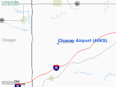
5 nautical miles N of Williamsburg, KS |
|
Location: |
Franklin County, KS |
|
Magnetic Variation: |
05E (1995) |
Owner & Manager
|
Ownership: |
Privately owned |
|
Owner: |
Timothy A. Chanay |
|
Address: |
738 Jackson Road
Pomona, KS 66076 |
|
Phone number: |
913-746-5496 |
|
Manager: |
Timothy A. Chanay |
|
Address: |
738 Jackson Road
Pomona, KS 66076 |
|
Phone number: |
913-746-5496 |
Airport
Operations and Facilities
|
Airport
Use: |
Private |
|
Segmented Circle: |
No |
|
Control
Tower: |
No |
|
Sectional chart: |
Kansas City |
|
Region: |
ACE - Central |
|
Boundary
ARTCC: |
ZKC - Kansas City |
|
Tie-in
FSS: |
ICT - Wichita |
|
FSS on
Airport: |
No |
|
FSS Toll
Free: |
1-800-WX-BRIEF |
|
Runway Information
Runway 01/19
|
Dimension: |
2400 x 80 ft / 731.5 x 24.4 m |
|
Surface: |
TURF, |
|
|
Runway 01
|
Runway 19
|
|
Traffic
Pattern: |
Left |
Left |
|
Obstruction: |
20 ft pline, 200.0 ft from runway |
20 ft pline, 40.0 ft from runway |
|
Radio Navigation Aids
|
ID |
Type |
Name |
Ch |
Freq |
Var |
Dist |
|
UKL |
NDB |
Boyd |
|
245.00 |
05E |
19.3 nm |
|
TO |
NDB |
Biloy |
|
521.00 |
05E |
36.6 nm |
|
MSB |
NDB |
Monarch |
|
410.00 |
04E |
45.0 nm |
|
GKB |
NDB |
Norge |
|
517.00 |
05E |
48.7 nm |
|
GQ |
NDB |
Norge |
|
517.00 |
05E |
48.7 nm |
|
FOE |
TACAN |
Forbes |
053X |
|
05E |
26.4 nm |
|
OJC |
VOR/DME |
Johnson County |
077X |
113.00 |
06E |
38.1 nm |
|
EMP |
VORTAC |
Emporia |
075X |
112.80 |
08E |
35.7 nm |
|
TOP |
VORTAC |
Topeka |
125X |
117.80 |
05E |
36.2 nm |
|
BUM |
VORTAC |
Butler |
106X |
115.90 |
07E |
48.1 nm |
|
FOE |
VOT |
Forbes |
|
111.00 |
|
26.7 nm |
Remarks
-
PROVIDED MAINTAIN
20:1 GLIDE SLOPE AND 7:1 TRANSITIONAL SURFACE.
Based Aircraft
|
Aircraft based
on field: |
1 |
|
Single Engine
Airplanes: |
1 |
Chanay Airport
Address:
Franklin County, KS
Tel:
913-746-5496
Images
and information placed above are from
http://www.airport-data.com/airport/40KS/
We
thank them for the data!
|
General Info |
| Country |
United
States |
| State |
KANSAS
|
| FAA ID |
40KS
|
| Latitude |
38-32-24.045N |
|
Longitude |
095-27-02.925W |
|
Elevation |
1110
feet |
| Near
City |
WILLIAMSBURG |
We don't guarantee the information is fresh and accurate. The data may
be wrong or outdated.
For more up-to-date information please refer to other sources.
|
|


