 |
|
|
|
|
|
Location &
QuickFacts
|
FAA
Information Effective: |
2007-07-05 |
|
Airport
Identifier: |
7IA2 |
|
Airport
Status: |
Operational |
|
Longitude/Latitude: |
096-24-21.1320W/43-27-04.9090N
-96.405870/43.451364 (Estimated) |
|
Elevation: |
1476 ft / 449.88 m (Surveyed) |
|
Land: |
10 acres |
|
From
nearest city: |
2 nautical miles E of Larchwood, IA |
|
Location: |
Lyon County, IA |
|
Magnetic Variation: |
06E (1985) |
Owner & Manager
|
Ownership: |
Privately owned |
|
Owner: |
Russell Zangger |
|
Address: |
1917 135th Street
Larchwood, IA 51241 |
|
Phone
number: |
712-477-2256 |
|
Manager: |
Russell Zangger |
|
Address: |
P.o. Box 47
Larchwood, IA 51241 |
|
Phone number: |
712-477-2256 |
Airport Operations and Facilities
|
Airport
Use: |
Private |
|
Wind
indicator: |
Yes |
|
Segmented Circle: |
No |
|
Control
Tower: |
No |
|
Lighting
Schedule: |
RDO-CTL
ACTVT LIRL RY 17/35 - 122.9. |
|
Landing fee charge: |
No |
|
Sectional chart: |
Omaha |
|
Region: |
ACE - Central |
|
Boundary ARTCC: |
ZMP - Minneapolis |
|
Tie-in FSS: |
FOD - Fort Dodge |
|
FSS on Airport: |
No |
|
FSS Phone: |
515-955-8114 |
|
FSS Toll Free: |
1-800-WX-BRIEF |
Airport Services
|
Airframe
Repair: |
NONE |
|
Power
Plant Repair: |
NONE |
|
Runway Information
Runway 12/30
|
Dimension: |
3500 x 100 ft / 1066.8 x 30.5 m |
|
Surface: |
TURF, |
|
|
Runway 12
|
Runway 30
|
|
Traffic
Pattern: |
Left |
Left |
|
Runway 17/35
|
Dimension: |
2315 x 22 ft / 705.6 x 6.7 m |
|
Surface: |
ASPH, Fair Condition |
|
Edge Lights: |
Low |
|
|
Runway 17
|
Runway 35
|
|
Traffic
Pattern: |
Left |
Left |
|
Obstruction: |
19 ft road, 291.0 ft from runway, 4:1 slope to clear |
, 50:1 slope to clear
+4' FENCE 40' FROM RWY END. |
|
Radio Navigation Aids
|
ID |
Type |
Name |
Ch |
Freq |
Var |
Dist |
|
FS |
NDB |
Rokky |
|
245.00 |
06E |
18.6 nm |
|
SOY |
NDB |
Sioux Center |
|
368.00 |
06E |
21.3 nm |
|
SHL |
NDB |
Sheldon |
|
338.00 |
05E |
28.8 nm |
|
ISB |
NDB |
Sibley |
|
269.00 |
05E |
29.0 nm |
|
ORC |
NDB |
Orange City |
|
521.00 |
05E |
31.5 nm |
|
MDS |
NDB |
Wentworth |
|
400.00 |
05E |
45.0 nm |
|
VMR |
NDB |
Vermillion |
|
375.00 |
06E |
47.4 nm |
|
PQN |
NDB/DME |
Pipestone |
028X |
284.00 |
06E |
32.5 nm |
|
DDL |
VOR/DME |
Sheldon |
023X |
108.60 |
05E |
28.8 nm |
|
OTG |
VOR/DME |
Worthington |
043X |
110.60 |
08E |
37.8 nm |
|
FSD |
VORTAC |
Sioux Falls |
097X |
115.00 |
09E |
20.2 nm |
Remarks
-
NO SNOW REMOVAL.
DURING WINTER CALL 712-477-2256 FOR FIELD CONDITIONS.
-
ULTRALIGHT
ACTIVITY ON AND INVOF ARPT.
-
PROVIDED APPROACH
TO EACH RWY IS MAINTAINED FOR A MINIMUM 20:1 GLIDE SLOPE & THE AIRPORT
TRANSITIONAL SURFACE BE MAINTAINED FOR A 7:1 SLOPE.
Based
Aircraft
|
Aircraft based
on field: |
19 |
|
Single Engine
Airplanes: |
18 |
|
Ultralights: |
1 |
Operational Statistics
Time Period:
1992-06-22 -
1993-06-21
|
Aircraft
Operations: |
16/Week |
|
General
Aviation Local: |
50.0% |
|
General
Aviation Itinerant: |
50.0% |
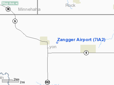
Zangger Airport
Address:
Lyon County, IA
Tel:
712-477-2256
Images
and information placed above are from
http://www.airport-data.com/airport/7IA2/
We
thank them for the data!
|
General Info |
| Country |
United
States |
| State |
IOWA
|
| FAA ID |
7IA2
|
| Latitude |
43-27-04.909N |
|
Longitude |
096-24-21.132W |
|
Elevation |
1476
feet |
| Near
City |
LARCHWOOD |
We don't guarantee the information is fresh and accurate. The data may
be wrong or outdated.
For more up-to-date information please refer to other sources.
|
|


