 |
|
Woodbine Municipal Airport |
| Woodbine Municipal Airport |
| IATA: none – ICAO: none – FAA LID: 3Y4 |
| Summary |
| Airport type |
Public |
| Owner |
City of Woodbine |
| Serves |
Woodbine, Iowa |
| Elevation AMSL |
1,068 ft / 326 m |
| Coordinates |
41°44′10″N 095°41′01″W / 41.73611°N 95.68361°W / 41.73611; -95.68361 |
| Runways |
| Direction |
Length |
Surface |
| ft |
m |
| 17/35 |
2,045 |
623 |
Turf |
| Statistics (2007) |
| Aircraft operations |
560 |
| Source: Federal Aviation Administration |
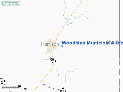
Woodbine Municipal Airport (FAA LID: 3Y4) is a city-owned public-use airport located one nautical mile (2 km) east of the central business district of Woodbine, a city in Harrison County, Iowa, United States.
Facilities and aircraft
Woodbine Municipal Airport covers an area of 20 acres (8 ha) at an elevation of 1,068 feet (326 m) above mean sea level. It has one runway designated 17/35 with a 2,045 by 95 feet (623 x 29 m) turf surface. For the 12-month period ending September 17, 2007, the airport had 560 aircraft operations, an average of 46 per month, all of which were general aviation.
The above content comes from Wikipedia and is published under free licenses – click here to read more.
Location &
QuickFacts
|
FAA
Information Effective: |
2007-07-05 |
|
Airport
Identifier: |
3Y4 |
|
Airport
Status: |
Operational |
|
Longitude/Latitude: |
095-41-01.0220W/41-44-09.9580N
-95.683617/41.736099 (Estimated) |
|
Elevation: |
1068 ft / 325.53 m (Surveyed) |
|
Land: |
20 acres |
|
From
nearest city: |
1 nautical miles E of Woodbine, IA |
|
Location: |
Harrison County, IA |
|
Magnetic Variation: |
05E (1985) |
Owner & Manager
|
Ownership: |
Publicly owned |
|
Owner: |
City Of Woodbine |
|
Address: |
517 Walker St
Woodbine, IA 51579 |
|
Phone number: |
712-647-2550 |
|
Manager: |
Dencil Hammack |
|
Address: |
901 Park Street
Woodbine, IA 51579-1032 |
|
Phone number: |
712-647-2430 |
Airport
Operations and Facilities
|
Airport
Use: |
Open to public |
|
Wind
indicator: |
Yes |
|
Segmented Circle: |
No |
|
Control
Tower: |
No |
|
Lighting
Schedule: |
DUSK-DAWN |
|
Landing
fee charge: |
No |
|
Sectional chart: |
Omaha |
|
Region: |
ACE - Central |
|
Boundary
ARTCC: |
ZMP - Minneapolis |
|
Tie-in
FSS: |
FOD - Fort Dodge |
|
FSS on
Airport: |
No |
|
FSS
Phone: |
515-955-8114 |
|
FSS Toll
Free: |
1-800-WX-BRIEF |
|
NOTAMs
Facility: |
FOD (NOTAM-d service avaliable) |
Airport Communications
Airport Services
|
Airframe
Repair: |
NONE |
|
Power
Plant Repair: |
NONE |
|
Runway Information
Runway 17/35
|
Dimension: |
2045 x 95 ft / 623.3 x 29.0 m |
|
Surface: |
TURF, Good Condition |
|
Edge Lights: |
Low |
|
|
Runway 17
|
Runway 35
|
|
Traffic
Pattern: |
Left |
Left |
|
Displaced
threshold: |
455.00 ft |
545.00 ft |
|
Obstruction: |
89 ft trees, 1330.0 ft from runway, 110 ft right of
centerline, 14:1 slope to clear
APCH SLOPE 20:1 TO DSPLCD THLD. |
102 ft tree, 1520.0 ft from runway, 45 ft right of
centerline, 14:1 slope to clear
APCH SLOPE 20:1 TO DSPLCD THLD. |
|
Radio Navigation Aids
|
ID |
Type |
Name |
Ch |
Freq |
Var |
Dist |
|
HNR |
NDB |
Harlan |
|
272.00 |
05E |
18.1 nm |
|
DNS |
NDB |
Denison |
|
350.00 |
04E |
20.2 nm |
|
OM |
NDB |
Gerfi |
|
320.00 |
05E |
25.4 nm |
|
MEY |
NDB |
Mapleton |
|
335.00 |
05E |
27.2 nm |
|
ADU |
NDB |
Audubon |
|
266.00 |
04E |
34.8 nm |
|
AIO |
NDB |
Atlantic |
|
365.00 |
04E |
34.9 nm |
|
MLE |
NDB |
Millard |
|
371.00 |
06E |
37.9 nm |
|
FET |
NDB |
Fremont |
|
311.00 |
06E |
41.3 nm |
|
CIN |
NDB |
Carroll |
|
397.00 |
04E |
44.3 nm |
|
SU |
NDB |
Salix |
|
414.00 |
07E |
44.7 nm |
|
RDK |
NDB |
Red Oak |
|
230.00 |
04E |
47.4 nm |
|
PMV |
NDB |
Plattsmouth |
|
329.00 |
06E |
48.7 nm |
|
SKI |
NDB |
Sac City |
|
356.00 |
04E |
49.8 nm |
|
OFF |
TACAN |
Offutt |
054X |
|
05E |
38.5 nm |
|
TQE |
VOR |
Tekamah |
|
108.40 |
07E |
22.2 nm |
|
SCB |
VOR/DME |
Scribner |
47X |
111.00 |
06E |
43.2 nm |
|
OVR |
VORTAC |
Omaha |
110X |
116.30 |
08E |
34.3 nm |
|
SUX |
VORTAC |
Sioux City |
112X |
116.50 |
09E |
46.4 nm |
|
OMA |
VOT |
Omaha |
|
109.00 |
|
28.0 nm |
Remarks
-
PLINE 90' EAST OF
CNTRLN.
-
20' LGT POLES
EAST EDGE OF HANGERS.
-
EXISTED PRIOR TO 1959.
Based Aircraft
|
Aircraft based
on field: |
2 |
|
Single Engine
Airplanes: |
2 |
Operational Statistics
Time Period:
2004-11-10 -
2005-11-09
|
Aircraft
Operations: |
11/Week |
|
General
Aviation Itinerant: |
100.0% |
Woodbine Municipal Airport
Address:
Harrison County, IA
Tel:
712-647-2550, 712-647-2430
Images
and information placed above are from
http://www.airport-data.com/airport/3Y4/
We
thank them for the data!
|
General Info |
| Country |
United
States |
| State |
IOWA
|
| FAA ID |
3Y4
|
| Latitude |
41-44-09.958N |
|
Longitude |
095-41-01.022W |
|
Elevation |
1068
feet |
| Near
City |
WOODBINE
|
We don't guarantee the information is fresh and accurate. The data may
be wrong or outdated.
For more up-to-date information please refer to other sources.
|
|


