 |
|
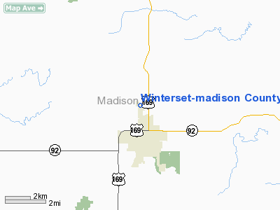
Winterset - Madison County Airport |
|
|
Location &
QuickFacts
|
FAA
Information Effective: |
2007-07-05 |
|
Airport
Identifier: |
3Y3 |
|
Airport
Status: |
Operational |
|
Longitude/Latitude: |
094-01-15.8230W/41-21-45.9640N
-94.021062/41.362768 (Estimated) |
|
Elevation: |
1110 ft / 338.33 m (Estimated) |
|
Land: |
33 acres |
|
From
nearest city: |
2 nautical miles N of Winterset, IA |
|
Location: |
Madison County, IA |
|
Magnetic Variation: |
04E (1985) |
Owner & Manager
|
Ownership: |
Publicly owned |
|
Owner: |
Wntrset Arpt Auth
WYMAN WILSON - CHAIRMAN, ARPT AUTHORITY. |
|
Address: |
3405 North 8th Avenue
Winterset, IA 50273 |
|
Phone
number: |
515-462-3337 |
|
Manager: |
Wntrset Arpt Auth |
|
Address: |
3405 North 8th Ave
Winterset, IA 50273 |
|
Phone number: |
515-462-1811 |
Airport Operations and Facilities
|
Airport
Use: |
Open to public |
|
Wind
indicator: |
Yes |
|
Segmented Circle: |
No |
|
Control
Tower: |
No |
|
Lighting
Schedule: |
DUSK-DAWN
ROTG BCN OTS INDEFLY. |
|
Beacon
Color: |
Clear-Green (lighted land airport) |
|
Landing
fee charge: |
No |
|
Sectional chart: |
Omaha |
|
Region: |
ACE - Central |
|
Traffic
Pattern Alt: |
800 ft |
|
Boundary
ARTCC: |
ZMP - Minneapolis |
|
Tie-in
FSS: |
FOD - Fort Dodge |
|
FSS on
Airport: |
No |
|
FSS
Phone: |
515-955-8114 |
|
FSS Toll
Free: |
1-800-WX-BRIEF |
|
NOTAMs
Facility: |
FOD (NOTAM-d service avaliable) |
|
Federal Agreements: |
N |
Airport Communications
|
CTAF: |
122.700 |
|
Unicom: |
122.700 |
Airport Services
|
Fuel
available: |
100LL |
|
Airframe
Repair: |
MAJOR |
|
Power
Plant Repair: |
MAJOR |
|
Bottled
Oxygen: |
NONE |
|
Bulk
Oxygen: |
NONE |
|
Runway Information
Runway 14/32
|
Dimension: |
3000 x 50 ft / 914.4 x 15.2 m |
|
Surface: |
ASPH, Good Condition |
|
Edge Lights: |
Medium |
|
|
Runway 14
|
Runway 32
|
|
Longitude: |
094-01-27.9800W |
094-01-03.6600W |
|
Latitude: |
41-21-59.1100N |
41-21-35.8100N |
|
Elevation: |
1110.00 ft |
1093.00 ft |
|
Alignment: |
127 |
127 |
|
Traffic
Pattern: |
Left |
Left |
|
Markings: |
Non-precision instrument, Good Condition |
Non-precision instrument, Good Condition |
|
Displaced
threshold: |
175.00 ft |
0.00 ft |
|
Obstruction: |
31 ft tree, 620.0 ft from runway, 180 ft right of
centerline, 13:1 slope to clear
APCH SLOPE 25:1 FM DSPLCD THLD.
15 FT ROAD 140 FT FM RY END. |
15 ft trees, 603.0 ft from runway, 80 ft right of
centerline, 26:1 slope to clear |
|
Radio Navigation Aids
|
ID |
Type |
Name |
Ch |
Freq |
Var |
Dist |
|
GFZ |
NDB |
Greenfield |
|
338.00 |
04E |
19.2 nm |
|
GCT |
NDB |
Guthrie Center |
|
518.00 |
05E |
26.7 nm |
|
UNE |
NDB |
Union County |
|
379.00 |
04E |
28.5 nm |
|
PRO |
NDB |
Perry |
|
251.00 |
06E |
28.8 nm |
|
IKV |
NDB |
Ankeny |
|
275.00 |
03E |
28.8 nm |
|
CNC |
NDB |
Chariton |
|
335.00 |
05E |
36.4 nm |
|
CRZ |
NDB |
Corning |
|
278.00 |
04E |
39.9 nm |
|
OXV |
NDB |
Knoxville |
|
284.00 |
03E |
41.1 nm |
|
EFW |
NDB |
Jefferson |
|
391.00 |
03E |
41.7 nm |
|
BNW |
NDB |
Boone |
|
407.00 |
03E |
42.2 nm |
|
ADU |
NDB |
Audubon |
|
266.00 |
04E |
44.6 nm |
|
AIO |
NDB |
Atlantic |
|
365.00 |
04E |
46.3 nm |
|
PEA |
NDB |
Pella |
|
257.00 |
02E |
48.7 nm |
|
TNU |
VOR/DME |
Newton |
072X |
112.50 |
03E |
48.2 nm |
|
DSM |
VORTAC |
Des Moines |
122X |
117.50 |
07E |
17.4 nm |
|
LMN |
VORTAC |
Lamoni |
114X |
116.70 |
07E |
46.1 nm |
|
DSM |
VOT |
Des Moines |
|
109.20 |
|
18.9 nm |
Remarks
-
ULTRALIGHT & SKY
DIVING ACTIVITY ON & INVOF ARPT.
-
RY 32 END SAFETY
AREA EXTENDS ONLY 58'; SHARP DROP AT THAT POINT.
-
INADQT CLNC FOR
HLDG ON THE TURNAROUND AT THE THLD OF RY 32.
-
RY 32 IS CALM
WIND RY.
-
PRVDD NW END RWY
IS DSPLCD SUF DSTC TO PRVD 15' CLNC OVR E/W RD FOR A 20:1 APCH RATIO.
Based
Aircraft
|
Aircraft based
on field: |
22 |
|
Single Engine
Airplanes: |
21 |
|
Multi Engine
Airplanes: |
1 |
Operational Statistics
Time Period:
2004-09-30 -
2005-09-29
|
Aircraft
Operations: |
103/Week |
|
General
Aviation Local: |
48.3% |
|
General
Aviation Itinerant: |
51.7% |
Winterset-madison County Airport
Address:
Madison County, IA
Tel:
515-462-3337,
515-462-1811
Images
and information placed above are from
http://www.airport-data.com/airport/3Y3/
We
thank them for the data!
|
General Info |
| Country |
United
States |
| State |
IOWA
|
| FAA ID |
3Y3
|
| Latitude |
41-21-45.964N |
|
Longitude |
094-01-15.823W |
|
Elevation |
1110
feet |
| Near
City |
WINTERSET |
We don't guarantee the information is fresh and accurate. The data may
be wrong or outdated.
For more up-to-date information please refer to other sources.
|
|


