 |
|
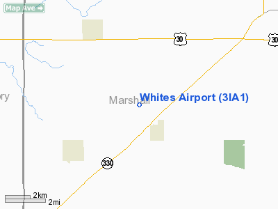
Location &
QuickFacts
|
FAA
Information Effective: |
2007-07-05 |
|
Airport
Identifier: |
3IA1 |
|
Airport
Status: |
Operational |
|
Longitude/Latitude: |
093-07-11.7260W/41-57-38.9570N
-93.119924/41.960821 (Estimated) |
|
Elevation: |
1050 ft / 320.04 m (Estimated) |
|
Land: |
0 acres |
|
From
nearest city: |
1 nautical miles NW of Melbourne, IA |
|
Location: |
Marshall County, IA |
|
Magnetic Variation: |
03E (1985) |
Owner & Manager
|
Ownership: |
Privately owned |
|
Owner: |
Ralph A. White |
|
Address: |
2705 Gerhart Ave
Melbourne, IA 50162 |
|
Phone number: |
515-482-3116 |
|
Manager: |
Ralph A. White |
|
Address: |
2705 Gerhart Ave
Melbourne, IA 50162 |
|
Phone number: |
515-482-3116 |
Airport Operations and Facilities
|
Airport Use: |
Private |
|
Wind indicator: |
Yes |
|
Segmented Circle: |
No |
|
Control Tower: |
No |
|
Landing fee charge: |
No |
|
Sectional chart: |
Omaha |
|
Region: |
ACE - Central |
|
Boundary ARTCC: |
ZAU - Chicago |
|
Tie-in FSS: |
FOD - Fort Dodge |
|
FSS on Airport: |
No |
|
FSS Phone: |
515-955-8114 |
|
FSS Toll Free: |
1-800-WX-BRIEF |
Airport Services
|
Runway Information
Runway 17/35
|
Dimension: |
2500 x 90 ft / 762.0 x 27.4 m |
|
Surface: |
TURF, |
|
|
Runway 17
|
Runway 35
|
|
Traffic
Pattern: |
Left |
Left |
|
Markings: |
Nonstandard, |
Nonstandard, |
|
Displaced
threshold: |
100.00 ft |
100.00 ft |
|
Obstruction: |
5 ft fence |
5 ft fence, 0.0 ft from runway |
|
Radio Navigation Aids
|
ID |
Type |
Name |
Ch |
Freq |
Var |
Dist |
|
MIW |
NDB |
Marshalltown |
|
239.00 |
03E |
12.7 nm |
|
GGI |
NDB |
Grinnell |
|
248.00 |
02E |
23.1 nm |
|
IKV |
NDB |
Ankeny |
|
275.00 |
03E |
25.4 nm |
|
IFA |
NDB |
Iowa Falls |
|
368.00 |
03E |
31.7 nm |
|
BNW |
NDB |
Boone |
|
407.00 |
03E |
33.2 nm |
|
PEA |
NDB |
Pella |
|
257.00 |
02E |
34.3 nm |
|
TZT |
NDB |
Belle Plaine |
|
371.00 |
02E |
37.7 nm |
|
OXV |
NDB |
Knoxville |
|
284.00 |
03E |
40.0 nm |
|
EBS |
NDB |
Webster City |
|
323.00 |
03E |
44.1 nm |
|
HPT |
NDB |
Hampton |
|
230.00 |
03E |
46.2 nm |
|
PRO |
NDB |
Perry |
|
251.00 |
06E |
47.2 nm |
|
TNU |
VOR/DME |
Newton |
072X |
112.50 |
03E |
10.7 nm |
|
JWJ |
VOR/DME |
Elmwood |
031X |
109.40 |
03E |
13.1 nm |
|
DSM |
VORTAC |
Des Moines |
122X |
117.50 |
07E |
39.4 nm |
|
ALO |
VORTAC |
Waterloo |
059X |
112.20 |
06E |
48.1 nm |
|
DSM |
VOT |
Des Moines |
|
109.20 |
|
35.5 nm |
Remarks
-
CONDL: PROVIDED
APPROACH TO EACH RWY IS MAINTAINED FOR A MIN 20:1 GLIDE SLOPE AND THE
TRANSITIONAL SURFACE BE MAINTAINED FOR A 7:1 SLOPE.
Based
Aircraft
|
Aircraft based
on field: |
2 |
|
Single Engine
Airplanes: |
2 |
Whites Airport
Address:
Marshall County, IA
Tel:
515-482-3116
Images
and information placed above are from
http://www.airport-data.com/airport/3IA1/
We
thank them for the data!
|
General Info |
| Country |
United
States |
| State |
IOWA
|
| FAA ID |
3IA1
|
| Latitude |
41-57-38.957N |
|
Longitude |
093-07-11.726W |
|
Elevation |
1050
feet |
| Near
City |
MELBOURNE |
We don't guarantee the information is fresh and accurate. The data may
be wrong or outdated.
For more up-to-date information please refer to other sources.
|
|


