 |
|
|
|
|
|
Location &
QuickFacts
|
FAA
Information Effective: |
2007-07-05 |
|
Airport
Identifier: |
Y01 |
|
Airport
Status: |
Operational |
|
Longitude/Latitude: |
091-28-10.3010W/43-16-49.7140N
-91.469528/43.280476 (Estimated) |
|
Elevation: |
1281 ft / 390.45 m (Surveyed) |
|
Land: |
48 acres |
|
From
nearest city: |
1 nautical miles NE of Waukon, IA |
|
Location: |
Allamakee County, IA |
|
Magnetic Variation: |
02E (1985) |
Owner & Manager
|
Ownership: |
Publicly owned |
|
Owner: |
City Of Waukon |
|
Address: |
101 Allamakee
Waukon, IA 52172 |
|
Phone
number: |
563-568-3491 |
|
Manager: |
Frank Byrnes
HOME PHONE 563-568-4356. |
|
Address: |
Byrnes Tv 9-11th St,nw
Waukon, IA 52172 |
|
Phone number: |
563-568-3644 |
Airport Operations and Facilities
|
Airport
Use: |
Open to public |
|
Wind
indicator: |
Yes |
|
Segmented Circle: |
No |
|
Control
Tower: |
No |
|
Lighting
Schedule: |
DUSK-DAWN
ACTVT LIRL RY 07/25 & REIL RY 07 - CTAF. |
|
Landing
fee charge: |
No |
|
Sectional chart: |
Chicago |
|
Region: |
ACE - Central |
|
Boundary
ARTCC: |
ZMP - Minneapolis |
|
Tie-in
FSS: |
FOD - Fort Dodge |
|
FSS on
Airport: |
No |
|
FSS
Phone: |
515-955-8114 |
|
FSS Toll
Free: |
1-800-WX-BRIEF |
|
NOTAMs
Facility: |
FOD (NOTAM-d service avaliable) |
Airport Communications
Airport Services
|
Fuel
available: |
100LL |
|
Airframe
Repair: |
NONE |
|
Power
Plant Repair: |
NONE |
|
Bottled
Oxygen: |
NONE |
|
Bulk
Oxygen: |
NONE |
|
Runway Information
Runway 07/25
|
Dimension: |
2413 x 60 ft / 735.5 x 18.3 m |
|
Surface: |
ASPH, Poor Condition
RY 07/25 RUTS & LOOSE ROCK. |
|
Edge Lights: |
Low |
|
|
Runway 07
|
Runway 25
|
|
Traffic
Pattern: |
Left |
Left |
|
Markings: |
Basic, Poor Condition
RY 07/25 MARKINGS FADED. |
Basic, Poor Condition |
|
Runway End
Identifier: |
Yes
OTS INDEFLY. |
|
|
Obstruction: |
26 ft sign, 617.0 ft from runway, 28 ft right of
centerline, 16:1 slope to clear |
4 ft fence, 375.0 ft from runway, 43:1 slope to clear |
|
Radio Navigation Aids
|
ID |
Type |
Name |
Ch |
Freq |
Var |
Dist |
|
DEH |
NDB |
Decorah |
|
236.00 |
01E |
11.7 nm |
|
CHU |
NDB |
Caledonia |
|
209.00 |
03E |
18.4 nm |
|
XWY |
NDB |
West Union |
|
278.00 |
02E |
24.5 nm |
|
CJJ |
NDB |
Cresco |
|
293.00 |
02E |
29.4 nm |
|
OLZ |
NDB |
Oelwein |
|
260.00 |
02E |
42.2 nm |
|
LSE |
VOR/DME |
La Crosse |
021X |
108.40 |
02E |
37.0 nm |
|
ONA |
VOR/DME |
Winona |
051X |
111.40 |
01E |
48.9 nm |
|
UKN |
VORTAC |
Waukon |
113X |
116.60 |
05E |
3.0 nm |
|
ODI |
VORTAC |
Nodine |
126X |
117.90 |
01E |
38.0 nm |
Remarks
-
RY 07 HAS A +15
FT ROAD AT 120 FT 135 FT R.
Based
Aircraft
|
Aircraft based
on field: |
4 |
|
Single Engine
Airplanes: |
4 |
Operational Statistics
Time Period:
2004-08-19 -
2005-08-18
|
Aircraft
Operations: |
39/Week |
|
General
Aviation Local: |
75.0% |
|
General
Aviation Itinerant: |
25.0% |
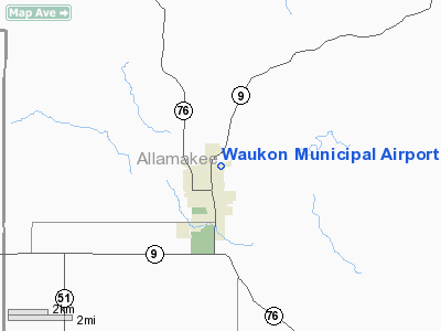
Waukon Municipal Airport
Address:
Allamakee County, IA
Tel:
563-568-3491,
563-568-3644
Images
and information placed above are from
http://www.airport-data.com/airport/Y01/
We
thank them for the data!
|
General Info |
| Country |
United
States |
| State |
IOWA
|
| FAA ID |
Y01
|
| Latitude |
43-16-49.714N |
|
Longitude |
091-28-10.301W |
|
Elevation |
1281
feet |
| Near
City |
WAUKON
|
We don't guarantee the information is fresh and accurate. The data may
be wrong or outdated.
For more up-to-date information please refer to other sources.
|
|


