 |
|
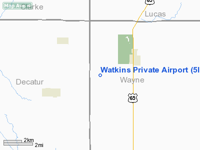
Location &
QuickFacts
|
FAA
Information Effective: |
2007-07-05 |
|
Airport
Identifier: |
5IA3 |
|
Airport
Status: |
Operational |
|
Longitude/Latitude: |
093-32-33.7770W/40-50-38.0100N
-93.542716/40.843892 (Estimated) |
|
Elevation: |
1095 ft / 333.76 m (Surveyed) |
|
Land: |
90 acres |
|
From
nearest city: |
3 nautical miles SW of Humeston, IA |
|
Location: |
Wayne County, IA |
|
Magnetic Variation: |
04E (1985) |
Owner & Manager
|
Ownership: |
Privately owned |
|
Owner: |
Tom Watkins |
|
Address: |
Rr2 Box 80
Humeston, IA 50123 |
|
Phone number: |
515-877-6471 |
|
Address: |
|
Airport
Operations and Facilities
|
Airport
Use: |
Private |
|
Wind
indicator: |
Yes |
|
Segmented Circle: |
No |
|
Control
Tower: |
No |
|
Sectional chart: |
Omaha |
|
Region: |
ACE - Central |
|
Boundary
ARTCC: |
ZAU - Chicago |
|
Tie-in
FSS: |
FOD - Fort Dodge |
|
FSS
Phone: |
515-955-8114 |
|
FSS Toll
Free: |
1-800-WX-BRIEF |
|
Runway Information
Runway 14/32
|
Dimension: |
1870 x 66 ft / 570.0 x 20.1 m |
|
Surface: |
TURF, |
|
|
Runway 14
|
Runway 32
|
|
Traffic
Pattern: |
Left |
Left |
|
Displaced
threshold: |
80.00 ft |
250.00 ft |
|
Obstruction: |
4 ft fence |
4 ft fence, 0.0 ft from runway |
|
Radio Navigation Aids
|
ID |
Type |
Name |
Ch |
Freq |
Var |
Dist |
|
CNC |
NDB |
Chariton |
|
335.00 |
05E |
13.2 nm |
|
TVK |
NDB |
Centerville |
|
290.00 |
04E |
30.7 nm |
|
OXV |
NDB |
Knoxville |
|
284.00 |
03E |
33.4 nm |
|
UNE |
NDB |
Union County |
|
379.00 |
04E |
37.2 nm |
|
PEA |
NDB |
Pella |
|
257.00 |
02E |
43.3 nm |
|
TRX |
NDB |
Trenton |
|
400.00 |
03E |
46.0 nm |
|
LMN |
VORTAC |
Lamoni |
114X |
116.70 |
07E |
24.4 nm |
|
DSM |
VORTAC |
Des Moines |
122X |
117.50 |
07E |
36.0 nm |
|
DSM |
VOT |
Des Moines |
|
109.20 |
|
42.2 nm |
Remarks
-
PROVIDED APCH TO
EACH RUNWAY MAONTAINED FOR A MINIMUM 20:1 GLIDE SLOPE AND TRANSITIONAL SURFACE
MAINTAINED FOR A 7:1 SLOPE.
Watkins Private Airport
Address:
Wayne County, IA
Tel:
515-877-6471
Images
and information placed above are from
http://www.airport-data.com/airport/5IA3/
We
thank them for the data!
|
General Info |
| Country |
United
States |
| State |
IOWA
|
| FAA ID |
5IA3
|
| Latitude |
40-50-38.010N |
|
Longitude |
093-32-33.777W |
|
Elevation |
1095
feet |
| Near
City |
HUMESTON
|
We don't guarantee the information is fresh and accurate. The data may
be wrong or outdated.
For more up-to-date information please refer to other sources.
|
|


