 |
|
Waterloo Regional Airport |
| Waterloo Regional Airport |
 |
| IATA: ALO â ICAO: KALO â FAA LID: ALO
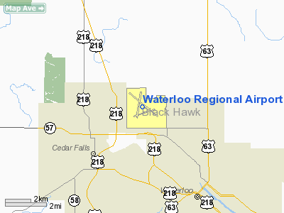
Location of Waterloo Regional Airport
|
| Summary |
| Airport type |
Public |
| Operator |
City of Waterloo |
| Serves |
Waterloo, Iowa |
| Elevation AMSL |
873 ft / 266 m |
| Coordinates |
42°33â²25â³N 092°24â²01â³W / 42.55694°N 92.40028°W / 42.55694; -92.40028 |
| Website |
www.FlyALO.com |
| Runways |
| Direction |
Length |
Surface |
| ft |
m |
| 12/30 |
8,400 |
2,560 |
Asphalt |
| 18/36 |
6,002 |
1,829 |
Asphalt |
| 6/24 |
5,403 |
1,647 |
Asphalt |
| Statistics (2006) |
| Aircraft operations |
46,833 |
| Based aircraft |
94 |
| Source: Federal Aviation Administration |
FAA airport diagram Waterloo Regional Airport (IATA: ALO, ICAO: KALO, FAA LID: ALO) is a city-owned public-use airport located four miles (6 km) northwest of the central business district of Waterloo, a city in Black Hawk County, Iowa, United States. It is mostly used for general aviation but is also served by one commercial airline. Overview
The Waterloo Regional Airport is a small regional airport with limited facilities with two gates and one jetbridge. Delta Airlines (formerly Northwest) has been the airport's only carrier for several years and offers three regularly scheduled daily flights to Minneapolis-Saint Paul. Delta Connection operates two daily flights utilizing a Saab-Fairchild 340 turboprop and one flight per day on a Canadiar Regional Jet.
Numerous carriers once operated at ALO during the 1980s and 1990s, including American Eagle, United Express, Transworld Express, Midway Connection, and Air Midwest (dba Eastern Express). In the 1960s and 1970s airlines such as Ozark and Braniff also served Waterloo, and there were many flights to Minneapolis, Chicago, Denver, and St. Louis. Competition from nearby airports, especially The Eastern Iowa airport in Cedar Rapids, forced these carriers to eventually drop service from Waterloo Regional. Northwest Airlines attempted mainline jet service from Waterloo using DC-9s, but the number of passengers was insufficient to maintain profitability.
Incidents
Northwest Flight 335 landed without incident at the Waterloo Regional Airport on June 2, 2009, about an hour into its flight from Detroit to Los Angeles with 182 passengers and a flight crew of eight. No injuries were reported. The flight crew diverted the aircraft to Waterloo as a precaution after reporting a "smoky odor" in the cabin.
Northwest flew mechanics to Waterloo to inspect the Boeing 757 and arranged for an extra flight for the stranded passengers [1].
Facilities and aircraft
Waterloo Regional Airport covers an area of 2,583 acres (1,045 ha) which contains three asphalt paved runways: 12/30 measuring 8,400 x 150 ft (2,560 x 46 m), 18/36 measuring 6,002 x 150 ft (1,829 x 46 m) and 6/24 measuring 5,403 x 129 ft (1,647 x 39 m).
For the 12-month period ending October 31, 2006, the airport had 46,833 aircraft operations, an average of 128 per day: 66% general aviation, 13% military, 11% scheduled commercial and 10% air taxi. At that time there were 94 aircraft based at this airport: 79% single-engine, 9% multi-engine, 3% jet and 10% military.
Airlines and destinations
| Airlines |
Destinations |
| Delta Connection operated by Mesaba Airlines |
Minneapolis/St. Paul |
| Delta Connection operated by Pinnacle Airlines |
Minneapolis/St. Paul |
The above content comes from Wikipedia and is published under free licenses – click here to read more.
Location &
QuickFacts
|
FAA
Information Effective: |
2007-07-05 |
|
Airport
Identifier: |
ALO |
|
Airport
Status: |
Operational |
|
Longitude/Latitude: |
092-24-01.2370W/42-33-25.4930N
-92.400344/42.557081 (Estimated) |
|
Elevation: |
873 ft / 266.09 m (Surveyed) |
|
Land: |
2583 acres |
|
From
nearest city: |
4 nautical miles NW of Waterloo, IA |
|
Location: |
Black Hawk County, IA |
|
Magnetic Variation: |
03E (1985) |
Owner & Manager
|
Ownership: |
Publicly owned |
|
Owner: |
City Of Waterloo |
|
Address: |
715 Mulberry
Waterloo, IA 50701 |
|
Phone
number: |
319-291-4323 |
|
Manager: |
Mr. Bradley A. Hagen, A.a.e. |
|
Address: |
2790 Airport Blvd
Waterloo, IA 50704 |
|
Phone number: |
319-291-4483 |
Airport
Operations and Facilities
|
Airport
Use: |
Open to public |
|
Wind
indicator: |
Yes |
|
Segmented Circle: |
No |
|
Control
Tower: |
Yes |
|
Lighting
Schedule: |
DUSK-DAWN
WHEN ATCT CLSD ACTVT MIRL RY 18/36 & HIRL RY 12/30; MALSR RY 12; MALS
RY 30 VASI RYS 06; 24; 18 & 36 - CTAF. |
|
Beacon
Color: |
Clear-Green (lighted land airport) |
|
Landing
fee charge: |
No |
|
Sectional chart: |
Chicago |
|
Region: |
ACE - Central |
|
Boundary
ARTCC: |
ZAU - Chicago |
|
Tie-in
FSS: |
FOD - Fort Dodge |
|
FSS on
Airport: |
No |
|
FSS
Phone: |
515-955-8114 |
|
FSS Toll
Free: |
1-800-WX-BRIEF |
|
NOTAMs
Facility: |
ALO (NOTAM-d service avaliable) |
|
Certification type/date: |
I A S 05/1973
CLSD TO UNSKED ACR OPNS WITH MORE THAN 30 PSGR SEATS 2300-0600 EXCP 72
HRS PPR AMGR. CALL AMGR 319-291-4483. ARFF INDEX B PROVIDED. ARFF
INDEX C AVBL ON 72 HRS REQ. |
|
Federal Agreements: |
NGY3 |
Airport Communications
|
CTAF: |
125.075 |
|
Unicom: |
122.950 |
Airport Services
|
Fuel
available: |
100LLA
FUEL AVBL ON REQ 2200-0500.
FEE FOR
SVCS. |
|
Airframe
Repair: |
MAJOR |
|
Power
Plant Repair: |
MAJOR |
|
Bottled
Oxygen: |
HIGH/LOW |
|
Bulk
Oxygen: |
HIGH/LOW |
|
Runway Information
Runway 06/24
|
Dimension: |
5403 x 129 ft / 1646.8 x 39.3 m |
|
Surface: |
ASPH, Fair Condition |
|
Surface
Treatment: |
Saw-cut or plastic Grooved |
|
Weight Limit: |
Single wheel: 29500 lbs.
Dual wheel: 37000 lbs. |
|
Edge Lights: |
Medium |
|
|
Runway 06
|
Runway 24
|
|
Longitude: |
092-24-28.0210W |
092-23-21.1870W |
|
Latitude: |
42-33-02.2920N |
42-33-22.4640N |
|
Elevation: |
868.00 ft |
866.00 ft |
|
Alignment: |
68 |
127 |
|
Traffic
Pattern: |
Left |
Left |
|
Markings: |
Non-precision instrument, Good Condition |
Non-precision instrument, Good Condition |
|
Crossing
Height: |
47.00 ft |
52.00 ft |
|
VASI: |
4-box on left side |
4-box on left side |
|
Visual
Glide Angle: |
3.00° |
3.00° |
|
Runway End
Identifier: |
Yes |
Yes |
|
Obstruction: |
57 ft tree, 2250.0 ft from runway, 500 ft left of
centerline, 35:1 slope to clear |
58 ft tree, 2200.0 ft from runway, 100 ft right of
centerline, 34:1 slope to clear |
|
Runway 12/30
|
Dimension: |
8400 x 150 ft / 2560.3 x 45.7 m |
|
Surface: |
ASPH, |
|
Surface
Treatment: |
Saw-cut or plastic Grooved |
|
Weight Limit: |
Single wheel: 55000 lbs.
Dual wheel: 75000 lbs.
Dual tandem wheel: 140000 lbs. |
|
Edge Lights: |
High |
|
|
Runway 12
|
Runway 30
|
|
Longitude: |
092-24-43.0650W |
092-23-14.3630W |
|
Latitude: |
42-33-57.7290N |
42-33-06.8890N |
|
Elevation: |
873.00 ft |
867.00 ft |
|
Alignment: |
127 |
127 |
|
ILS Type: |
ILS |
|
|
Traffic
Pattern: |
Left |
Left |
|
Markings: |
Precision instrument, Good Condition |
Non-precision instrument, Good Condition |
|
Crossing
Height: |
57.00 ft |
52.00 ft |
|
VASI: |
4-light PAPI on left side |
4-box on left side |
|
Visual
Glide Angle: |
3.00° |
3.00° |
|
RVR
Equipment: |
touchdown |
|
|
Approach
lights: |
MALSR |
MALS |
|
Obstruction: |
107 ft tree, 5200.0 ft from runway, 1000 ft left of
centerline, 46:1 slope to clear |
, 50:1 slope to clear |
|
Runway 18/36
|
Dimension: |
6002 x 150 ft / 1829.4 x 45.7 m |
|
Surface: |
ASPH, Fair Condition |
|
Surface
Treatment: |
Saw-cut or plastic Grooved |
|
Weight Limit: |
Single wheel: 50000 lbs.
Dual wheel: 75000 lbs. |
|
Edge Lights: |
Medium |
|
|
Runway 18
|
Runway 36
|
|
Longitude: |
092-24-05.3140W |
092-24-16.1760W |
|
Latitude: |
42-33-57.1260N |
42-32-58.3860N |
|
Elevation: |
870.00 ft |
867.00 ft |
|
Alignment: |
127 |
8 |
|
Traffic
Pattern: |
Left |
Left |
|
Markings: |
Non-precision instrument, Fair Condition |
Non-precision instrument, Fair Condition |
|
Crossing
Height: |
42.00 ft |
40.00 ft |
|
VASI: |
4-box on left side |
4-box on left side |
|
Visual
Glide Angle: |
3.00° |
3.00° |
|
Runway End
Identifier: |
Yes |
Yes |
|
Obstruction: |
75 ft tree, 1875.0 ft from runway, 450 ft left of
centerline, 22:1 slope to clear |
50 ft tree, 2300.0 ft from runway, 250 ft left of
centerline, 42:1 slope to clear |
|
Radio Navigation Aids
|
ID |
Type |
Name |
Ch |
Freq |
Var |
Dist |
|
OLZ |
NDB |
Oelwein |
|
260.00 |
02E |
20.3 nm |
|
IIB |
NDB |
Wapsie |
|
206.00 |
02E |
20.9 nm |
|
VTI |
NDB |
Garrison |
|
338.00 |
03E |
26.3 nm |
|
CCY |
NDB |
Charles City |
|
375.00 |
03E |
32.1 nm |
|
MIW |
NDB |
Marshalltown |
|
239.00 |
03E |
35.3 nm |
|
XWY |
NDB |
West Union |
|
278.00 |
02E |
35.8 nm |
|
IY |
NDB |
Chukk |
|
417.00 |
03E |
37.6 nm |
|
HPT |
NDB |
Hampton |
|
230.00 |
03E |
37.8 nm |
|
IFA |
NDB |
Iowa Falls |
|
368.00 |
03E |
38.6 nm |
|
TZT |
NDB |
Belle Plaine |
|
371.00 |
02E |
40.7 nm |
|
JWJ |
VOR/DME |
Elmwood |
031X |
109.40 |
03E |
35.0 nm |
|
CID |
VOR/DME |
Cedar Rapids |
088X |
114.10 |
05E |
48.7 nm |
Remarks
-
RYS 06/24 LGTG
UNAVBL DURG HRS ATCT CLSD.
-
BIRDS ON & INVOF ARPT.
-
RY 30 IS CALM
WIND RY.
-
FM ATCT TWY 'C'
NOT VISIBLE AT TWY 'C' & RY 18 INTERSECTION.
-
WHEN DEPARTING
ALL RYS, ENDS OF OTHER RYS NOT VISIBLE.
-
WHEN ATCT CLSD &
DURG SNOW EVENTS, ALL ARR/DEP ACFT ANNOUNCE THEIR INTENTIONS ON CTAF 5 MIN
PRIOR TO USING THE RYS.
-
PERSONNEL & EQUP
PERFORMING SNOW REMOVAL OPNS WILL MONITOR CTAF.
Based
Aircraft
|
Aircraft based
on field: |
94 |
|
Single Engine
Airplanes: |
74 |
|
Multi Engine
Airplanes: |
8 |
|
Jet Engine
Airplanes: |
3 |
|
Military: |
9 |
Operational Statistics
Time Period:
2005-11-01 -
2006-10-31
|
Aircraft
Operations: |
129/Day |
|
Commerical: |
11.4% |
|
Air Taxi: |
9.7% |
|
General
Aviation Local: |
23.9% |
|
General
Aviation Itinerant: |
42.2% |
|
Military: |
12.7% |
Waterloo Regional Airport
Address:
Black Hawk County, IA
Tel:
319-291-4323,
319-291-4483
Images
and information placed above are from
http://www.airport-data.com/airport/ALO/
We
thank them for the data!
|
General Info |
| Country |
United
States |
| State |
IOWA
|
| FAA ID |
ALO
|
| Latitude |
42-33-25.493N |
|
Longitude |
092-24-01.237W |
|
Elevation |
873 feet
|
| Near
City |
WATERLOO
|
We don't guarantee the information is fresh and accurate. The data may
be wrong or outdated.
For more up-to-date information please refer to other sources.
|
|


