 |
|
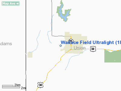
Location &
QuickFacts
|
FAA
Information Effective: |
2007-07-05 |
|
Airport
Identifier: |
1IA4 |
|
Airport
Status: |
Operational |
|
Longitude/Latitude: |
094-23-40.8550W/41-03-19.9600N
-94.394682/41.055544 (Estimated) |
|
Elevation: |
1290 ft / 393.19 m (Estimated) |
|
Land: |
2 acres |
|
From
nearest city: |
4 nautical miles W of Creston, IA |
|
Location: |
Union County, IA |
|
Magnetic Variation: |
05E (1985) |
Owner & Manager
|
Ownership: |
Privately owned |
|
Owner: |
Joe E. Wallace |
|
Address: |
2400 Hwy 25
Creston, IA 50801 |
|
Phone number: |
515-782-8190 |
|
Manager: |
Joe E. Wallace |
|
Address: |
2400 Hwy 25
Creston, IA 50801 |
|
Phone number: |
515-782-8190 |
Airport Operations and Facilities
|
Airport Use: |
Private |
|
Wind indicator: |
Yes |
|
Segmented Circle: |
No |
|
Control Tower: |
No |
|
Sectional chart: |
Omaha |
|
Region: |
ACE - Central |
|
Boundary ARTCC: |
ZMP - Minneapolis |
|
Tie-in FSS: |
FOD - Fort Dodge |
|
FSS on Airport: |
No |
|
FSS Phone: |
515-955-8114 |
|
FSS Toll Free: |
1-800-WX-BRIEF |
Airport Services
|
Runway Information
Runway 18/36
|
Dimension: |
1000 x 60 ft / 304.8 x 18.3 m |
|
Surface: |
TURF, |
|
|
Runway 18
|
Runway 36
|
|
Traffic
Pattern: |
Left |
Left |
|
Obstruction: |
35 ft plines, 300.0 ft from runway |
|
|
Radio Navigation Aids
|
ID |
Type |
Name |
Ch |
Freq |
Var |
Dist |
|
UNE |
NDB |
Union County |
|
379.00 |
04E |
6.3 nm |
|
GFZ |
NDB |
Greenfield |
|
338.00 |
04E |
16.4 nm |
|
CRZ |
NDB |
Corning |
|
278.00 |
04E |
16.8 nm |
|
ICL |
NDB |
Clarinda |
|
353.00 |
04E |
34.9 nm |
|
AIO |
NDB |
Atlantic |
|
365.00 |
04E |
36.1 nm |
|
GCT |
NDB |
Guthrie Center |
|
518.00 |
05E |
37.7 nm |
|
RDK |
NDB |
Red Oak |
|
230.00 |
04E |
39.0 nm |
|
ADU |
NDB |
Audubon |
|
266.00 |
04E |
44.7 nm |
|
CNC |
NDB |
Chariton |
|
335.00 |
05E |
46.9 nm |
|
PRO |
NDB |
Perry |
|
251.00 |
06E |
47.8 nm |
|
EVU |
NDB |
Emville |
|
317.00 |
05E |
48.7 nm |
|
SDA |
NDB |
Shenandoah |
|
411.00 |
05E |
49.5 nm |
|
LMN |
VORTAC |
Lamoni |
114X |
116.70 |
07E |
33.7 nm |
|
DSM |
VORTAC |
Des Moines |
122X |
117.50 |
07E |
40.8 nm |
|
DSM |
VOT |
Des Moines |
|
109.20 |
|
43.6 nm |
Remarks
-
PRVDD APCH TO EA
RWY MAINTAINED FOR A 20:1 GLIDE SLOPE AND TRANSITIONAL SFC FOR A 7:1 SLOPE.
Based
Aircraft
|
Aircraft based
on field: |
1 |
|
Ultralights: |
1 |
Wallace Field Ultralight
Address:
Union County, IA
Tel:
515-782-8190
Images
and information placed above are from
http://www.airport-data.com/airport/1IA4/
We
thank them for the data!
|
General Info |
| Country |
United
States |
| State |
IOWA
|
| FAA ID |
1IA4
|
| Latitude |
41-03-19.960N |
|
Longitude |
094-23-40.855W |
|
Elevation |
1290
feet |
| Near
City |
CRESTON
|
We don't guarantee the information is fresh and accurate. The data may
be wrong or outdated.
For more up-to-date information please refer to other sources.
|
|


