 |
|
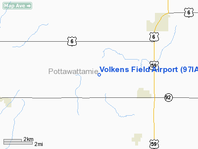
Location &
QuickFacts
|
FAA
Information Effective: |
2007-07-05 |
|
Airport
Identifier: |
97IA |
|
Airport
Status: |
Operational |
|
Longitude/Latitude: |
095-28-36.0000W/41-15-21.0000N
-95.476667/41.255833 (Estimated) |
|
Elevation: |
1275 ft / 388.62 m (Surveyed) |
|
Land: |
5 acres |
|
From
nearest city: |
3 nautical miles NW of Carson, IA |
|
Location: |
Pottawattamie County, IA |
|
Magnetic Variation: |
04E (2000) |
Owner & Manager
|
Ownership: |
Privately owned |
|
Owner: |
Wendell Volkens |
|
Address: |
16983 370th St
Carson, IA 51525 |
|
Phone number: |
712-484-3903 |
|
Manager: |
Jeff Clausen |
|
Address: |
16983 370th St
Carson, IA 51525 |
|
Phone number: |
712-484-3903 |
Airport
Operations and Facilities
|
Airport
Use: |
Private |
|
Wind
indicator: |
Yes |
|
Segmented Circle: |
No |
|
Control
Tower: |
No |
|
Lighting
Schedule: |
PHONE REQ
FOR LIRL, CALL 712-484-3903. |
|
Sectional chart: |
Omaha |
|
Region: |
ACE - Central |
|
Boundary
ARTCC: |
ZMP - Minneapolis |
|
Tie-in
FSS: |
FOD - Fort Dodge |
|
FSS
Phone: |
515-955-8114 |
|
FSS Toll
Free: |
1-800-WX-BRIEF |
|
Runway Information
Runway 18/36
|
Dimension: |
2000 x 75 ft / 609.6 x 22.9 m |
|
Surface: |
TURF, |
|
Edge Lights: |
Low |
|
|
Runway 18
|
Runway 36
|
|
Traffic
Pattern: |
Left |
Left |
|
Radio Navigation Aids
|
ID |
Type |
Name |
Ch |
Freq |
Var |
Dist |
|
RDK |
NDB |
Red Oak |
|
230.00 |
04E |
17.6 nm |
|
HNR |
NDB |
Harlan |
|
272.00 |
05E |
20.4 nm |
|
AIO |
NDB |
Atlantic |
|
365.00 |
04E |
21.4 nm |
|
OM |
NDB |
Gerfi |
|
320.00 |
05E |
22.7 nm |
|
PMV |
NDB |
Plattsmouth |
|
329.00 |
06E |
27.2 nm |
|
MLE |
NDB |
Millard |
|
371.00 |
06E |
29.0 nm |
|
SDA |
NDB |
Shenandoah |
|
411.00 |
05E |
30.5 nm |
|
CRZ |
NDB |
Corning |
|
278.00 |
04E |
36.1 nm |
|
ADU |
NDB |
Audubon |
|
266.00 |
04E |
36.5 nm |
|
ICL |
NDB |
Clarinda |
|
353.00 |
04E |
37.8 nm |
|
AFK |
NDB |
Nebraska City |
|
347.00 |
05E |
42.8 nm |
|
DNS |
NDB |
Denison |
|
350.00 |
04E |
44.0 nm |
|
GFZ |
NDB |
Greenfield |
|
338.00 |
04E |
46.8 nm |
|
FET |
NDB |
Fremont |
|
311.00 |
06E |
48.4 nm |
|
OFF |
TACAN |
Offutt |
054X |
|
05E |
20.9 nm |
|
TQE |
VOR |
Tekamah |
|
108.40 |
07E |
43.8 nm |
|
OVR |
VORTAC |
Omaha |
110X |
116.30 |
08E |
12.9 nm |
|
OMA |
VOT |
Omaha |
|
109.00 |
|
18.7 nm |
Remarks
-
PRVDD A CLEAR
APCH FOR A 20:1 GLIDE SLOPE; A CLEAR TRANSITIONAL SFC FOR A 7:1 SLOPE; TREES
OFF NORTH END SHOULD BE REMOVED.
Based
Aircraft
|
Aircraft based
on field: |
1 |
|
Single Engine
Airplanes: |
1 |
Volkens Field Airport
Address:
Pottawattamie County, IA
Tel:
712-484-3903
Images
and information placed above are from
http://www.airport-data.com/airport/97IA/
We
thank them for the data!
|
General Info |
| Country |
United
States |
| State |
IOWA
|
| FAA ID |
97IA
|
| Latitude |
41-15-04.980N |
|
Longitude |
095-28-06.000W |
|
Elevation |
1250
feet |
| Near
City |
CARSON
|
We don't guarantee the information is fresh and accurate. The data may
be wrong or outdated.
For more up-to-date information please refer to other sources.
|
|


